From Ax-les-Thermes to the Prat Redoun refuge

This hike forms the first stage of a five-day route between Ax-les-Thermes and La Tour-de-Carol. This first stage presents no difficulty unless weather conditions are poor. The start is at Ax railway station, where you follow the road and then a very pretty path that climbs up into the mountains to reach an unstaffed but very comfortable refuge.

This walk is only suitable for hikers accustomed to high-altitude mountain terrain and confident in navigating.

This walk is part of a multi-day hike: From Ax-les-Thermes to La Tour de Carol

Details

1607231
Creation:
Last update:
Last review:
  • Walking
    Activity: Walking
  • ↔
    Distance: 9.35 mi
  • ◔
    Average duration: 7h 30 
  • ▲
    Difficulty: Difficult

  • ⚐
    Back to start: No
  • ↗
    Ascent: + 3,701 ft
  • ↘
    Descent: - 115 ft

  • ▲
    Highest point: 5,883 ft
  • ▼
    Lowest point: 2,215 ft
  • ⚐ Country: France
  • ⚐
    Area: Pyrenees
  • ⚐ City: Ax-les-Thermes (09110)
  • ⚑
    Start: N 42.724795° / E 1.833249°
  • ⚑
    End: N 42.650254° / E 1.762173°
  • ❏
    IGN map(s): Ref. 2148ET, 2249OT, 2249OTR
  • Hour-by-hour weather

Photos

Description of the walk

Start from Ax-les-Thermes station.

(S/E) With your back to the station, follow the N2020 to the right with care, as far as Savignac-les-Ormeaux.

(1) At a sports shop, take a small road on the left. Then take thesecond road on the right, Rue du Pont. At the next junction, turn right.

(2) At the fork in the road, turn left and cross the Ariège. Continue along the Chemin de Pradatel, which passes under a power line and then, at a hairpin bend to the right, under the N20.

(3) You will then begin a steep, winding climb up the tarmac road. Pass under a power line and head up the Najar valley. You’ll reach the Granges de la Vallée de Savignac and, 200 metres further on, the end of the tarmac road.

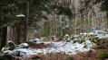
(4) Continue westwards along a path marked in yellow, which climbs gently through the woodland, still following the course of the Najar. Head south-south-west to reach the Jasse des Esquers de dessous.

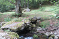
(5) Continue along the path and, 300 metres further on, pass the upper Jasse des Esquers. Keep following the yellow markings and stay on the left bank of the stream. Reach the Pont du Ressec (a lovely spot, ideal for a picnic).

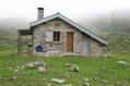
(6) Carry on southwards following the yellow markings and you’ll soon reach the first hut. Further south, you’ll reach a second hut.

(7) The path continues, still well signposted. It climbs quite steeply to reach the plateau.

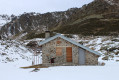
(8) Continue south-west to reach the Prat Redoun mountain refuge (E).

Waypoints

  1. S : mi 0 - alt. 2,297 ft - Ax-les-Thermes railway station
  2. 1 : mi 0.94 - alt. 2,215 ft - Savignac-les-Ormeaux
  3. 2 : mi 1.07 - alt. 2,215 ft - Turn left at the fork in the road towards the - Ariège (rivière)
  4. 3 : mi 1.38 - alt. 2,310 ft - N20 road
  5. 4 : mi 4.09 - alt. 3,556 ft - Barns in the Savignac Valley
  6. 5 : mi 5.75 - alt. 4,140 ft - Jasse des Esquers de dessous
  7. 6 : mi 7.16 - alt. 4,636 ft - Pont du Ressec
  8. 7 : mi 7.72 - alt. 4,918 ft - Cabin – Shelter
  9. 8 : mi 8.75 - alt. 5,696 ft - Plateau
  10. E : mi 9.35 - alt. 5,883 ft - Pra Redoun refuge

Notes

There are several places along the route where you can access water.

The Prat Redoun refuge is a very clean and well-maintained hut, with electric lighting. It sleeps six. If the hut is full, you can camp nearby (in summer, watch out for herds of cows).

The yellow markings are consistent but become more sporadic about 300 or 400 metres from the Prat Redoun refuge.

It takes about 4 hours from the end of the road to reach the refuge (E).

This hike can be done as a day trip, setting off early in the morning. In that case, of course, you can leave your car at the end of the tarmac road (4).

Worth a visit

Reviews and comments

4.6 / 5
Based on 3 reviews

Reliability of the description
4.3 / 5
Ease of following the route
4.3 / 5
Route interest
5 / 5
gypaetus
gypaetus

Hello Isabelle,
Thanks for the post.
You’re right, you do need to go all the way to the end of the tarmac road if it’s just for a day’s walk; I’d set the starting point at Ax-les-Thermes for the circular route and the return by train to the starting point.
I do remember getting a bit lost as I approached the Pra Redoun hut because there weren’t many cairns and it was very foggy… and there were cows!
That said, the hut is brilliant!
Originally, I’d planned to camp by the Embizon pond and then continue the circular route, but the lack of a marked path through the forest put me off; if you’re not carrying too much, it’s doable; it’s been marked out since, but it’s still quite steep.
Best regards,

Machine-translated

Isabelle Cloux
Isabelle Cloux

Overall rating : 4 / 5

Date of your route : Nov 08, 2023
Reliability of the description : ★★★★☆ Good
Ease of following the route : ★★★☆☆ Average
Route interest : ★★★★★ Very good
Very busy route : No

A lovely walk, at least from where the tarmac road ends (the road itself isn’t very busy, but it’s a long way to walk). Depending on the season, you can also park your car a little further on from the end of the tarmac; there are two car parks just before the start of the path, and in autumn, when the days are short, I think this is more practical if you want to spend more time in the mountains (the track is good and suitable for cars).
So I went by the additional information stating that it took about 4 hours from point 4 to the refuge; well, I don’t think so, unless you don’t stop to take photos or have a coffee during a break…
I didn’t have a heavy rucksack, but I like to make the most of the mountains, so even though I keep a good pace, I take my time to admire the views… so it took me 5 hours. I also think that after the second hut, the signposting is hard to spot because there are so many cow tracks and very muddy patches to go round, which slow you down. I found the markings easier to spot on the way down (perhaps because the sun wasn’t in my eyes as it was on the way up?)
I reckon rather than spending time looking for the markings, the main thing is to stay fairly close to the stream as a reference point as soon as you lose sight of the markers (every time I lost them, I’d strayed quite a way from the stream)
Given the time of year, I did the round trip in a day, and even though the descent is long, it only takes about two hours, even with stops...

Machine-translated

Dieg
Dieg

Overall rating : 5 / 5

Date of your route : Jan 19, 2019
Reliability of the description : ★★★★★ Very good
Ease of following the route : ★★★★★ Very good
Route interest : ★★★★★ Very good

A superb snow-covered hike following the Najar stream. Be careful – there’s a lot of ice on the path and 30–40 cm of snow up there; otherwise, nothing out of the ordinary. The Prat Redoun chalet is very well maintained; everything’s there: six beds (no blankets, unlike the hut just before it), quite a few kitchen utensils and firewood. As Wilier said, the start isn’t much fun but it gets your legs going I couldn’t find the various water sources as indicated, but I’d brought what I needed; there’s no water at Prat Redoun either… the pipes must be frozen at this time of year.
I’ll be back this summer – it’s well worth it! Thanks
(and thanks also to the person who left some raspberry jam at Prat – a real treat.)

Machine-translated

gypaetus
gypaetus

Hello Wilier,
I’m really glad you were able to go on the ride in the middle of winter – it must have been lovely; it’s actually meant to be a summer ride, originally.
You’re absolutely right, the start of the walk is on the road, but that’s only for people doing the route from Ax-les-Thermes to Latour-de-Carol; and even then, it’s possible either to arrange a lift or to hitchhike, even though the road isn’t very busy...
For those doing the day hike, you need to leave your car at the end of the tarmac road; the actual hike starts there.
Kind regards, Gypaétus.

Machine-translated

wilier
wilier

Overall rating : 4.7 / 5

Date of your route : Dec 30, 2018
Reliability of the description : ★★★★☆ Good
Ease of following the route : ★★★★★ Very good
Route interest : ★★★★★ Very good

A lovely walk that follows a beautiful stream; there are no steep gradients
or any dangerous sections. Today we had to be careful as it was cold
and the path was often covered in ice, but it was brilliant.
However, the start of the walk isn’t much fun as you have to walk along the
road, but you can leave your car at the end of the tarmac road.
We’ll come back to do this walk in the summer once the snow has melted – it’s well
it. Thank you.

Machine-translated

Other walks in the area

For more walks, use our search engine .

The GPS track and description are the property of this route's author. Please do not copy them without permission.