Refugi Mont Roig – Cabane de Marterat

A short transitional stage, offering a chance to rest and enjoy the scenery. You can also extend the route with the fourth stage to complete the circular route in three days. Another route, which is slightly longer and arguably more interesting, is also possible. It is mentioned as an alternative in the route description and is of a higher difficulty level.

This walk is part of a multi-day hike: Boucle de 4 jours au départ de Salau

Details

n°3634365
Creation:
Last update:
Last review:
  • Walking
    Activity: Walking
  • ↔
    Distance: 5.60 mi
  • ◔
    Average duration: 4h 10 
  • ▲
    Difficulty: Moderate

  • ⚐
    Back to start: No
  • ↗
    Ascent: + 1,844 ft
  • ↘
    Descent: - 2,300 ft

  • ▲
    Highest point: 7,503 ft
  • ▼
    Lowest point: 5,492 ft
  • ⚐ Country: Spain
  • ⚐
    Area: Pyrenees
  • ⚐ City: Lladorre 
  • ⚑
    Start: N 42.706085° / E 1.188533°
  • ⚑
    End: N 42.724871° / E 1.244742°
  • ❏
    IGN map(s): Ref. 2048OT
  • Hour-by-hour weather

Photos

Description of the walk

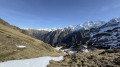
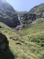
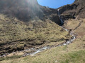
(S). From the Mont-Roig refuge, follow the path down into the valley (a somewhat steep descent along the spillway of the Estany de Llavera). Reach the Lo Fangassalau hut (at a place called La Pleta de lo Fangassal).

(1) Here there are two options:
- an option I was unable to take due to bad weather (see ‘Practical Information’).
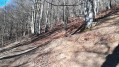
- continue the descent; this is the route shown on the map, losing altitude and passing through gradually changing vegetation. Cross wooded areas to reach Pleta Palomera.

(2) Carry on, cross the Riu del Port, then head due south to join a wide track at a hairpin bend.

(3) Take this track, turning almost 180° to the left; this is the Cami del Port de Tavascan. You’ll reach a car park with a small shelter.

(4) Continue due north to reach the northern tip of the Estany del Port, the point where the two routes meet.

(5) Then take the footpath that follows the track and complete the short climb to reach the Port de Marterat (or Port de Tavascan), the French-Spanish border.

(6) Then begin the descent to reach the Cabane de Marterat, today’s stop (E).

Waypoints

  1. S : mi 0 - alt. 7,503 ft - Mont-Roig mountain refuge
  2. 1 : mi 1.55 - alt. 6,122 ft - Lo Fangassal Hut
  3. 2 : mi 2.34 - alt. 5,689 ft - Pleta Palomera
  4. 3 : mi 3.01 - alt. 5,541 ft - Cami del Port de Tavascan
  5. 4 : mi 3.73 - alt. 5,932 ft - car park and shelter
  6. 5 : mi 4.87 - alt. 6,732 ft - Estany del Port
  7. 6 : mi 5.41 - alt. 7,280 ft - Port de Marterat
  8. E : mi 5.6 - alt. 7,021 ft - Marterat Hut

Notes

(E) Marterat Hut: comfortable, renovated in September 2008; it is a safe shelter, equipped with a small auxiliary heater; sleeps nine. A little paradise!

(1) Alternative route: take the path on the left leading to the Estanyet de Mollàs, then leave this path on the left for another path that climbs north-west, following the spillway of the Estanys de la Riberata (Riu de la Riberata). Once you reach the lakes, walk along their right-hand side, heading due east to reach the Col de la Riberata (2,391 m) further up. Then descend to the Grand Estany de Mariola (2,296 m), walk along its right-hand side to descend to the southern tip of the Estany del Port, or cross the Col de Montarenyo (2,351 m). Reach the lake of the same name below, then descend due east, following the spillway of the small lake to the northern tip of the Estany del Port. From here, join the (5)

Worth a visit

Mariole Spring further down the path, below the Marterat hut.

Reviews and comments

5 / 5
Based on 1 review

Reliability of the description
5 / 5
Ease of following the route
5 / 5
Route interest
5 / 5
lasyan3
lasyan3

Overall rating : 5 / 5

Date of your route : Jul 24, 2025
Reliability of the description : ★★★★★ Very good
Ease of following the route : ★★★★★ Very good
Route interest : ★★★★★ Very good
Very busy route : No

An easy stage with no difficulties.
We had beautiful weather until we reached the lakes, then it deteriorated very quickly and rained all the way to the hut. As the weather was forecast to remain like this for at least two days, we decided to do the fourth stage straight away.

Machine-translated

Other walks in the area

For more walks, use our search engine .

The GPS track and description are the property of this route's author. Please do not copy them without permission.