


6beryeti

 Visorando Member
 Premium user
 - Location: Coublevie (38500)
- Gender: man
Sign up:
Published route(s)
 The Lakes of Chamrousse and the Grand Van
 8.20 mi
 +3,274 ft
 -3,268 ft
 6h 35
6h 35
 Difficult
 Departure from Chamrousse (Isère)
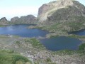
We’re going to walk on the ocean!Or how to walk around a ski resort almost without seeing the slopes, but taking in some beautiful lakes and a summit far more impressive than the famous Croix de Chamrousse.
La Grave – Goléon Mountain Hut
4.72 mi
+3,271 ft
-108 ft
5h 00
Difficult
Departure from La Grave (Hautes-Alpes)
The idea behind this three-day self-supported trek is to link the Goléon massif to the Grandes Rousses massif via the ridges to the north of the Plateau d’Emparis.
It’s a wild hike requiring not only good physical fitness but also the ability to read maps and the terrain.
Thefirst day is just a warm-up.
From Goléon to Les Grandes Rousses: La Grave / Clavans
86.50 mi
+29,537 ft
-26,375 ft
3 days
 Very difficult
Departure from La Grave (Hautes-Alpes)
Very difficult
Departure from La Grave (Hautes-Alpes)
From the Goléon massif to the Grandes Rousses massif, via the ridges between Emparis and Arves.A multi-day hike, with a bivouac, along the ridges between Emparis and Arves.
Col de La Valette – Clavans via Lac des Quirlies
8.94 mi
+1,939 ft
-4,895 ft
5h 50
Difficult
Departure from Besse (Isère) (Isère)
Return to the Romanche by heading down the Ferrand valley.
A return trip – though optional – to the Quirlies glacial lake would be a shame to miss.
Valfréjus – Thabor mountain hut
 3.37 mi
+1,952 ft
-0 ft
3h 15
3.37 mi
+1,952 ft
-0 ft
3h 15
 Moderate
Departure from Modane (Savoie)
Moderate
Departure from Modane (Savoie)
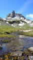
An easy route to reach the Thabor refuge and spend a good night’s sleep before heading over to Mont Thabor and the Chalets de Laval.
This section is accessible by mountain bike.
Valfréjus – Alpe du Lauzet
22.33 mi
+8,278 ft
-8,930 ft
3 days
Difficult
Departure from Modane (Savoie)
A journey between the Maurienne and the Guisane Valley.
Chalet de Laval - Alpe du Lauzet
8.12 mi
+2,785 ft
-3,793 ft
6h 10
Difficult
Departure from Névache (Hautes-Alpes)
A traverse of the Cerces massif via one of its highest passes (Béraudes) and some very beautiful lakes.And a chance to see much of the previous day’s descent route, as well as the many lakes on the other side.In early summer, the route can be made difficult by the presence of snow in the Lac des Béraudes cirque or a snow cornice on the Col des Béraudes (speaking from experience).
The ridges of Lac du Vallon
 10.87 mi
+5,955 ft
-5,955 ft
10h 10
Difficult
Departure from Chantelouve (Isère)
10.87 mi
+5,955 ft
-5,955 ft
10h 10
Difficult
Departure from Chantelouve (Isère)
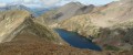
A technicolour skyline route…
After a gruelling 500m climb on a more or less pleasant track, the forest finally opens out. At around 2,100m, the adventure begins. You need to make your way to the summit of Les Clottoux as best you can.
From up there, the rest of the route is clear. A ridge walk to Le Neyrard, then above Lac du Vallon to La Berche Noire.
Refuge des Fonts de Cervières – Andrea Tornior Bivouac
 9.76 mi
+4,888 ft
-3,291 ft
8h 45
Difficult
Departure from Cervières (Hautes-Alpes)
9.76 mi
+4,888 ft
-3,291 ft
8h 45
Difficult
Departure from Cervières (Hautes-Alpes)
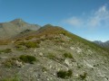
A fairly alpine stage of the Queyras Transfrontière, featuring the ascent of a magnificent 3,000-metre peak: Le Grand Glaiza.
The start of this stage is accessible by car via Cervières on the D902 from Briançon, then the D89T through Cervières.
Nino Sardi Mountain Hut – Granero Mountain Hut
9.24 mi
+4,098 ft
-4,895 ft
7h 50
Difficult
Departure from Abriès (Hautes-Alpes)
A transitional stage – a little long, but ending at a remarkable site. A short off-trail section between the Col de Malaure and the Col d’Urine requires a bit of care.
Refuge de la Blanche – Franco Boerio Bivouac
 8.91 mi
+4,465 ft
-2,543 ft
8h 00
Difficult
Departure from Saint-Véran (Hautes-Alpes)
8.91 mi
+4,465 ft
-2,543 ft
8h 00
Difficult
Departure from Saint-Véran (Hautes-Alpes)
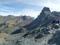
A foray into the Haute Ubaye to round off the route in style at its highest point. With the option of watching the sunset from the summit of the Bric de Rubren.
The route deliberately moves away from the border to take the easiest route up the hill.
Crossing the Rochers du Parquet
 9.02 mi
+3,291 ft
-3,291 ft
7h 00
Moderate
Departure from Chichilianne (Isère)
9.02 mi
+3,291 ft
-3,291 ft
7h 00
Moderate
Departure from Chichilianne (Isère)
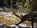
A "Haut Plateau du Vercors" route with breathtaking views of Mont Aiguille.
Crossing the Tête des Chétives
 10.19 mi
+5,315 ft
-5,348 ft
8 hrs
Very difficult
Departure from Le Périer (Isère)
10.19 mi
+5,315 ft
-5,348 ft
8 hrs
Very difficult
Departure from Le Périer (Isère)
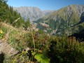
A circular route along the edge of the Écrins National Park, featuring a lovely ridge walk that is far more impressive than it is difficult.
A long route with a significant elevation gain, but no technical difficulty. All this for an exceptional panorama of the Vercors, the Dévoluy and the surrounding mountains with their striking colours.
Saint Véran – Refuge de la Blanche
 10.15 mi
+4,537 ft
-3,035 ft
8h 35
Difficult
Departure from Saint-Véran (Hautes-Alpes)
10.15 mi
+4,537 ft
-3,035 ft
8h 35
Difficult
Departure from Saint-Véran (Hautes-Alpes)
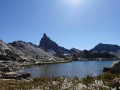
This serves as an introduction to a cross-border trek between Saint-Véran and Larche. We set off from the mountain pastures for a gentle approach to the border, through a rocky and colourful landscape that can at times be quite disorientating. There are no real difficulties, but a good understanding of how to read the terrain is sometimes necessary to avoid losing your way.
From Saint-Véran to Larche: Ubaye Transfrontière
49.21 mi
+20,728 ft
-21,916 ft
5 days
Very difficult
Departure from Saint-Véran (Hautes-Alpes)
A fantastic Franco-Italian ride between Saint-Véran and Larche! It will take you through strange places, from the solitary, green rocky landscapes of Saint-Véran to the fantastical, almost Dolomite-like terrain of the massif between Chambeyron and Orrenaye.
From Rubren to Marinet
 12.45 mi
+4,498 ft
-6,201 ft
10 hrs
Very difficult
Departure from Saint-Paul-sur-Ubaye (Alpes-de-Haute-Provence)
12.45 mi
+4,498 ft
-6,201 ft
10 hrs
Very difficult
Departure from Saint-Paul-sur-Ubaye (Alpes-de-Haute-Provence)
A very long day criss-crossing the border. But what breathtaking scenery! And you won’t be bothered by the neighbours... there’s little chance of coming across other two-legged creatures. But perhaps some ibex, vultures, including (apparently) a pair of bearded vultures.
From the Barenghi Bivouac to Larche via the Col du Vallonnet
13.36 mi
+3,953 ft
-7,723 ft
8 hrs
Very difficult
Departure from Saint-Paul-sur-Ubaye (Alpes-de-Haute-Provence)
This route largely followsGRP®® markings (Tour du Chambeyron). A safe option, yet still spectacular.Spectacular, because the route constantly alternates between stark, steep and rocky terrain and lush, rolling and reassuring landscapes.Safe, because it is fully signposted and even offers alternative routes to avoid the most difficult sections in the event of bad weather.