La Grave – Goléon Mountain Hut

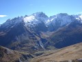
The idea behind this three-day self-supported trek is to link the Goléon massif to the Grandes Rousses massif via the ridges to the north of the Plateau d’Emparis.
It’s a wild hike requiring not only good physical fitness but also the ability to read maps and the terrain.
Thefirst day is just a warm-up.

This walk is part of a multi-day hike: Du Goléon aux Grandes Rousses : La Grave / Clavans

Details

11700
Creation:
Last update:
Last review:
  • Walking
    Activity: Walking
  • ↔
    Distance: 4.72 mi
  • ◔
    Average duration: 5h 00 
  • ▲
    Difficulty: Difficult

  • ⚐
    Back to start: No
  • ↗
    Ascent: + 3,271 ft
  • ↘
    Descent: - 108 ft

  • ▲
    Highest point: 8,031 ft
  • ▼
    Lowest point: 4,852 ft

Description of the walk

(S) From La Grave, simply follow the signposted path that climbs up to the Goléon refuge. Do pop into Ventelon, a pretty hamlet full of flowers. A little more tarmac and you’ll reach the hamlet of Les Hières.

(1). Next, a track followed by a path. Cross the hamlet of Valfroide.

(2) Head up the wide valley of the Maurian torrent.

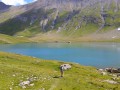
(3) All that remains is to climb up to the Goléon Lake pass, behind which lies the Goléon mountain hut (E).

Waypoints

  1. S : mi 0 - alt. 4,852 ft
  2. 1 : mi 1.49 - alt. 5,876 ft - The hamlet of Les Hières
  3. 2 : mi 2.39 - alt. 6,030 ft - The hamlet of Valfroide
  4. 3 : mi 3.74 - alt. 6,791 ft - Maurian Torrent
  5. E : mi 4.72 - alt. 7,999 ft

Notes

Goléon Mountain Hut
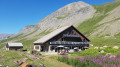
Even if you’re planning to pitch your tent, pop in for a drink.
You’ll be greeted with a warm welcome and some good advice.
For your campsite, you can choose between the lake’s shores and the Rubans area – or why not the flat areas beneath the Cruq des Aiguilles, which you’ll be passing the next day?
What’s more, there are springs to be found in that area.
Personally, although the lake is tempting, I prefer Les Rubans or the Cruq – it makes for a better start to the rest of the route, which is very long.

Worth a visit

The Col Lombard and the Aiguille du Goléon (glacier hike).
The Vallons de la Meije on the other side of the mountain.

Reviews and comments

4.7 / 5
Based on 2 reviews

Reliability of the description
4.5 / 5
Ease of following the route
4.5 / 5
Route interest
5 / 5
le dav 42
le dav 42

Overall rating : 5 / 5

Date of your route : Jul 15, 2023
Reliability of the description : ★★★★★ Very good
Ease of following the route : ★★★★★ Very good
Route interest : ★★★★★ Very good
Very busy route : Yes

Please disregard the previous comment; that comment referred to the walk to the Belvédère from the Evariste Chancel refuge.

Machine-translated

le dav 42
le dav 42

Overall rating : 4.3 / 5

Date of your route : Jul 18, 2023
Reliability of the description : ★★★★☆ Good
Ease of following the route : ★★★★☆ Good
Route interest : ★★★★★ Very good
Very busy route : No

Be careful at point 7 – I couldn’t find the path and ended up on a mountain bike track before reaching the path between point 1 and point 2.

Machine-translated

Other walks in the area

For more walks, use our search engine .

The GPS track and description are the property of this route's author. Please do not copy them without permission.