The ridges of Lac du Vallon

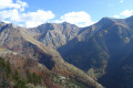
A technicolour skyline route…
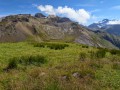
After a gruelling 500m climb on a more or less pleasant track, the forest finally opens out. At around 2,100m, the adventure begins. You need to make your way to the summit of Les Clottoux as best you can.
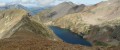
From up there, the rest of the route is clear. A ridge walk to Le Neyrard, then above Lac du Vallon to La Berche Noire.

Details

75649
Creation:
Last update:
Last review:
  • Walking
    Activity: Walking
  • ↔
    Distance: 10.87 mi
  • ◔
    Average duration: 10h 10 
  • ▲
    Difficulty: Difficult

  • ⚐
    Back to start: Yes
  • ↗
    Ascent: + 5,955 ft
  • ↘
    Descent: - 5,955 ft

  • ▲
    Highest point: 9,157 ft
  • ▼
    Lowest point: 3,638 ft

Photos

Description of the walk

Start from the church at Chantelouve in the hamlet of Les Bosses.

(S/E) With your back to the church, turn left, cross the bridge and take theGR® on the left.

(1) At the first junction on the track, leave the Sentier du Lac on your left – that’s the way back.
You’ll need to cover 400 to 500 metres of elevation gain along a rather unpleasant forest track before you reach a footpath. As you emerge from the forest, you’ll see the summit of Les Clottoux and the Prés de l’Aiguille. Cross these areas, staying on the path, until you reach the altitude of 2140.

(2) At the fork, turn left and head up towards the track that passes beneath the Clottoux, sticking to the grassy areas or natural “steps” as much as possible where the scree is stable.
Follow this path northwards to reach the base of the northern shoulder of the Clottoux.

(3) From there, the aerial journey begins. Climb to the summit of the Clottoux.

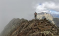
(4) Turn east and follow the ridge to the summit of the Neyrard. It’s virtually without difficulty apart from a few rocky “spikes” (including a very beautiful one shaped like a stack of multicoloured plates) which can be bypassed to the north. The final stretch of the Neyrard (the slope below the 2770 mark) is hard-earned. It’s steep, but you can always find decent footholds.
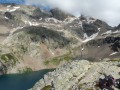
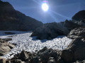
From the summit, don’t miss the sweeping view over the lake. Be careful not to be tempted by the slopes that appear to descend easily… it’s at the bottom that things get tricky… rocky outcrops!

(5) Head north-west towards the Berche Noire. It’s best to bypass the first rocky outcrop to the south by descending 50 to 60 metres. The traverse across a sloping scree slope is short and, ultimately, quite ‘comfortable’. You can clearly see where you can climb back up onto the Berche Noire ridge, at a point slightly lower down. Follow this ridge to a cairn of dark, glossy schist. It’s best not to go any further. If you come across light-coloured rocks, turn back.

(6) You can make out the start of a path quite clearly, which allows you to descend without any real difficulty or risk of falling. At no point should you be above a rocky ledge or in a field of boulders. You can descend by sight, avoiding any rocky ledges (these are mainly to the right) or boulder fields (mainly to the left, light-coloured rocks). Further down, in grassy areas, you can spot cairns leading to the shore of Lac du Vallon.

(7) Cross the spillway and follow the signposted path to reach the valley. After the beautiful waterfalls at the spillway, take care near the Cabane du Pré de la Vache.

(8) The path may be obscured by tall grass. The map indicates that you should just go past it and then head down below it. You’ll find a clear track about twenty metres further down. Join the track where it crosses a stream.

(9) Head left, then turn right before the torrent. Continue downhill and rejoin the track you took at the start.

(1) Follow the path downwards to reach the hamlet of Les Bosses (S/E).

Waypoints

  1. S/E : mi 0 - alt. 3,648 ft - Hameau des Bosses. Towards the bridge at the - Malsanne (rivière)
  2. 1 : mi 1.52 - alt. 4,554 ft - Crossroads, turn right
  3. 2 : mi 3.43 - alt. 7,021 ft - Crossroads, turn left
  4. 3 : mi 4.31 - alt. 7,799 ft - Base of the north shoulder of Les Clottoux
  5. 4 : mi 4.68 - alt. 8,268 ft - Clottoux Summit
  6. 5 : mi 5.98 - alt. 9,157 ft - Le Neyrard
  7. 6 : mi 6.45 - alt. 9,022 ft - Berche Noire
  8. 7 : mi 6.86 - alt. 8,192 ft - Source de la Malsanne - Lac du Vallon
  9. 8 : mi 7.97 - alt. 6,558 ft - Pré de la Vache mountain hut
  10. 9 : mi 8.8 - alt. 5,105 ft - Track, on the left
  11. S/E : mi 10.87 - alt. 3,652 ft - Hameau des Bosses

Notes

Note that if you don’t feel up to tackling the Berche Noire, you can reach the Cabane du berger de la Vivolle from the Neyrard or the slopes below the Berche Noire. From there, simply follow the ascent route.
Also, be careful not to set off on the eastern slope of the Crête Clottoux / Neyrard, over the black schist… there’s no way down that side and you won’t be able to climb back up.
There is, however, a route beneath the Neyrard to join theGR®54variant that passes by Lac de Plan Vianney.

After a quick calculation, and having mapped out the route elsewhere, I reckon the elevation gain is around 1,750 metres rather than the 1,920 metres given here… which is still pretty good.

There’s not much space to park in the hamlet… Be careful not to get in the way.

The Cabane de la Vivolle is a sheepfold that’s occupied in summer. The shepherd is friendly, and so are his dogs. That said, you shouldn’t just turn up unannounced in the middle of a flock of sheep. The two Anatolian shepherds will be sure to remind you of this, just in case. But if you’re respectful, they’ll be respectful too.

There’s no real risk of vertigo or any worrying proximity to sheer drops on this walk… That’s why I haven’t rated it as ‘very difficult’.
Still, it’s not worth taking someone along without warning who doesn’t have much experience of this sort of route. Especially as it’s a long one!
So, if you’re not on a ridge and find yourself above a rock face, it means you’ve taken a wrong turn.
Good walking boots and walking poles (or even an ice axe at the start of the season) are recommended.

Worth a visit

The different types of rock and their colours.
The ‘stacked plates’ on the ridge between Clottoux and Neyrard.
Panoramic view of the Obiou, the Muzelle and the Rochail.
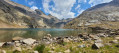
The magnificent, deeply incised Lac du Vallon, one of the largest lakes in the Écrins.
The Marsanne Waterfalls, the outlet of Lac du Vallon.
The petrifying spring as you cross the Malsanne near the Cabane des Charmettes (junction with signpost).

Always be cautious and plan ahead when you're outdoors. Visorando and the author of this route cannot be held responsible for any accidents occurring on this route.

The GR® and PR® markings are the intellectual property of the Fédération Française de Randonnée Pédestre.

Reviews and comments

4.8 / 5
Based on 2 reviews

Reliability of the description
5 / 5
Ease of following the route
4.5 / 5
Route interest
5 / 5
JerryTheJawa
JerryTheJawa
• Edited:

Overall rating : 5 / 5

Date of your route : Aug 01, 2026
Reliability of the description : ★★★★★ Very good
Ease of following the route : ★★★★★ Very good
Route interest : ★★★★★ Very good
Very busy route : No

A superb route, offering a varied and quite challenging hike. Thank you very much.

Machine-translated

f2x
f2x

Overall rating : 4.7 / 5

Date of your route : Aug 06, 2022
Reliability of the description : ★★★★★ Very good
Ease of following the route : ★★★★☆ Good
Route interest : ★★★★★ Very good
Very busy route : No

A lovely, intense walk 👌

Machine-translated

Other walks in the area

For more walks, use our search engine .

The GPS track and description are the property of this route's author. Please do not copy them without permission.