Col de La Valette – Clavans via Lac des Quirlies

Return to the Romanche by heading down the Ferrand valley.
A return trip – though optional – to the Quirlies glacial lake would be a shame to miss.

This walk is part of a multi-day hike: From Goléon to Les Grandes Rousses: La Grave / Clavans

Details

n°13223
Creation:
Last update:
Last review:
  • Walking
    Activity: Walking
  • ↔
    Distance: 8.94 mi
  • ◔
    Average duration: 5h 50 
  • ▲
    Difficulty: Difficult

  • ⚐
    Back to start: No
  • ↗
    Ascent: + 1,939 ft
  • ↘
    Descent: - 4,895 ft

  • ▲
    Highest point: 8,422 ft
  • ▼
    Lowest point: 4,573 ft

Description of the walk

Nothing too complicated. Just follow the trail.
It’s still quite alpine, though, as you’ll be walking on scree all the way to Lac des Quirlies.

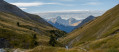
(S) From the Col de la Valette, take the path heading west towards the shepherd’s hut and reach the Valette torrent.

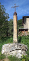
(1) Head south and climb briskly and rather ruggedly up the Crête des Sauvages (impressive but not particularly exposed) to reach the Fond de Ferrand plateau. Then descend 300 metres to the Pierre à l’Oiseau, a large erratic boulder.

(2) You’ll easily find a path heading north which, following the spillway more or less, leads to the Lac des Quirlies.

(3) Head back down the same route to the Pierre à l’Oiseau.

(2) Continue due south along the proper path which runs alongside the Ferrand on the right bank. Reach the junction with the path leading up towards the Col de Sarenne.

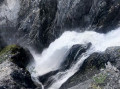
(4) Ignore this path and carry on straight ahead to reach the top of the Ferrand waterfall.

(5) Head down and then cross the torrent via the Pont du Ferrand. Walk past the hamlet of Le Perron at a distance to reach the Chalets des Prés further down.

(6) Continue downhill to reach theGR®54.

(7) Take this path straight ahead and you’ll easily reach the village of Clavans-le-Haut (E).

Waypoints

  1. S : mi 0 - alt. 7,552 ft - Col de la Valette (2291m)
  2. 1 : mi 0.48 - alt. 7,605 ft - Valette torrent
  3. 2 : mi 2.29 - alt. 7,149 ft - Pierre à l’Oiseau
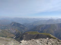
  4. 3 : mi 3.26 - alt. 8,422 ft - Lac des Quirlies
  5. 4 : mi 6.33 - alt. 6,148 ft - Col de Sarenne junction
  6. 5 : mi 6.94 - alt. 5,686 ft - Ferrand Waterfall
  7. 6 : mi 7.99 - alt. 5,108 ft - Les Prés
  8. 7 : mi 8.39 - alt. 4,921 ft - GR54
  9. E : mi 8.94 - alt. 4,573 ft - Clavans-le-Haut

Notes

If the shepherd is there, don’t hesitate to ask him for some water.
Otherwise, do make sure to find a spring – there are plenty of sheep in the area.
(E) From Clavans, you can head back down to Le Chambon and catch the Briançon–Grenoble bus.

Worth a visit

At the bottom of the waterfall, you can also head up to the Col de Sarenne (signposted).
There’s a lodge (Auberge du Savel) in Clavans that looks very cosy.

Always be cautious and plan ahead when you're outdoors. Visorando and the author of this route cannot be held responsible for any accidents occurring on this route.

The GR® and PR® markings are the intellectual property of the Fédération Française de Randonnée Pédestre.

Reviews and comments

4.3 / 5
Based on 2 reviews

Reliability of the description
4.5 / 5
Ease of following the route
3.5 / 5
Route interest
5 / 5
Sophie_Morin
Sophie_Morin

Overall rating : 4 / 5

Date of your route : Aug 05, 2023
Reliability of the description : ★★★★☆ Good
Ease of following the route : ★★★☆☆ Average
Route interest : ★★★★★ Very good
Very busy route : No

Route followed in part, for a one- or two-day hiking trip with a bivouac.
Setting off from Clavans-le-Haut to reach Besse. From Besse, I followed the route as far as La Valette. A fairly easy hike, mostly along a wide track, with stunning scenery; I came across the torrent below -> about 5 hours’ walk from Besse to La Valette (including a quick lunch break halfway) and not a soul in sight.
From the Chalet de la Valette, I didn’t take the pass; instead, I made my way to Les Sauvages via the signposted path (a steep and potentially slippery slate scree slope) and camped above the Cabane des Sauvages.
I lost my phone during the adventure and decided to head straight back down to Clavans-le-Haut the next day.
It’s possible to reach the Lac des Quirlies via the Col de la Valette, but there’s apparently a steep section that’s a bit tricky (according to the shepherd I met there with his huge flock and his mountain dogs).
I’m also wondering whether it’s possible to reach the lake from Les Sauvages, without heading back down towards the Pierre de l’Oiseau, for a future trip.
Water is available fairly regularly, but there are herds further up the stream, so make sure you bring a filter.

Machine-translated

nadvl
nadvl

Overall rating : 4.7 / 5

Date of your route : Mar 10, 2021
Reliability of the description : ★★★★★ Very good
Ease of following the route : ★★★★☆ Good
Route interest : ★★★★★ Very good
Very busy route : No

With the slushy snow and scree, we didn’t go any further than the waterfall as we had someone with us who wasn’t feeling comfortable. But the walk was lovely and we were all alone in the world. We’ve planned to do it again in the drier season.
It’s worth noting that there was an extremely slippery section due to the snowmelt along the route. We left the tracks to walk across the grassy areas.
We passed through numerous avalanche debris fields. In the height of winter, this is a high-risk area. You must make sure to check the BERA forecast before setting off and carry an avalanche transceiver.
On 10 March, this was no longer necessary.

In summary, a relatively easy walk that doesn’t require great physical fitness but can be potentially dangerous depending on the season and snow conditions.

Machine-translated

Other walks in the area

For more walks, use our search engine .

The GPS track and description are the property of this route's author. Please do not copy them without permission.