Country:

 City:


The easiest option is to do a round trip to the summit from the bivouac, leaving your rucksacks behind.
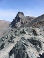
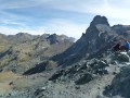
From the refuge, simply head for the Col de Mongioia and follow the ridge to the right. It’s fairly well signposted and there are quite a few cairns. After about a quarter of an hour, look carefully to your left for a rock marked ‘Facile’ in faded red paint. That’s the way to go, not the attractive ascending ledge beckoning you straight ahead. That route works too, but you’ll end up right at the top beneath a wall that you’ll have to climb. Nothing too difficult, though. It’s up to you. But the “easy” route really is along the ridge and leads straight to the summit.
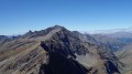
(1) You’ll be treated to a breathtaking view. I was there with some Italians who pointed out that you could even see the sea and the Gulf of Genoa! And to the north-north-east, Mont Blanc, Gran Paradiso and Monte Rosa are emerging from the mist!
Head back down to the pass and then to the bivouac to collect your rucksacks and make your way towards the Pas de Salsa: you could also try Mont Salsa and its impressive trail, visible from the bivouac.
(2) From the Pas de Salsa, keep a close eye on the cairns and, above all, don’t lose sight of them.
(3) After the easy start to the valley, the route continues across a scree slope that becomes increasingly jumbled and difficult to navigate, unless you stay firmly on the track.
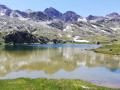
(4) Once you reach Lac du Loup with its pretty quaking grass, you can descend the Vallon du Loup via a well-trodden track on the left bank of the lake or look out for the gully just above it to the north-north-east (cairn). This is where you choose your route.
Head for a small pass which takes you into a barely marked little valley that you must follow north-north-east. By maintaining this direction and keeping a close eye out for the most distinct tracks and animal trails, you’ll reach the Italian lakes of Le Longet.
(5) The spot is well worth a break and a bit of a wander. Make sure you spot the track that branches off to the north of the marked path. Follow it until you feel it’s taking you back towards the border. There’s a clear track on your right that takes you over a small, easily visible grassy pass.
(6) Next, descend into a gully to around 2,650 m. Maintain this altitude by finding the right drovers' road, which leads up an easy slope to rejoin the signposted path. This road leaves the scree slopes of the Tête des Toillies on your left and passes a temporary lake.
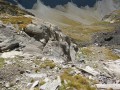
(7) A little further on, the track heads straight ahead up the slope. Ignore it and look for another track on your right, marked with paint. It climbs gently up a wild valley flanked by strangely shaped rocks, leading you to another temporary lake, at which point it’s time to head west towards the clearly visible Col Blanchet.
(8) If you’ve still got a bit of energy left, don’t hesitate to make a round trip to the right to Rocca Bianca – a final little 3,000-metre peak for the journey, with a guaranteed misty atmosphere!
(9) Return to Col Blanchet. After that, simply follow the signposts to reach the lake and the Refuge de la Blanche (E).

 Visorando Member
 Very difficult
 Moderate