


 Country:

 City:
City:


This is a challenging alpine route. Some sections do not allow for an easy return to the valley, particularly once you’ve passed the Sommet de la Buffe.
Don’t forget to stop at the Refuge du Goléon or Les Bergeries to stock up on drinking water, even if you do manage to find springs along the route.
The second day is very long, the third a little shorter, so it’s possible to split the route up differently.
The starting point (La Grave) is accessible via the VFD coach service between Grenoble and Briançon.
Once you reach Clavans, you need to walk down to the dam (there are quite a few walkers there, and you can hitch a lift) to get back to the bus stop.
From Goléon to Les Grandes Rousses: La Grave / Clavans


From the Goléon massif to the Grandes Rousses massif, via the ridges between Emparis and Arves.
A multi-day hike, with a bivouac, along the ridges between Emparis and Arves.
Details
Creation:
Last update:
Last review:
–
–
-
 Activity: Walking
 -
 Distance: 86.50 mi
 -
 Average duration: 3 days
 -
 Difficulty: Very difficult
 -
-
 Back to start: No
 -
 Ascent: + 29,537 ft
 -
 Descent: - 26,375 ft
 -
-
 Highest point: 9,583 ft
 -
 Lowest point: 4,573 ft
Stages of the route
This route needs several days, find the details below:
Notes
Worth a visit
Other walks in the area
La Grave – Goléon Mountain Hut
 Visorando Member4.72 mi
+3,271 ft
-108 ft
5h 00
Visorando Member4.72 mi
+3,271 ft
-108 ft
5h 00
 Difficult
 Departure from La Grave (Hautes-Alpes)
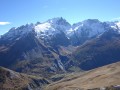
The idea behind this three-day self-supported trek is to link the Goléon massif to the Grandes Rousses massif via the ridges to the north of the Plateau d’Emparis.
It’s a wild hike requiring not only good physical fitness but also the ability to read maps and the terrain.
Thefirst day is just a warm-up.
Belvedere at the Évariste Chancel refuge
 7.67 mi
+4,157 ft
-4,186 ft
7h 10
Difficult
Departure from La Grave (Hautes-Alpes)
7.67 mi
+4,157 ft
-4,186 ft
7h 10
Difficult
Departure from La Grave (Hautes-Alpes)
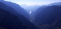
This outing, starting from La Grave, offers remarkable views of the Romanche valley. These views will be the bonus of the day after passing Lac de Puy Vachier and the Évariste Chancel refuge.
La Grave - Alpe de Villar-d'Arêne mountain hut
 6.87 mi
+2,618 ft
-669 ft
5h 25
Difficult
Departure from La Grave (Hautes-Alpes)
6.87 mi
+2,618 ft
-669 ft
5h 25
Difficult
Departure from La Grave (Hautes-Alpes)
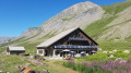
After a rest day in La Grave, set off on this8th stage, which presents no technical difficulties and involves no significant elevation gain. A route that circles La Meije, initially following the Romanche torrent. You will pass close to Villar d'Arène. Thesecond section, starting from Pont d'Arsine, is slightly more challenging and much wilder, taking in the Pas d'Anna Falque and the Plan d'Alpe before reaching the Refuge de l'Alpe de Villar-d'Arêne, which offers breathtaking views of the surrounding mountains.
The hamlet of Le Chazelet via the Notre-Dame de Bon Repos Chapel
 4.82 mi
+1,706 ft
-1,696 ft
3h 40
4.82 mi
+1,706 ft
-1,696 ft
3h 40
 Moderate
Departure from La Grave (Hautes-Alpes)
Moderate
Departure from La Grave (Hautes-Alpes)
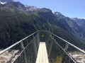
To reach the hamlet of Chazelet, you can drive there (handy for popping out for an ice cream with the family). You could do a round trip following part of the GR®50–GR®54 trail or, as shown here, go via the Notre-Dame de Bon Repos Chapel and take the opportunity to see the magnificent waterfall above the hamlet of Fréaux. In any case, the view of the glaciers is spectacular.
Le Chazelet par l'Oratoire et le Perchoir
 5.51 mi
+1,575 ft
-1,578 ft
3h 45
Moderate
Departure from La Grave (Hautes-Alpes)
5.51 mi
+1,575 ft
-1,578 ft
3h 45
Moderate
Departure from La Grave (Hautes-Alpes)
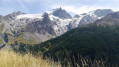
Splendide point de vue sur le massif de la Meije depuis l'Oratoire dotée de la table d'orientation des Portes composée de 2 parties: le versant Nord de la Meije et le versant sud en direction du Chazelet et de la Savoie.
Lac du Goléon
 7.45 mi
+2,290 ft
-2,290 ft
5h 25
Moderate
Departure from La Grave (Hautes-Alpes)
7.45 mi
+2,290 ft
-2,290 ft
5h 25
Moderate
Departure from La Grave (Hautes-Alpes)
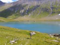
Mountain hike ending at the glacial lake of Goléon, superb balcony views of the Meije massif and discovery of typical mountain hamlets.
Le Signal de la Grave et le Lac du Goléon
9.60 mi
+3,675 ft
-3,675 ft
6 hrs
Very difficult
Departure from La Grave (Hautes-Alpes)
A 360° view of La Meije and its neighbours and the discovery of Lac du Goléon, one of the most beautiful lakes in the Alps.
⚠️ 30/07/2025: modification to (4) to follow the Tour des Aiguilles d'Arves and avoid private property.
For more walks, use our search engine .
The GPS track and description are the property of this route's author. Please do not copy them without permission.

