The Col Blanchâtre and the Ravin de la Noire

A short circular walk from the Refuge de la Blanche through a wild valley with incredible colours.

Details

364545
Creation:
Last update:
Last review:
  • Walking
    Activity: Walking
  • ↔
    Distance: 4.04 mi
  • ◔
    Average duration: 3h 40 
  • ▲
    Difficulty: Difficult

  • ⚐
    Back to start: Yes
  • ↗
    Ascent: + 2,119 ft
  • ↘
    Descent: - 2,123 ft

  • ▲
    Highest point: 10,105 ft
  • ▼
    Lowest point: 8,205 ft

Photos

Description of the walk

Start from the Refuge de la Blanche.

(S/E) From the Refuge de la Blanche, go round the lake to the left and head south. Then turn right and then left onto a well-marked path towards the Col de la Noire. After crossing a torrent, you’ll start a fairly direct ascent, interrupted by a flat section at around 2,750m.
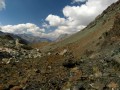
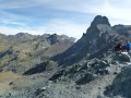
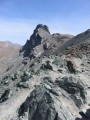
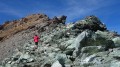
The route continues through an increasingly rocky landscape, with rocks ranging in colour from black to green and reddish.

(1) At the Col de la Noire, head left towards the east along a clearly visible track that starts on the ridge before skirting the Tête de la Petite Noire to the north. A short section may be tricky to navigate if there is a snowfield, before returning to the ridge and then onto a large plateau at an altitude of 2,969 metres.

The track continues eastwards at the foot of the summit of the Tête des Toillies to reach the pass named “Blanchâtre” on some maps.

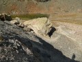
(2) You are now on the French-Italian border. There is an impressive couloir on the Italian side. Go round a small, dark-green rocky outcrop (serpentinite) to the west (on the French side), then continue along the ridge following a trail that remains clearly visible.

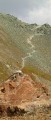
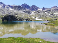
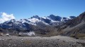
When you start to get a good bird’s-eye view of the Lacs du Longet, it’s time to spot a small, not-too-steep white couloir on the right, bordered by light beige calc-schist. The path widens onto a schist slope and you need to reach a drovers' road at the foot of a rocky outcrop. Go round it to reach the Ravin de la Noire and an unnamed lake at around 2,890 m.

(3) Simply follow the fairly flat scree slope, then find a good drovers' road slightly ascending towards the north-west to reach a small escarpment.

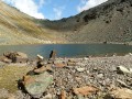
(4) Cross this before descending towards Lac de la Noire.

(5) Head northwards up the marked path towards the Col de la Noire.

(1) Descend in the same direction via the ascent route to return to the refuge (S/E).

Waypoints

  1. S/E : mi 0 - alt. 8,209 ft - Refuge de la Blanche
  2. 1 : mi 1.14 - alt. 9,675 ft - Col de la Noire
  3. 2 : mi 1.68 - alt. 10,075 ft - Col Blanchâtre
  4. 3 : mi 2.28 - alt. 9,531 ft - Small, unnamed lake
  5. 4 : mi 2.63 - alt. 9,557 ft - Rock face
  6. 5 : mi 2.72 - alt. 9,475 ft - Lac de la Noire
  7. S/E : mi 4.04 - alt. 8,209 ft - Lac de la Blanche

Notes

Good footwear is strongly recommended on this very rocky route. An ice axe will certainly be useful in early summer. Snow cover can make crossing the scree slope on the north face behind the Petite Tête Noire tricky.
I’ve rated this route as difficult because part of it takes place off the marked trail and requires a good understanding of the terrain and some navigation skills.

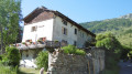
The start is at the Refuge de la Blanche. An excellent place, run by the man who built it (François). A good, peaceful base camp (though there may be music playing) for hiking or even climbing in the area (long routes on the Tête des Toillies, a climbing school very close to the refuge).
Great atmosphere, tasty and generous food, and lovely dormitories.

You can also set off from Saint-Véran, but you’ll need to allow at least an extra 4 hours there and back, or from the end of the track (restricted access) at the copper mine. From there, it’s only an extra 2 hours there and back.

Worth a visit

The highly distorted lava pillows of the Tête des Toillies

Other walks in the area

For more walks, use our search engine .

The GPS track and description are the property of this route's author. Please do not copy them without permission.