


01rando

 Visorando Member
 Premium user
 - Location: Miribel (01700)
- Gender: man
Sign up:
Published route(s)
 The Clarée lakes route: Laramon, Serpent, Les Gardioles, Blanc
 8.96 mi
 +3,579 ft
 -4,459 ft
 7h 15
7h 15
 Difficult
 Departure from Névache (Hautes-Alpes)
This hike is certainly long, but it will allow you to discover one of the major areas of the wonderful Clarée Valley.
The Cabane des Aiguillettes
6.65 mi
+2,769 ft
-2,776 ft
5h 30
Difficult
Departure from Saint-Michel-les-Portes (Isère)
A pleasantly varied loop between vegetation and rock, spiced up by the crossing of a scree slope and a passage with cables at Pas du Fouillet. To be done outside the snowy season.Return facing the imposing block formed by Mont Aiguille.
CAUTION! The scree slope and Pas du Fouillet between points (3) and (5) are currently closed (July 2025). At point (3), continue straight ahead to reach the Pas des Bachassons via the Serres and Maupas ravines, point (6), from where you can reach the Cabane des Aiguillettes, point (6), for a picnic. Then, you will need to return to the Pas des Bachassons to continue the hike.
Le Reposoir - Refuge de la Combe
 3.14 mi
+1,719 ft
-436 ft
2h 55
3.14 mi
+1,719 ft
-436 ft
2h 55
 Moderate
Departure from Bellecombe-en-Bauges (Savoie)
Moderate
Departure from Bellecombe-en-Bauges (Savoie)
This hike can be done either:
- as a day trip,
- or as part of a longer hike (first stage of the circular route: Around Charbon Mountain). It was during this tour that it was completed.
Around the Charbon mountain
 9.98 mi
+3,740 ft
-3,743 ft
2 days
Moderate
Departure from Bellecombe-en-Bauges (Savoie)
9.98 mi
+3,740 ft
-3,743 ft
2 days
Moderate
Departure from Bellecombe-en-Bauges (Savoie)
This circular route includes an overnight stay at the Combe refuge, where children will enjoy the end of the day at the farm-refuge (herding the flock with dogs, milking, etc.) and parents will enjoy tartiflette made with sheep's cheese. The next day's stage, which is longer than the previous day's, can only be completed with children who are not only motivated but who have already hiked in the mountains (I have personally hiked with children aged 7, 9 and 11).
Combe refuge - Le Reposoir
 6.84 mi
+2,021 ft
-3,307 ft
4h 55
Moderate
Departure from Chevaline (Haute-Savoie)
6.84 mi
+2,021 ft
-3,307 ft
4h 55
Moderate
Departure from Chevaline (Haute-Savoie)
Second day of the hike: Around Charbon Mountain with a stop at Dent des Portes.
The Cabane des Olettes
 5.88 mi
+2,313 ft
-2,303 ft
4h 45
Moderate
Departure from Crots (Hautes-Alpes)
5.88 mi
+2,313 ft
-2,303 ft
4h 45
Moderate
Departure from Crots (Hautes-Alpes)
This day-long circular hike, where you are unlikely to encounter too many other hikers, even in summer, takes place largely in open countryside, allowing you to walk alongside some of the peaks south of Lake Serre-Ponçon, including Pouzenc (2,898m).
From Caléyère Castle to Les Séryères
 8.20 mi
+2,851 ft
-2,854 ft
6h 15
Moderate
Departure from Embrun (Hautes-Alpes)
8.20 mi
+2,851 ft
-2,854 ft
6h 15
Moderate
Departure from Embrun (Hautes-Alpes)
A walk not far from Embrun offering a pleasant, peaceful day out. The route is almost circular through the Mont Guillaume national forest, with an ascent and return off the beaten track, plus a visit to the Belvédère de la Para viewpoint.
Lac de Souliers from Brunissard
 6.69 mi
+2,395 ft
-2,398 ft
5h 10
Moderate
Departure from Arvieux (Hautes-Alpes)
6.69 mi
+2,395 ft
-2,398 ft
5h 10
Moderate
Departure from Arvieux (Hautes-Alpes)
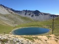
This is a pleasantly varied circular hike thanks to a climb mainly through forest, the lake and its surroundings, the rocky atmosphere of the Casse Déserte and the unusual return route along the bed of the Torrent de l'Izoard.
This lake is very popular in July and August because it is easily accessible from the Col d'Izoard road, but this route allows you to enjoy most of the hike in peace and quiet.
Assy Plateau - Platé Refuge
 2.59 mi
+3,438 ft
-102 ft
4h 10
Difficult
Departure from Passy (Haute-Savoie) (Haute-Savoie)
2.59 mi
+3,438 ft
-102 ft
4h 10
Difficult
Departure from Passy (Haute-Savoie) (Haute-Savoie)
First day of the hike.
A good, varied climb that will take you to the Désert de Platé, a rather exceptional protected site.
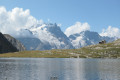
Lac and Refuge du Goléon
 10.55 mi
+3,327 ft
-3,323 ft
7h 45
Difficult
Departure from Villar-d'Arêne (Hautes-Alpes)
10.55 mi
+3,327 ft
-3,323 ft
7h 45
Difficult
Departure from Villar-d'Arêne (Hautes-Alpes)
A long day's hike giving you plenty of time to admire the La Meije massif and the Aiguilles d'Arves with an extra page just for you.
Col du Barle from Les Gourniers
 8.07 mi
+3,963 ft
-3,953 ft
7h 10
Difficult
Departure from Réallon (Hautes-Alpes)
8.07 mi
+3,963 ft
-3,953 ft
7h 10
Difficult
Departure from Réallon (Hautes-Alpes)
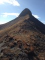
This round-trip route is one of many hiking options available from the hamlet of Les Gourniers, offering views of, amongst other things, the highest peak in the Embrunais region, the Mourre Froid at an altitude of 2,993 metres.
The Gates of Morgon from Pierre Arnoux
 8.15 mi
+2,776 ft
-2,769 ft
6h 10
Difficult
Departure from Savines-le-Lac (Hautes-Alpes)
8.15 mi
+2,776 ft
-2,769 ft
6h 10
Difficult
Departure from Savines-le-Lac (Hautes-Alpes)
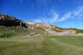
A one-day circular walk that takes you along a less-travelled path than some to the Cirque de Morgon, a truly stunning setting, particularly in autumn. The route features six metal steps set into the rock, which can be negotiated without difficulty.
The Pic de Morgon from the Fontaine de l'Ours
10.56 mi
+3,786 ft
-3,809 ft
8h 10
Difficult
Departure from Crots (Hautes-Alpes)
A beautiful, challenging circular walk for those who want to explore the Morgon cirque and experience one of the finest views of Lake Serre-Ponçon and the surrounding peaks.Autumn, with its vibrant colours, is the best time of year to visit.
Col de la Gardette (Hautes-Alpes)
 6.70 mi
+2,306 ft
-2,310 ft
5h 05
Moderate
Departure from Réallon (Hautes-Alpes)
6.70 mi
+2,306 ft
-2,310 ft
5h 05
Moderate
Departure from Réallon (Hautes-Alpes)
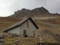
This round trip, which is more of a stroll than a hike, even if there is a little elevation gain and distance, allows you to gain a little height for a view of the beautiful landscapes at the southern end of the Écrins massif (Le Mourre Froid and other peaks), not to mention the beautifully carved Aiguilles de Chabrières mountains on the south-eastern side.
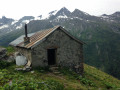
Lécheron mountain chalet
 3.34 mi
+2,008 ft
-2,008 ft
3h 15
Moderate
Departure from Champagny-en-Vanoise (Savoie)
3.34 mi
+2,008 ft
-2,008 ft
3h 15
Moderate
Departure from Champagny-en-Vanoise (Savoie)
One of the first hikes to do when discovering the Champagny-le-Haut valley and a great way to pick up some cow's or goat's cheese for lunch. This hike can be extended to Froide Fontaine.
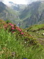
Under the Roche du Tougne
 5.90 mi
+2,421 ft
-2,421 ft
4h 50
Difficult
Departure from Champagny-en-Vanoise (Savoie)
5.90 mi
+2,421 ft
-2,421 ft
4h 50
Difficult
Departure from Champagny-en-Vanoise (Savoie)
This is a beautiful summer hike where you can encounter flora and ibex... if you're lucky.
However, the first sign indicating Plan du Pré, a dead end, leaves you wondering whether it is possible to complete the route. This is not the case, because although the trail ends above Plan du Pré, you will find another one after crossing several streams, including the Tougne. All you have to do is descend and cross the Doron de Champagny on a footbridge.
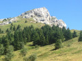
Pic Saint-Michel via the Combe Oursière and return via the Chemin des Anciens
 5.79 mi
+1,850 ft
-1,860 ft
4h 15
Moderate
Departure from Lans-en-Vercors (Isère)
5.79 mi
+1,850 ft
-1,860 ft
4h 15
Moderate
Departure from Lans-en-Vercors (Isère)
One of the peaks bordering the Vercors Regional Park to the east. Relatively easy to access, in good weather it offers a wide panorama from Mont Blanc on your left to the Écrins massif via the Belledonne chain. The climb via the Combe Oursière is less frequented than via Les Allières. A well-shaded route for most of the way.
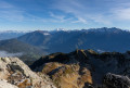
Pointe de Rognier with return via the Mollards ridge
 7.55 mi
+3,196 ft
-3,196 ft
6h 15
Difficult
Departure from Saint-Alban-des-Hurtières (Savoie)
7.55 mi
+3,196 ft
-3,196 ft
6h 15
Difficult
Departure from Saint-Alban-des-Hurtières (Savoie)
This is a beautiful hike at the northern end of the Belledonne massif. With the help of an orientation table, discover the 360° view that awaits you at the top of this peak.
As indicated in the paragraph "During the hike or nearby", part of the hike can be done with young children, with an elevation gain of about 600m.
Lac de la Patinoire
 6.07 mi
+2,625 ft
-2,625 ft
5h 05
Difficult
Departure from Pralognan-la-Vanoise (Savoie)
6.07 mi
+2,625 ft
-2,625 ft
5h 05
Difficult
Departure from Pralognan-la-Vanoise (Savoie)
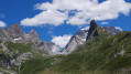
A very pleasant hike with a vast panorama from the Rosset Pass opening onto the Grande Casse and the Vanoise glaciers. The final point of the climb is the lake and its feeding glacier, which you will discover in the last few steps.
See § practical information
Les Hommes Courbés
 6.01 mi
+3,169 ft
-3,176 ft
5h 30
Difficult
Departure from Champagny-en-Vanoise (Savoie)
6.01 mi
+3,169 ft
-3,176 ft
5h 30
Difficult
Departure from Champagny-en-Vanoise (Savoie)
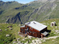
Locals call this section of the hike “Les Hommes Courbés” (The Bent Men) because of the shape of the mountain. You be the judge...
This pleasant and varied hike is particularly suitable for a hot day as two-thirds of the route is in the shade.
For information on the difficulty, see the ‘Practical Information’ section.
The Pointe de Miribel circular route from Plaine Joux
 8.02 mi
+1,811 ft
-1,801 ft
5h 15
Moderate
Departure from Onnion (Haute-Savoie)
8.02 mi
+1,811 ft
-1,801 ft
5h 15
Moderate
Departure from Onnion (Haute-Savoie)
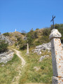
A varied hike that will take you to the Pointe de Miribel, where you can enjoy views over Lake Geneva and its surroundings, as well as Mont Blanc and its range.
Around Cerdon
 9.89 mi
+2,552 ft
-2,546 ft
6h 45
Difficult
Departure from Cerdon (Ain)
9.89 mi
+2,552 ft
-2,546 ft
6h 45
Difficult
Departure from Cerdon (Ain)
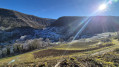
An hour from Lyon, this varied hike has its charm.With a succession of ascents and descents and a somewhat technical section on the ridge, you won't get bored.- IBP: 81In summer, the route is often shaded. In autumn, the colours of the trees and especially the vineyards will make your eyes sparkle and your cameras click away.This hike is not recommended for children.
Lac et Col de la Ponsonnière via the Grand Lac
 8.33 mi
+3,084 ft
-3,087 ft
6h 30
Difficult
Departure from Le Monêtier-les-Bains (Hautes-Alpes)
8.33 mi
+3,084 ft
-3,087 ft
6h 30
Difficult
Departure from Le Monêtier-les-Bains (Hautes-Alpes)
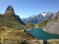
An alternative route for the round trip to Le Grand Lac and Lac de la Ponsonnière allows for a circular route involving a chimney passage, but this restricts access to those with at least some mountain experience.A breathtaking, panoramic view of the Écrins Massif: Mont Pelvoux, the Barre des Écrins, the Pic de Neige Cordier, the Meije, the Rateau and more.
Les Pertes de la Valserine and much more
11.77 mi
+1,752 ft
-1,755 ft
6h 55
Moderate
Departure from Bellegarde-sur-Valserine (Ain)
This is a long hike that allows you to visit and admire not only the Pertes de la Valserine area, but also to walk along the banks of this river, which has profoundly shaped the landscape over the centuries and enabled industrial activity in the 19th century.
The Pas de la Beccia from the Col du Mont-Cenis
 9.08 mi
+2,746 ft
-2,746 ft
6h 35
Difficult
Departure from Lanslebourg-Mont-Cenis (Savoie)
9.08 mi
+2,746 ft
-2,746 ft
6h 35
Difficult
Departure from Lanslebourg-Mont-Cenis (Savoie)
This is a circular hike passing by the Old Fort of La Turra before crossing the Pas de la Beccia at 2,717 m and descending with a beautiful view of Lake Mont-Cenis and its dam.
The Voie du Tacot starting from Bois-d'Oingt
6.81 mi
+942 ft
-945 ft
3h 55
Moderate
Departure from Le Bois-d'Oingt (Rhône)
It is thanks to the Amis de la Voie du Tacot that you will discover this walk. This association organises walks throughout the year, with the largest gathering taking place in early November. Two lines of the Chemins de Fer du Beaujolais, opened between 1901 and 1902, linked Villefranche to Monsols and Villefranche to Tarare. The car replaced the train in 1934. Walk along sections of this track, now converted into a footpath, which runs the entire length from Liergues to Sarcey.