The Gates of Morgon from Pierre Arnoux

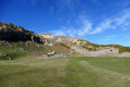
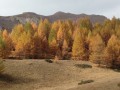
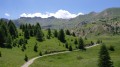
A one-day circular walk that takes you along a less-travelled path than some to the Cirque de Morgon, a truly stunning setting, particularly in autumn. The route features six metal steps set into the rock, which can be negotiated without difficulty.

Details

834441
Creation:
Last update:
Last review:
  • Walking
    Activity: Walking
  • ↔
    Distance: 8.15 mi
  • ◔
    Average duration: 6h 10 
  • ▲
    Difficulty: Difficult

  • ⚐
    Back to start: Yes
  • ↗
    Ascent: + 2,776 ft
  • ↘
    Descent: - 2,769 ft

  • ▲
    Highest point: 6,319 ft
  • ▼
    Lowest point: 3,927 ft

Photos

Description of the walk

The Pierre Arnoux car park is accessible by car from Savines-le-Lac via the D468T, then the Route Forestière des Blaches (4.5 km of unpaved road).

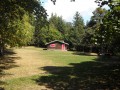
(S/E) Take the gently sloping path on your left as you arrive at Pierre Arnoux. Along the first kilometre, information boards provide details about life in the forest and forestry operations.

(1) Continue along the path to reach the Pignée spring.

(2) Walk past the spring and carry on along the same path until you reach a forest track.

(3) Once at the forest track, turn onto it, keeping to your left.

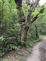
(4) After about fifty metres, leave the track and take a path on the right. Head up this path and ignore a fork to the left. Carry on climbing until you reach the metal steps.

(5) Carry on climbing until you reach the forest track leading to the sheepfold at the foot of the Pic de Morgon.

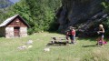
(6) Take this road, heading off to your right. After a few metres, you’ll reach a cross and enter the majestic Cirque de Morgon. You’ll come to a spring feeding a long trough where you can fill your water bottles with refreshingly cool water (a lovely spot for a picnic, facing the ridges that enclose the cirque, with, from left to right, the Pic de Charance (2,316 m), the Tête de la Vieille (2,381 m) and the Pic de Morgon (2,324 m) above you.

(7) Retrace your steps.

(6) Continue eastwards along the forest track towards the Grand Clot car park. After about 400m, head north-east. Avoid the car park by cutting across the bends in the forest track. Join theGR® de Pays Tour du Lac de Serre-Ponçon (yellow and red markings).

(8) Leave the forest road and join theGRP® on the left. At the next junction, turn left. Descend along the winding path, staying on theGRP®, to reach the hamlet of Les Charbonnières (picnic area with two tables).

(9) Turn left onto the forest road just above the picnic area.

(4) Carry on along the track and you’ll very soon reach a junction you passed on the way out.

(3) Carry on straight ahead along the forest track, not along the path you took on the way there. Ignore a turn-off on the right and continue along the track.

(10) At the signpost, follow the sign for track H3, on the right. Carry on until you reach the starting point (S/E).


Waypoints

  1. S/E : mi 0 - alt. 4,229 ft - Pierre Arnoux car park
  2. 1 : mi 0.2 - alt. 4,098 ft - Pré de la Fontaine
  3. 2 : mi 0.58 - alt. 4,236 ft - La Pignée spring
  4. 3 : mi 0.67 - alt. 4,314 ft - Forest track
  5. 4 : mi 0.71 - alt. 4,318 ft - Junction
  6. 5 : mi 1.91 - alt. 5,020 ft - Metal steps
  7. 6 : mi 2.69 - alt. 6,224 ft - Portes de Morgon
  8. 7 : mi 3.23 - alt. 6,237 ft - Water trough
  9. 8 : mi 5.02 - alt. 5,344 ft - GR de Pays, to the left
  10. 9 : mi 6.36 - alt. 3,927 ft - Picnic area
  11. 10 : mi 7.96 - alt. 4,272 ft - Signpost for Trail H3
  12. S/E : mi 8.15 - alt. 4,229 ft - Pierre Arnoux car park

Notes

Although this walk presents no particular technical difficulties, it should be classified as difficult for those unaccustomed to walking, given its elevation gain and length. For those wishing to discover the beauty of the Cirque de Morgon, a good option might be to do a round trip from the “Grand Clot” car park (elevation gain: 300m, round-trip distance: 4km).
Wear good, high-top, lugged boots for safety, and use walking poles to reduce fatigue and improve safety.
Water points are available at the start, at the Pierre Arnoux area, and at the sheepfold, the highest point (no pun intended) of the walk. I would not recommend the spring at (2).

Worth a visit

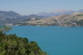
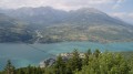
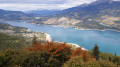
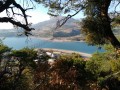
Take a look from the viewpoint near the Pierre Arnoux car park. This is the only spot on this route where you’ll have a good view of the lake and the Savines bridge.

Discover information about forest life thanks to the information boards dotted along part of the route. The Boscodon Forest is an important source of timber from several species.

Extend the walk to the Pic de Morgon (an additional climb of around 300 metres) to enjoy one of the most beautiful and spectacular views of Lake Serre-Ponçon and the surrounding mountains. See the walk ‘The Pic de Morgon from the Fontaine de l’Ours’, which offers a gentler but longer route to the summit of the Pic de Morgon.

Nearby, a visit to the Romanesque-style Boscodon Abbey is highly recommended.

Always be cautious and plan ahead when you're outdoors. Visorando and the author of this route cannot be held responsible for any accidents occurring on this route.

The GR® and PR® markings are the intellectual property of the Fédération Française de Randonnée Pédestre.

Reviews and comments

4.5 / 5
Based on 2 reviews

Reliability of the description
4.5 / 5
Ease of following the route
4.5 / 5
Route interest
4.5 / 5
Luce
Luce
• Edited:

Overall rating : 4 / 5

Date of your route : Jul 20, 2023
Reliability of the description : ★★★★☆ Good
Ease of following the route : ★★★★☆ Good
Route interest : ★★★★☆ Good
Very busy route : No

We really enjoyed this walk. It was tough at the start; it’s quite a steep climb once you’re near the ladder (in fact, you follow the ‘Pic de Morgon via the ladder’ path), but you’re climbing in the cool of the forest. Once we reached point 6, we decided to carry on to the Lac (or rather, the pond…) de Morgon for a picnic amidst the magnificent scenery of the Morgon cirque. From there, we pressed on to the Morgon ridge to get a better view of the spectacular landscape. When we reached the start of the final climb before the peak, I stopped, but my husband carried on to the peak itself and came back delighted. Please note that some sections of the ridge are very narrow and will be really difficult for anyone prone to vertigo.
We then retraced our steps to continue with the planned hike. This return journey (point 7) towards the ‘Grand Clos’ car park is quite arduous, as you walk along a sort of forest track covered in stones of varying sizes that are rather unstable. The route becomes interesting again when, after the aforementioned car park, you leave the track and take a path on the left, signposted ‘Pierre Arnoux’ at 4.8 km. From there, it’s about 2 km downhill along a very steep, knee-straining path (especially at the end of the walk). Once this gruelling stretch was over, we were delighted to finish the walk with a 2.5 km stretch of road that climbed gently and was nice and flat.

Machine-translated

Sally84
Sally84

Overall rating : 5 / 5

Date of your route : Oct 23, 2018
Reliability of the description : ★★★★★ Very good
Ease of following the route : ★★★★★ Very good
Route interest : ★★★★★ Very good

A superb route.
We did the hike over two days on 20–21 October because I wanted to spend one last night under the stars before winter set in. We slept in the cirque (there were already night-time frosts at this time of year ❄️)
It’s a challenging hike as there’s a significant elevation gain over just a few kilometres. The view from the summit is extraordinary.
A slight snag for dog owners, though: although we weren’t in the protected mountain area, there’s a sheepfold in the cirque and, depending on the season, flocks may be there. On the way down, we came across signs asking that dogs be kept on a lead or not brought in at all. By then, it was far too late for us...
I highly recommend this hike!

Machine-translated

gazok54
gazok54 ★

Thank you, abrgrando2005
It’s true that Morgon, Les Ecrins, Queyras and so on are still very snowy at the moment. We’ll have to wait for the warmer weather, which is taking its time to arrive this year.

Machine-translated

abrgrando2005
abrgrando2005
• Edited:

I’ve downloaded this walk, but I won’t be doing it until May or June; there’s still snow on the Morgon.

Machine-translated

Other walks in the area

For more walks, use our search engine .

The GPS track and description are the property of this route's author. Please do not copy them without permission.