The Cirque des Évettes

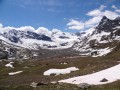
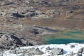
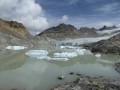
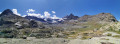
This full-day hike will allow you to explore the Plan des Évettes, a magnificent glacial cirque which, unfortunately, has seen its glaciers retreat over the years.
It is dominated by several peaks over 3,000 m, including the Albaron at 3,637 m.
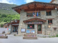
As you sit on the refuge’s terrace, you’ll find it hard to tear yourself away from this fabulous landscape. And why not consider spending the night at the Refuge des Évettes?

Details

n°23580195
Creation:
Last update:
Last review:
  • Walking
    Activity: Walking
  • ↔
    Distance: 9.83 mi
  • ◔
    Average duration: 6h 50 
  • ▲
    Difficulty: Difficult

  • ⚐
    Back to start: Yes
  • ↗
    Ascent: + 2,621 ft
  • ↘
    Descent: - 2,648 ft

  • ▲
    Highest point: 8,491 ft
  • ▼
    Lowest point: 5,948 ft

Description of the walk

Coming from Bessans via the D902 and passing Bonneval-sur-Arc on your left, you’ll reach a sweeping bend where the tourist office is situated at the junction with the Route du Tralenta, which branches off to the right. Take this road, which climbs gently for about 300 m, to reach a car park on your left.
Coming from the Col de l’Iseran, the Route du Tralenta will be on your left.

(S/E) The walk starts at the exit of the car park; turn left and follow a path that will take you to the hamlet of L’Écot. On leaving the hamlet, you’ll come to a small road leading to the hamlet of Le Mollard. Do not head towards the hamlet, but carry on straight ahead until you reach a crossroads.

(1) At the crossroads, continue down the road on your right.

(2) Turn left to reach the start of the path leading to the Gorge de la Reculaz.

(3) The path continues through a flat, green area before reaching the trickiest part of the walk.

(4) This is where the most challenging 360 m of ascent begins, with several short sections fitted with cables to help you make your way up.

(5) Once you can see the small bridge by the waterfall, head in that direction.

(6) Ignore a hairpin bend to the right – you’ll take that on the way back – and carry on straight ahead.

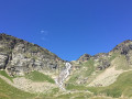
(7) Reculaz Waterfall Bridge – don’t forget to take a souvenir photo. Retrace your steps.

(6) Carry on along the path on the left, which will take you to the Refuge des Èvettes.

(8) You are now starting your return journey by taking the path to the left of the refuge.

(9) At the signpost, follow the direction indicated for Bessans; to do this, do not continue straight ahead but turn round to take a path slightly above the one you arrived on. A few metres further on, turn right and continue along theGRP® Tour de la Haute-Maurienne.

(10) You are now beneath the cables of the Moulinet ski lift. Follow the faintly marked path to join the track leading to the ski lifts.

(11) Continue down this path to reach the departure point for two ski lifts near the Refuge du Criou.

(12) Follow a wide track – which serves as a ski run at other times of the year – to reach the bridge spanning the Arc.

(13) After crossing the bridge, take the path on your right which leads you back to the car park (S/E).

Waypoints

  1. S/E : mi 0 - alt. 6,014 ft - Tralenta car park
  2. 1 : mi 1.77 - alt. 6,660 ft - Change of direction
  3. 2 : mi 1.87 - alt. 6,637 ft - Change of direction
  4. 3 : mi 2.01 - alt. 6,673 ft - Change of direction – Danger warning sign
  5. 4 : mi 3.21 - alt. 7,014 ft - Start of the ascent along the Gorge de la Reculaz
  6. 5 : mi 4.02 - alt. 8,209 ft - Change of direction
  7. 6 : mi 4.09 - alt. 8,258 ft - Round trip to the Reculaz Waterfall
  8. 7 : mi 4.28 - alt. 8,199 ft - Bridge near the - Cascade de la Reculaz
  9. 8 : mi 4.82 - alt. 8,484 ft - Les Èvettes Mountain Hut - Col des Evettes
  10. 9 : mi 6.25 - alt. 7,621 ft - Signpost – Subtle change of direction
  11. 10 : mi 7.54 - alt. 7,379 ft - Passage under the ski lift cables
  12. 11 : mi 7.95 - alt. 7,142 ft - Change of direction
  13. 12 : mi 8.46 - alt. 6,709 ft - Criou Mountain Hut
  14. 13 : mi 9.67 - alt. 5,951 ft - Bridge over the - Arc (rivière) - Affluent de l'Isère
  15. S/E : mi 9.83 - alt. 6,014 ft - Tralenta car park

Notes

This hike has been classified as ‘Difficult’ due to its length and, in particular, the tricky section between points (4) and (5). It should only be undertaken in good weather, when the ground is dry.
If you are with children, the utmost caution is required on the section between points (4) and (5), near the bridge and the waterfall.
Good walking boots are strongly recommended for safety reasons.
There are short sections fitted with cables.
Make sure you take enough water with you, even though it is possible to top up your supplies at the mountain hut.
Spending the night at the mountain hut is a very pleasant option and avoids the need for such a long day’s walk.

Option to reduce the elevation gain slightly, but above all the distance: Start the walk from the car parks near L’Écot and, on the way back, at point (9), take the path towards L’Écot, saving 250 metres of elevation gain and nearly 7 km in distance.

Worth a visit

After crossing the bridge (7), you can venture a little further into the Plan des Evettes.

Reviews and comments

5 / 5
Based on 2 reviews

Reliability of the description
5 / 5
Ease of following the route
5 / 5
Route interest
5 / 5
BoB60'
BoB60'

Overall rating : 5 / 5

Date of your route : Sep 22, 2026
Reliability of the description : ★★★★★ Very good
Ease of following the route : ★★★★★ Very good
Route interest : ★★★★★ Very good
Very busy route : No

A lovely day’s hike, with a few tricky sections but nothing too difficult towards the end of the climb up through the gorges towards the Cirque des Évettes. The return route along the ridge towards Bonneval seems rather long...

Machine-translated

hbarillon
hbarillon

Overall rating : 5 / 5

Date of your route : Aug 28, 2024
Reliability of the description : ★★★★★ Very good
Ease of following the route : ★★★★★ Very good
Route interest : ★★★★★ Very good
Very busy route : No

A lovely walk. As mentioned in the information, there are two tricky sections.

Machine-translated

Other walks in the area

For more walks, use our search engine .

The GPS track and description are the property of this route's author. Please do not copy them without permission.