


Refine your search for walks in Prat
Prat walks


 From Poulloguer Pond to Coatascorn
 Visorando Member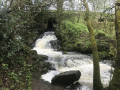
 6.98 mi
 +469 ft
 -479 ft
 3h 35
3h 35
 Moderate
 Departure from Prat (Côtes-d'Armor)
Although this walk uses a few tarmac roads, priority has been given here to forest paths and tracks open to farm machinery. In return, it offers magnificent scenery both around Poulloguer Pond and along the stream of the same name, with a very pleasant walk through the village of Coatascorn, a quintessential Trégor village with all its stone houses.
Brélidy and its surroundings
 7.94 mi
+515 ft
-545 ft
4h 05
Moderate
Departure from Brélidy (Côtes-d'Armor)
7.94 mi
+515 ft
-545 ft
4h 05
Moderate
Departure from Brélidy (Côtes-d'Armor)
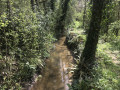
A very pleasant walk through the forest with a few slightly challenging sections, but these should not put off beginners as they are more than made up for by the lovely views of the local rivers, far from the noise of the town.
It ends with the panoramic view from the oppidum.
Along the Donant
 7.67 mi
+361 ft
-361 ft
3h 50
Moderate
Departure from Bégard (Côtes-d'Armor)
7.67 mi
+361 ft
-361 ft
3h 50
Moderate
Departure from Bégard (Côtes-d'Armor)
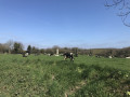
The Donant and the Kerogan Stream flow into the Jaudy, one of the many coastal rivers of the Trégor.
This route allows you to discover peaceful, leafy landscapes as you walk along both sunken paths and tarmac roads where, at times, you can forget about civilisation.
If you’d rather not go hiking, you can spend the day at the amusement park, which serves as the starting point.
The Trégor countryside in Pluzunet
 7.40 mi
+197 ft
-200 ft
3h 35
Moderate
Departure from Pluzunet (Côtes-d'Armor)
7.40 mi
+197 ft
-200 ft
3h 35
Moderate
Departure from Pluzunet (Côtes-d'Armor)
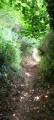
The Trégor countryside, always rich in peaceful scenery, is at its best during this walk, which presents no difficulty.
From Tonquédec to the castle ruins via the Léguer
7.26 mi
+371 ft
-381 ft
3h 40
Moderate
Departure from Tonquédec (Côtes-d'Armor)
There is virtually no elevation gain on this walk in the Trégor forest. Just magnificent scenery, starting with paths through chestnut trees, then a walk along the banks of the Léguer, ending with a visit to the imposing ruins of Tonquédec Castle. At the end of the walk, don't forget to visit the village church.
Castles and chapels in the Trégor
7.14 mi
+587 ft
-617 ft
3h 50
Moderate
Departure from Tonquédec (Côtes-d'Armor)
The chapels of Kerrivoalan and Saint-Gildas on the one hand; but also Kergrist Castle (a private residence open to visitors only in summer) and, of course, the ruins of Tonquédec Castle and its oratory on the other; and finally the mills at Traoumorvan, Kergrist and Kergrot bear witness, throughout this route, to a Brittany that was once warlike, devout and agricultural, but has now become a tourist destination.
To the east of Tonquédec
 7.15 mi
+236 ft
-236 ft
3h 30
Moderate
Departure from Tonquédec (Côtes-d'Armor)
7.15 mi
+236 ft
-236 ft
3h 30
Moderate
Departure from Tonquédec (Côtes-d'Armor)
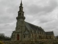
We are not inviting you to hike towards Tonquédec Castle, which was dismantled around 1626 on the orders of Richelieu and is situated to the north-west of the village of the same name, but rather to the south-east of this village. There we will find the Guindy, a river dear to the people of Trégor, as well as green sunken paths in lush countryside.
La Roche-Derrien and the Hortence Garden
7.58 mi
+469 ft
-472 ft
3h 55
Moderate
Departure from Langoat (Côtes-d'Armor)
This walk begins and ends on the banks of the ponds at La Roche-Derrien (Crec’h an Goué). The route first takes us to St Anne’s Chapel, which is part of Kermézen Castle. We then cross the Hortence Garden (10ha), where a Dutch couple grow hydrangeas to export to the land of tulips. We finish by admiring the view of Le Jaudy from a promontory, the Oppidum de La Roche, with the Calvaire Chapel.
Tonquédec Castle and Kerfons Chapel
 4.90 mi
+643 ft
-633 ft
2h 50
4.90 mi
+643 ft
-633 ft
2h 50
 Easy
Departure from Tonquédec (Côtes-d'Armor)
Easy
Departure from Tonquédec (Côtes-d'Armor)
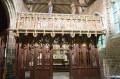
Two historic sites along this walk: Tonquédec Castle with its walls and restoration work, and the magnificent little Chapel of Kerfons. All this is complemented by a relaxing stroll along the Léguer.
A stroll through the heritage of Rospez
 5.54 mi
+102 ft
-102 ft
2h 40
Easy
Departure from Rospez (Côtes-d'Armor)
5.54 mi
+102 ft
-102 ft
2h 40
Easy
Departure from Rospez (Côtes-d'Armor)
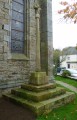
This walk through the heritage of Rospez is offered by the "heritage" group of the "Ro'Spered" association.
The remarkable sites linked together are very diverse: parish church, chapels, fountain, crosses or calvaries, flax scutching machine, Bronze Age tumulus, restored wash house... crossroads of three Roman roads...
A hike through the Rospez countryside, discovering the remains of a past dating back nearly three millennia...
The Léguer on the outskirts of Le Danot
 7.12 mi
+682 ft
-699 ft
3h 50
Moderate
Departure from Pluzunet (Côtes-d'Armor)
7.12 mi
+682 ft
-699 ft
3h 50
Moderate
Departure from Pluzunet (Côtes-d'Armor)
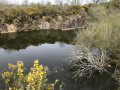
A walk through the Trégor forest, where you’ll follow the Léguer coastal river, as well as passing chapels and cave dwellings.
Option to take a shortcut, reducing the distance to 8 km; classified as ‘Easy’.
From Saint-Éloi to the Pergat Menhir, returning along the banks of the Guindy
 7.15 mi
+200 ft
-200 ft
3h 30
Moderate
Departure from Louargat (Côtes-d'Armor)
7.15 mi
+200 ft
-200 ft
3h 30
Moderate
Departure from Louargat (Côtes-d'Armor)
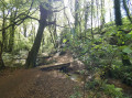
There is virtually no elevation gain on this route, which follows small forest paths alongside a river and stream, allowing you to enjoy the sound of the water and the birdsong.
There is no answer to the mystery of the menhirs when faced with this colossus weighing several tonnes, which has stood in this small clearing for over 5,000 years.
Tro Ménez Bré
 6.46 mi
+574 ft
-600 ft
3h 30
Moderate
Departure from Pédernec (Côtes-d'Armor)
6.46 mi
+574 ft
-600 ft
3h 30
Moderate
Departure from Pédernec (Côtes-d'Armor)
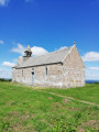
This walk offers nothing less than the chance to climb the highest point in the Côtes d’Armor and enjoy a completely unobstructed 360° view. On a clear day, it’s even said that you can see the sea!
From Buhulien, the banks of the Léguer between Lannion and Kerfons
7.98 mi
+801 ft
-814 ft
4h 20
Moderate
Departure from Lannion (Côtes-d'Armor)
Walking around the Coat Azur forest means discovering all these hamlets which, in the Middle Ages, lived off the coastal river – hence the many castles that line its banks: Coatfrec, Tonquédec, Kergrist
Today, the largest of these continue to grow, bringing together the homes of people who work in Lannion.
The sunken paths north of Hengoat
7.33 mi
+262 ft
-266 ft
3h 35
Moderate
Departure from Hengoat (Côtes-d'Armor)
Hengoat, a small commune in the Côtes-d’Armor whose name can be translated into French as “The Old Wood” (hen = old and goat = wood), was voted “Commune of the World” in 2012.
This route, which unfortunately runs on tarmac for too much of the way, allows you to explore the surroundings of this Breton village via some very beautiful sunken paths.
Hent Glas route around Hengoat
 6.07 mi
+243 ft
-236 ft
3h 00
Moderate
Departure from Hengoat (Côtes-d'Armor)
6.07 mi
+243 ft
-236 ft
3h 00
Moderate
Departure from Hengoat (Côtes-d'Armor)
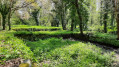
A walk through the Hengoat countryside: a peaceful, quiet route with no particular difficulty. You can take the time to listen, hear and admire the birds!
The route is well signposted; the blue markings were put in place by volunteers from the Glad war dro Hengoad association (Hengoat heritage). A map of the route is available outside the town hall at the start of the walk.
Circular between Kernévez Jaudy and Tréglamus
8.79 mi
+472 ft
-469 ft
4h 25
Moderate
Departure from Pédernec (Côtes-d'Armor)
A beautiful hike between Pédernec and Tréglamus on different types of paths. You will walk through the countryside, passing pretty hamlets and isolated farms, mainly on PR® or GR® trails. Between the views of the Ménez Bré summit and the wind farms, you will encounter no difficulty on the route, except for a few slightly damp sections, depending on the season, in the sunken paths.
Circular Pédernec, from Kernévez Jaudy to Ménez Bré
8.50 mi
+719 ft
-712 ft
4h 30
Moderate
Departure from Pédernec (Côtes-d'Armor)
This circular walk in the Pedernecoise countryside will take you to the summit of Ménez Bré, the highest point in Trégor at an altitude of 302 metres. At the foot of the Saint-Hervé Chapel, you will have a 360° view of the Guingamp region and the Pink Granite Coast to the Monts d'Arrée. Apart from the fairly steep climb to the summit, you will encounter no difficulty on this hike. Choose a sunny day to enjoy the most magnificent view possible.
Circular route around Pédernec from Kernévez Jaudy via Guénézan and Rumodu
8.98 mi
+322 ft
-344 ft
4h 25
Moderate
Departure from Pédernec (Côtes-d'Armor)
This easy circular route, starting from the hamlet of Kernévez Jaudy in Pédernec, will take you through the surrounding countryside along various paths linking the different hamlets on either side of the four-lane road connecting Guingamp to Lannion. You’ll be able to admire the Chapel of Lorette and the church at Pédernec, as well as a few wayside crosses adorning the crossroads, whilst walking along the banks of small streams and the River Jaudy will offer you a refreshing break.
Tréguier and its surroundings
 7.32 mi
+525 ft
-545 ft
3h 50
Moderate
Departure from Minihy-Tréguier (Côtes-d'Armor)
7.32 mi
+525 ft
-545 ft
3h 50
Moderate
Departure from Minihy-Tréguier (Côtes-d'Armor)
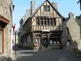
During this walk, you will discover Tréguier with its Saint-Yves cathedral, narrow cobbled streets and stone houses, including that of Ernest Renan, a famous writer of the late 19th century. You will also enjoy the banks of the Guindy, a small river that flows into the Jaudy. As both rivers are subject to tidal influences, it is advisable to set off an hour before high tide to make the most of the scenery.
A journey back in time with the Trégor routoirs
 7.08 mi
+315 ft
-292 ft
3h 30
Moderate
Departure from Pouldouran (Côtes-d'Armor)
7.08 mi
+315 ft
-292 ft
3h 30
Moderate
Departure from Pouldouran (Côtes-d'Armor)
After walking along the Bizien Mill Stream, you will come across the first routoirs. Then, after crossing the Rolland Mill, there is a whole route to explore the main routoirs of the Trégorrois region.
Walk through the heart of Trégor between Pouldouran and Troguéry
 4.91 mi
+171 ft
-154 ft
2h 25
Easy
Departure from Pouldouran (Côtes-d'Armor)
4.91 mi
+171 ft
-154 ft
2h 25
Easy
Departure from Pouldouran (Côtes-d'Armor)
An easy walk offering typical landscapes between the river and the countryside, as well as numerous examples of Trégor’s heritage, including the famous flax-drying sheds, the cultivation of which brought prosperity to this corner of Trégor.
Circular route around Plouisy from the shooting range to Kernabas Mill
6.09 mi
+282 ft
-282 ft
3h 05
Easy
Departure from Plouisy (Côtes-d'Armor)
This easy hike will allow you to discover the countryside around Plouisy, the village and the surrounding wild valleys. You can also enjoy the beauty of the Moulin de Kernabas (or Kernabat, depending on the map and signposts!) or the grounds of the Cours Sainte-Anne and Kernabas Castle or Saint-Antoine Chapel. At the starting point, you will find a picnic area with tables and sports equipment, perfect for ending a beautiful day in the great outdoors.
Shooting range at Plouisy
 4.57 mi
+79 ft
-79 ft
2h 10
Easy
Departure from Plouisy (Côtes-d'Armor)
4.57 mi
+79 ft
-79 ft
2h 10
Easy
Departure from Plouisy (Côtes-d'Armor)
An easy circular walk, featuring numerous footbridges, within the Champ de Tir nature reserve in Plouisy. This circular walk forms part of a longer route starting from the village of Plouisy, which has been accredited by the French Hiking Federation.
More walks in Prat
Select a point of interest below: