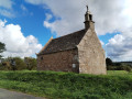
From Buhulien, the banks of the Léguer between Lannion and Kerfons

Walking around the Coat Azur forest means discovering all these hamlets which, in the Middle Ages, lived off the coastal river – hence the many castles that line its banks: Coatfrec, Tonquédec, Kergrist
Today, the largest of these continue to grow, bringing together the homes of people who work in Lannion.

Details

386033
Creation:
Last update:
Last review:
  • Walking
    Activity: Walking
  • ↔
    Distance: 7.98 mi
  • ◔
    Average duration: 4h 20 
  • ▲
    Difficulty: Moderate

  • ⚐
    Back to start: Yes
  • ↗
    Ascent: + 801 ft
  • ↘
    Descent: - 814 ft

  • ▲
    Highest point: 315 ft
  • ▼
    Lowest point: 26 ft
  • ⚐ Country: France
  • ⚐ City: Lannion (22300)
  • ⚑
    Start/End: N 48.717115° / W 3.411719°
  • ❏
    IGN map(s): Ref. 0714OT
  • Hour-by-hour weather

Description of the walk

Park in front of Buhulien Town Hall.

(S/E) Head east and turn right into the first street: Rue de Tonquédec. Walk partly alongside the cemetery on your left and turn right into the first street.
Follow the Chemin de Traou ar Ru to the hamlet of the same name.

Red and white markings forthe GR®34A

Turn left and continue to the crossroads.

(1) Turn left towards Toul ar Hoat and, when you reach the houses, follow the path to the right. Ignore a path branching off to the left and continue due south.
At the fork, turn left and, after 50 m, at the bend, carry on straight ahead towards Kermeur.

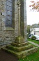
(2) At the wayside cross, continue westwards to reach the Léguer at Milin Kerginiou.

No further signposting

TheGR® continues to the left.
Turn right, then left to cross the river. After 50 m, at a bend, take the path on the left which heads due south, following the Léguer more or less closely.

(3) When it veers off to the right, it leads to Komanant Erwanig Marzhin. The path turns into a farm track and passes through the hamlet of Kerfaouez. As you continue, ignore a track on the left and then another on the right.

(4) Turn right to pass in front of a long farm shed. After the Komanant ar Flemm farm, the track becomes a path again and climbs northwards. It becomes a track again when you reach the houses.
At the crossroads, turn left and continue for 400 m. Turn onto the track on the right which joins the road.

(5) Turn left and follow this road, which passes through several hamlets. At a Fork in the road, in front of a beautiful property, keep to the right and continue until you reach the road.
Turn left and, after 450 m, take the path on the right which heads straight north.

(6) When you reach Kerallain, follow the road to the right, then take the one on the left after the houses at Douar Névez.
At the end of the road, turn left, follow the Chemin de Koad Freg, then veer left to cross the Léguer.

(7) Pass the Buhulien Mill on your right and continue along the road to the left. This takes you back to Buhulien by going straight ahead at the roundabout (S/E).

Waypoints

  1. S/E : mi 0 - alt. 220 ft - Town Hall car park
  2. 1 : mi 0.81 - alt. 194 ft - Turn left
  3. 2 : mi 2.02 - alt. 249 ft - Kermeur Calvary
  4. 3 : mi 2.82 - alt. 105 ft - A final view of the > - Léguer (le)
  5. 4 : mi 3.75 - alt. 305 ft - Turn right
  6. 5 : mi 4.92 - alt. 233 ft - Turn left
  7. 6 : mi 6.39 - alt. 138 ft - Turn right
  8. 7 : mi 7.24 - alt. 36 ft - Buhulien Mill
  9. S/E : mi 7.98 - alt. 223 ft - Town Hall car park

Notes

(7) At the Buhulien Mill, look out for a wide path on the left. This is the towpath which, running alongside the river, leads to Lannion. At this point, you cross theGR®34A, which comes from the path on the right and follows the towpath.

On the hill near the Buhulien Mill stand the ruins of Coatfrec Castle, which once protected this waterway. Listed as a historic monument since 1927, it is currently being restored but can only be visited during Heritage Days.

Always be cautious and plan ahead when you're outdoors. Visorando and the author of this route cannot be held responsible for any accidents occurring on this route.

The GR® and PR® markings are the intellectual property of the Fédération Française de Randonnée Pédestre.

Reviews and comments

4.3 / 5
Based on 3 reviews

Reliability of the description
4.7 / 5
Ease of following the route
4.7 / 5
Route interest
3.5 / 5
fps
fps

Overall rating : 3.7 / 5

Date of your route : Apr 09, 2025
Reliability of the description : ★★★★☆ Good
Ease of following the route : ★★★★★ Very good
Route interest : ★★☆☆☆ Disappointing
Very busy route : No

The walk got off to a good start, but then there were far, far too many tarmac roads or tracks.

Machine-translated

capali
capali
• Edited:

Overall rating : 5 / 5

Date of your route : Mar 04, 2020
Reliability of the description : ★★★★★ Very good
Ease of following the route : ★★★★★ Very good
Route interest : Not used / Not applicable

We love the paths through the woods – we have a great time there!!! Well, OK, at the moment you have to watch out for the mud, because
we’ve had loads of rain, so the paths are very muddy and slippery in places – you’ll need
good walking boots. Have a lovely walk. Edith

Machine-translated

capali
capali
• Edited:

Overall rating : 4.7 / 5

Date of your route : Feb 03, 2020
Reliability of the description : ★★★★★ Very good
Ease of following the route : ★★★★☆ Good
Route interest : ★★★★★ Very good

I love this place, so I’d say “brilliant...!!!”
Kind regards
Édith Bernard

Machine-translated

Other walks in the area

For more walks, use our search engine .

The GPS track and description are the property of this route's author. Please do not copy them without permission.