Shooting range at Plouisy

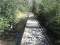
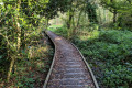
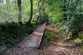
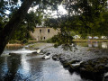
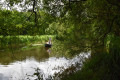
An easy circular walk, featuring numerous footbridges, within the Champ de Tir nature reserve in Plouisy. This circular walk forms part of a longer route starting from the village of Plouisy, which has been accredited by the French Hiking Federation.

Details

4212706
Creation:
Last update:
Last review:
  • Walking
    Activity: Walking
  • ↔
    Distance: 4.57 mi
  • ◔
    Average duration: 2h 10 
  • ▲
    Difficulty: Easy

  • ⚐
    Back to start: Yes
  • ↗
    Ascent: + 79 ft
  • ↘
    Descent: - 79 ft

  • ▲
    Highest point: 545 ft
  • ▼
    Lowest point: 466 ft
  • ⚐ Country: France
  • ⚐ City: Plouisy (22200)
  • ⚑
    Start/End: N 48.582716° / W 3.206184°
  • ❏
    IGN map(s): Ref. 0815SB, 0816SB
  • Hour-by-hour weather

Photos

Description of the walk

Start from the car park at the Plouisy Shooting Range.

Yellow markings

(S/E) Take the small access road to the site and follow the path on the left after the house.

(1) At the crossroads, continue left onto a fairly wide track.

(2) At the car park where the path forks, carry straight on.

(3) At the end of this wide track, take the stony path on the right and continue until you reach the tarmac road. This section of the route has been gravelled to avoid mud, but it is a bit difficult to walk on. An alternative route is available: see § Practical information.

(4) At the road, turn left towards the village of Kermarc. Walk through the village and carry on straight ahead until you reach a crossroads.

(5) Turn left onto the path and carry on straight ahead.

(6) At the crossroads, turn right and take the footbridges, then turn left a little further on. Keep following the path marked in yellow.

(7) Then turn sharply to the left. Continue along the marked path and cross a series of footbridges which will take you back towards the shooting range.

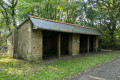
(8) Take the path on the right and walk past a shooting shelter and the picnic area. This path takes you straight back to the car park (S/E).


Waypoints

  1. S/E : mi 0 - alt. 545 ft - Shooting Range car park
  2. 1 : mi 0.27 - alt. 541 ft - Path towards Coajou Baslan
  3. 2 : mi 0.8 - alt. 522 ft - Coajou Baslan car park (wind turbines)
  4. 3 : mi 1.03 - alt. 518 ft - Kermarc circular junction
  5. 4 : mi 1.5 - alt. 482 ft - Junction towards Kermarc
  6. 5 : mi 2.23 - alt. 492 ft - Keravel junction
  7. 6 : mi 2.59 - alt. 499 ft - Path to the footbridges
  8. 7 : mi 3.65 - alt. 499 ft - Kerloas crossroads
  9. 8 : mi 4.15 - alt. 518 ft - Allée de la Butte de Tir
  10. S/E : mi 4.57 - alt. 545 ft - Shooting Range car park

Notes

Alternatives:

(2) You can visit the Coajou Baslan wind turbines on the left and then retrace your steps.

(3) You can turn left to head directly to (6) without going through the village of Kermarc.

Worth a visit

Reviews and comments

4.6 / 5
Based on 3 reviews

Reliability of the description
4.7 / 5
Ease of following the route
5 / 5
Route interest
4 / 5
pat-60
pat-60

Overall rating : 4.7 / 5

Date of your route : Jun 28, 2024
Reliability of the description : ★★★★★ Very good
Ease of following the route : ★★★★★ Very good
Route interest : ★★★★☆ Good
Very busy route : No

A very easy and well-documented route. What’s more, the information provided along the way gives an insight into the history of this shooting range.

Machine-translated

bossard claude
bossard claude

Overall rating : 4.7 / 5

Date of your route : Jun 17, 2024
Reliability of the description : ★★★★★ Very good
Ease of following the route : ★★★★★ Very good
Route interest : ★★★★☆ Good
Very busy route : No

80% woodland, very clean – be wary in autumn
Winter, but a lovely, completely flat walk
Not a single uphill section

Machine-translated

Olive22140
Olive22140

Overall rating : 4.3 / 5

Date of your route : Apr 18, 2021
Reliability of the description : ★★★★☆ Good
Ease of following the route : ★★★★★ Very good
Route interest : ★★★★☆ Good
Very busy route : Yes

A lovely little walk through woodland and along fields, far from the towns, with footbridges to cross certain areas, a very short tarmac section; the path is well-maintained and signposted, with a car park at the start of the route. It’s a very flat, very easy trail where we spotted a great spotted woodpecker and a roe deer – in short, it was brilliant.

Machine-translated

Other walks in the area

For more walks, use our search engine .

The GPS track and description are the property of this route's author. Please do not copy them without permission.