Country:
 City:
City:


Hengoat village car park; near the D20 and the church.
(S/E) Leave the car park by heading uphill to the left. After the church, turn right onto Rue du Moulin.
(1) Turn right towards Pen an Crec’h (a beautifully restored farmhouse). Walk through the Lower Town and continue to the end of the road. Take the path on the left and follow it to the end.
(2) Turn right onto the road and continue to the T-junction.
Turn right and follow the D72 eastwards. Cross the Ruisseau du Moulin de Bizien.
(3) Take the path on the left. It may be very muddy due to its proximity to the stream. Follow this path, ignoring all the side paths on the left, and continue straight on at a crossroads to reach a road in the middle of a bend.
(4) Follow this road to the left, then take the first road on the right towards Toul Bougeant. After 50 metres, take the path on the left, then turn right onto the road. Enter Moulin Rolland.
(5) Opposite the café, take the street on the left, cross the Ruisseau du Moulin de Bizien again, then continue left at the junction.
Carry on straight ahead along the path that continues from the road.
(6) At Kerdossen, turn left and then immediately right onto a path running alongside the woods. When you reach the road, keep right to reach the D20.
(7) Take the departmental road on the right for about 250 metres (watch out for traffic). At the right-hand bend, carry straight on towards the north.
(8) At the wayside cross, turn right, then left at the junction a few metres further on. After the left-hand bend, carry on straight ahead along the path. Cross the road and continue straight ahead along the path for about 500 metres.
(9) Turn left to head due south.
At the junction, turn right, then, once on the road, head towards Kerséhan and turn left.
(10) Continue along the road to the right, following the signs for “Le Launay”. Ignore any roads branching off to the left and always keep to the right.
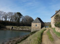
(11) At Le Launay, take the path on the left, cross the stream, go up the embankment and continue to the left.
On your left are two flax-threshing huts in need of restoration.
At the end of the path, turn left and continue along the road heading east. Keep heading east along a connecting path and carry straight on along the road as it curves to the right.
(12) Turn left, then, after 50m, take the path on the right. After a left-hand bend, continue to the right. Cross a stream, then, at the end of the path, turn left to reach a tarmac road.
This ends at the D20, which you should follow to the left to reach Hengoat and the car park on the left (S/E).

 A lovely route, but also very muddy in early April. Best done from mid-May onwards, when the paths are drier.
 Visorando Member

 Easy
Easy