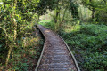
Brélidy and its surroundings

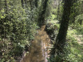
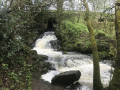
A very pleasant walk through the forest with a few slightly challenging sections, but these should not put off beginners as they are more than made up for by the lovely views of the local rivers, far from the noise of the town.
It ends with the panoramic view from the oppidum.

Details

175997
Creation:
Last update:
Last review:
  • Walking
    Activity: Walking
  • ↔
    Distance: 7.94 mi
  • ◔
    Average duration: 4h 05 
  • ▲
    Difficulty: Moderate

  • ⚐
    Back to start: Yes
  • ↗
    Ascent: + 515 ft
  • ↘
    Descent: - 545 ft

  • ▲
    Highest point: 328 ft
  • ▼
    Lowest point: 131 ft
  • ⚐ Country: France
  • ⚐ City: Brélidy (22140)
  • ⚑
    Start/End: N 48.660763° / W 3.220381°
  • ❏
    IGN map(s): Ref. 0815SB
  • Hour-by-hour weather

Photos

Description of the walk

Note: much of this walk follows a route marked by wooden signs bearing a green dot.
Start: Salle des Fêtes car park.

(S/E) Head off to the right: Rue de la Mairie; in the village, at the junction, turn left then immediately right.

(1) After the cemetery, at the bend, take the path on the left. It descends to the hamlet of Camarel. On the road, turn left. Follow this road to the bottom of a hill and take a path on the right.
When the path veers sharply to the right, about twenty metres further on, in a field, there is a beautiful menhir. Continue along this path.

(2) Turn left to head down towards the stream Le Théoulas. Continue to reach the road and the hamlet of Camarel. Return to the road by turning left.
At the end of this road, turn left onto Rue Bellevue.

(3) Carry straight on at the junction with Rue Croaz Naval towards Locmaria. At the next junction, turn right.

(4) At a left-hand bend, take the path that continues from the road. Follow this path alongside a field to reach the Théoulas stream below. The path climbs through a wooded area, winding its way up in a series of small bends. It ends at the Kervéziou road.

(5) Turn left onto it to reach a wayside cross. Cross the road and take the path that continues from it. When you reach a new road, turn right onto it and continue through the hamlet of Kerbiquet.

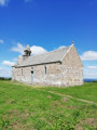
(6) As you pass, admire the small chapel on your right. Join the D20 and follow it to the left. Take the first road on the right, then follow a right-hand bend.

(7) Take the path on the left, then after 80m, continue onto another path on the right. It continues through the forest, running more or less parallel to the Jaudy. Near the D15, it branches off to the right, followed by an uphill section, a U-turn and then a descent. After a few slightly tricky sections, continue along the path that runs alongside the D15 below.

(8) Cross the D15 and continue along the path which rejoins the Jaudy.

(9) The path leads onto a road; take it on the left and continue along it.

(10) At a crossroads, take the path signposted for the hotel and the restaurant "Aux délices de Margot".
Follow this path and, before entering the castle courtyard, turn right towards the car park. Following this route, go through the entrance opposite the castle then turn right.
At the "Sacré-Coeur" statue, follow the path to the left towards the oppidum.

(11) Walk around the upper part of the oppidum to enjoy a 360° view of the landscape, then at the bottom of the descent take the path on the right which circles the first line of defence of the oppidum (the ditches are over five metres deep in some places).
Leave the oppidum via the arrival path. Turn right at the statue and cross the castle courtyard to reach the road.

(10) Turn left. Walk past the underground sewage treatment plant on your left and enter Brélidy via Rue de Kergouriou.

(12) In the village centre, take Place du Bourg to walk past the church and cemetery on your left. Head south along Rue Bellevue to the crossroads.

(3) Turn right, then after 50m take the path on the right to return to the car park at the start (S/E)


Waypoints

  1. S/E : mi 0 - alt. 259 ft - Village Hall car park
  2. 1 : mi 0.31 - alt. 230 ft - Cemetery
  3. 2 : mi 1.22 - alt. 246 ft - Crossroads
  4. 3 : mi 1.89 - alt. 249 ft - Croaz Naval crossroads
  5. 4 : mi 2.01 - alt. 230 ft - Crossroads
  6. 5 : mi 3.15 - alt. 282 ft - Calvary
  7. 6 : mi 3.63 - alt. 325 ft - Small chapel
  8. 7 : mi 3.85 - alt. 315 ft - Road junction
  9. 8 : mi 5.5 - alt. 180 ft - Cross the D15. Towards the - Jaudy (fleuve)
  10. 9 : mi 5.95 - alt. 230 ft - Road junction
  11. 10 : mi 6.25 - alt. 210 ft - Turn left
  12. 11 : mi 6.65 - alt. 289 ft - Brélidy Oppidum
  13. 12 : mi 7.61 - alt. 240 ft - Church Square
  14. S/E : mi 7.94 - alt. 259 ft - Village Hall car park

Worth a visit

Brélidy Castle: although this is private property, the public is permitted to cross the courtyard and access the oppidum under normal conditions: no damage, no noise disturbance, etc.

Reviews and comments

3.6 / 5
Based on 7 reviews

Reliability of the description
3.7 / 5
Ease of following the route
3.3 / 5
Route interest
3.9 / 5
TISSIER
TISSIER

Overall rating : 4 / 5

Date of your route : Sep 15, 2025
Reliability of the description : ★★★★☆ Good
Ease of following the route : ★★★★☆ Good
Route interest : ★★★★☆ Good
Very busy route : Yes

points 1 to 3 are of little interest as it is impossible to travel from point 2 to point 3 = private road

Machine-translated

Serge PLANCHAIS
Serge PLANCHAIS

Overall rating : 3.3 / 5

Date of your route : Oct 21, 2024
Reliability of the description : ★★★★☆ Good
Ease of following the route : ★★☆☆☆ Disappointing
Route interest : ★★★★☆ Good
Very busy route : No

I reported a passage blocked by a barrier.
And as we approached the Jaudy, we found ourselves in a private garden and I couldn’t find the path straight away.

Machine-translated

michel alain
michel alain

Overall rating : 3.3 / 5

Date of your route : Jul 24, 2023
Reliability of the description : ★★★★☆ Good
Ease of following the route : ★★★☆☆ Average
Route interest : ★★★☆☆ Average
Very busy route : No

Please take great care, as several routes intersect, so there are several colours on the signposts.

Machine-translated

Olive22140
Olive22140

Overall rating : 3.7 / 5

Date of your route : Apr 25, 2021
Reliability of the description : ★★★☆☆ Average
Ease of following the route : ★★★★☆ Good
Route interest : ★★★★☆ Good
Very busy route : No

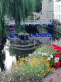
We’ve just done this walk; we had no trouble finding our way by following the GPS route. We set off from the church rather than the village hall, and we didn’t do the circular route around Brélidy Castle. The path runs almost entirely through woodland, alongside fields and the River Jaudy. The circular route after the church is lovely, with the little pond, the little canal, the river and the aquatic plants. However, this section isn’t very well-used, so the path disappears into the vegetation; several sections are muddy and you’re almost walking in the stream beds, but nothing impassable with good shoes at this time of year – worth seeing in winter. A very pleasant walk to get a breath of fresh air.

Machine-translated

andré navière
andré navière

The hike was possible, thanks to a compass and the route map, which was fortunately provided on an IGN map.
Starting from the church, as soon as we reached the Théaulas, the route no longer matched the map; after point 4, we were forced to use a ruined footbridge (only two beams remain, in very poor condition) to cross the stream and find our way out, as there were no landmarks at that point, (the path down is rutted by two tracks from slurry or water tankers). We make our way out via Run Du, Pen ar Crech and Prat Guern; once past the stream, we take the path immediately to our right, heading south-west, towards the wayside cross on the Run road (path OK in the woods but overgrown with ploughed fields along the edge, entrance hidden by undergrowth), to reach point 5 and rejoin the route on the map, with green dot signs at the crossroads (elevation 89) Kerbiquet and Lézuel leave us in doubt as the route is to the north; at point 5, we take the path on the left towards the chapel at Kerbiquet, then the first section along the Jaudy; there are no landmarks on the climb up the D15 towards Pen C’hra to turn left, so we head to Pen C’hra (the oppidum) via Kerhalic and return safely to the church. In summary, a start with more precise directions and a few additional signs or reminders would be welcome; it might also be worth noting that many of the sunken paths are currently streams. Thank you for your interest. Kind regards.

Machine-translated

bibi
bibi ★

Thank you for your review. Were you still able to go on the hike? Where did you set off from? What changes should be made to the description or the route on the map to help future hikers?
Kind regards

Machine-translated

andré navière
andré navière

Overall rating : 2.7 / 5

Date of your route : Mar 26, 2018
Reliability of the description : ★★★☆☆ Average
Ease of following the route : ★★☆☆☆ Disappointing
Route interest : ★★★☆☆ Average

I now understand why there are so many GPS waypoints... A haphazard start in the village; no village hall or community centre was indicated as the starting point, so we followed the signposts for this hall and walked all the way round Brelidy without seeing it... Many unmaintained paths, trees, branches, collapsed embankments; the green markers are only a very rough guide compared to the route on the map. However, there were a few pleasant stretches.

Machine-translated

gegedube
gegedube

Overall rating : 4.3 / 5

Date of your route : Mar 20, 2017
Reliability of the description : ★★★★☆ Good
Ease of following the route : ★★★★☆ Good
Route interest : ★★★★★ Very good

a very pleasant and pretty landscape

Machine-translated

Enora H.
Enora H.

Overall rating : 4 / 5

Date of your route : Jul 31, 2016
Reliability of the description : ★★★★☆ Good
Ease of following the route : ★★★★☆ Good
Route interest : ★★★★☆ Good

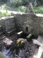
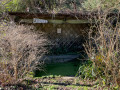
A lovely walk through the Breton countryside. What a joy to rediscover Breton heritage that has all too often disappeared, such as the wash houses and wayside shrines. We also enjoyed the little stone houses (former small farms) with their hollyhocks and blue agapanthus.
The only downside was that the signs indicate three different routes, but the colours are starting to fade; we took the wrong path, but that allowed us to pass by Brélidy Castle, which is magnificent.
All’s well that ends well!!! We found our route back onto the trail further on.
Enjoy the walk....

Machine-translated

Other walks in the area

For more walks, use our search engine .

The GPS track and description are the property of this route's author. Please do not copy them without permission.