Refine your search for walks in Teneur
Teneur walks
 The hedgerows
The old marked trail around Ambricourt is unfortunately poorly maintained or not maintained at all. We have been walking it for 25 years and have encountered difficulties every time (poor signage, paths buried under nettles or difficult to walk on).The start at Teneur allows you to pass (twice) in front of the superb limestone hillside of Teneur. Deer are often visible in or around the Bois de Crépy
The path is in very poor condition between points (2) and (6).
If possible, avoid the period between mid-June and mid-August. The passage after point (3) will be easier if the field is not too far into the growing season or has already been harvested.
 The humpback bridge at the start of Équirre
Starting from Équirre Castle, which was reduced by half following a fire, this walk takes you to the small village of Prédefin and back via the Lisbourg plain. The paths taken by the GRP® Tour du Ternois Nord are partly cultivated between points (8) and (9), but don't hesitate to cross them as they are often used by farmers.
 Eps and Herbeval mountains

A short but very hilly route (carto-explorer even gives 230m elevation gain) around the village of Eps, unjustly excluded by the marked trails. Beautiful views.Best done on a sunny day - it's magical!
 On the ridges around Bergueneuse

More than 22 km of trails for a nature trail with some nice climbs and descents. Sharpen your calves!Beautiful views, woods and, if you're lucky, a few wild animals. At least, the ones that the hunters don't slaughter, as we recently freed two roe deer caught in snares (fox traps, but any animal can get caught there, and it's legal!).
 La Creuse de Boyaval
In the Ternois, after a loop on the small roads of Sains-les-Pernes, head towards Fiefs, before descending to Boyaval via a wild hollow and returning to Sains-les-Pernes via the Chemin Vert, which would benefit from regular maintenance.
It is best to walk this route in dry weather, as some sections are difficult.
This is a difficult route because the paths are tricky and you need to be careful not to miss the entrances to some of the trails.
 From La Planquette to Bois de Fressin

A succession of small roads and paths for a day in the great outdoors.The icing on the cake: a good elevation gain with a superb climb in the Bois de Fressin.
For very experienced hikers, I highly recommend the alternative route described in the practical information section.
 Le Puits sans Fond depuis Febvin-Palfart
C’est un parcours en pleine nature. Sur les hauteurs, le randonneur apercevra l’Audomarois, les Monts des Flandres et le bassin minier. C'est un sentier balisé de la Communauté d'Agglomération du Pays de Saint-Omer.
 Le Puits sans Fond stream

A short walk that takes you up to the ridge before descending and going along the Puits sans Fond stream. More pleasant in dry weather, as some paths can be very wet.
 Around Bomy

A short walk in the Artois region, particularly pleasant in autumn.
 From Reclinghem to Mont d'Erny
Three nice climbs and a long stroll on the plateau for a walk in the countryside. A very hilly first part, then a long route on the heights before descending to Reclinghem with a magnificent view. The icing on the cake is a little extra circular that brings the elevation gain to over 300 m.
 Bours keep

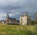
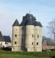
The walk starts from the Donjon de Bours (Bours keep) and takes you up to the plateau with its remarkable views. You'll then head back down to the village, finishing with a stroll through the narrow streets of Bours.
 In the footsteps of the Bours family
From the Bours Keep, passing by the Fontaine de la Baloche fountain, then through the Bois de Lanoy woods and past Antigneul Castle, the hike follows grassy paths offering beautiful views.
 Path from the keep starting from Bours

This hike starts at the Bours keep and takes us along paths and through woods to the top of a hill with remarkable views. You will descend via Les Eguerguettes towards the village. Please note: the descent is difficult in wet weather. The hike ends with a short tour of the narrow streets of Bours.
 The hills of Faux
A beautiful, undulating trail on the Ternois hillsides. Donjon de Bours (keep).
 The two woods and the Coqueline

A very pleasant nature trail in dry weather, but becomes more challenging in wet weather: grassy sections (a good test for your shoes, deep ruts, muddy sections).
Warning: October 2024. While it's relatively easy to get through the ruts, the last part of the path out of the wood (before point 9) is in a terrible state. The path has been broken up by machinery and you can only pass along the sides, which are themselves very difficult. It's very slippery and sometimes you have to change sides, which is a real challenge. This used to be a signposted mountain bike trail, is it still?
 From Turkey to Fond Breton (in less than 10 km!)
A short but fairly strenuous route with a steep hill and some very grassy paths.
On 12/08/2025: the start of the trail is once again very overgrown (brambles and nettles). It's passable but it's best to wear trousers or good gaiters and, of course, bring a walking stick or even a pair of secateurs.
 The Surgeon hills

A short, undulating route offering beautiful views.
 An uphill battle

It's a route that will delight altitude enthusiasts (Carto exploreur and the Visorando app suggest it's as high as 500m). What's more, the views are stunning.
Route slightly modified in November 2019.
All trails are very good as of May 14, 2020 (even if some are very grassy).
 The Canche, the moorland and the Ravin des Cavernes
In the Riez de Nœux-les-Auxi, there is a beautiful walk along the Canche in Boubers and Ligny. With the climb up the Ravin des Cavernes, you really feel like you are in another world (even more so now, with the final chaos). The route becomes very difficult in wet weather in the Riez and the ravine.
 L'ubac de Rebreuve-sur-Canche

A short, unpretentious and easy route.Very small roads and paths for a relaxing half-day out.
 De la Canche au Bois de Mortagne

An easy start on good paths, then a passage along the Sentier des Culs Trempés (which unfortunately is no longer maintained) before a beautiful climb up to Canettemont.
 Aux sources de la Canche

A long route that is ideal when the weather is less favourable.A few small roads (most of which have grass growing in the central reservation), some fairly easy country lanes and a very beautiful section leading down to Le Cauroy.
 Between Lys and the Canal
The town of Aire-sur-la-Lys is crossed by the Lys river. It is bordered by the Neuffossé Canal, which takes the name Canal d'Aire at La Bassée, from this town onwards. The Bassin des Quatre Faces (Four Faces Basin) once allowed boats to turn around and sail in the desired direction: towards the town, the Lys, the canal towards Saint-Omer or Béthune. It is a signposted trail in the Pays de Saint-Omer urban community.
