


Refine your search for walks in Saint-Père-sur-Loire
Saint-Père-sur-Loire walks


 From Chemin de la Plaine to the banks of the Loire: Between the levees
 Visorando Member
 6.17 mi
 +13 ft
 -13 ft
 2h 50
2h 50
 Easy
Easy
 Departure from Saint-Père-sur-Loire (Loiret)
A hike offering great contrasts between the open fields of the first part and the wild banks of the Loire in the second part, with its unspoilt natural site known as "Entre les levées". Proposed by the tourist office as part of the Randonnée des Châtaignes (Chestnut Hike), this route was very popular with hikers.
Chemin des Rauches along the Loire
6.82 mi
+13 ft
-13 ft
3h 10
 Moderate
Departure from Saint-Père-sur-Loire (Loiret)
Moderate
Departure from Saint-Père-sur-Loire (Loiret)
Alternating between meadows, forests, ponds and farmland, this route presents no difficulties. It begins and ends majestically on the banks of the Loire. This is a shortened version of the former "PR® des Rauches" with 76% of the route on unpaved paths.
Sully-sur-Loire and the banks of the Loire
11.41 mi
+30 ft
-30 ft
5h 15
Moderate
Departure from Sully-sur-Loire (Loiret)
A very pleasant route, mostly along the banks of the Loire. Good view of the Château de Sully and the Basilica of Saint-Benoit-sur-Loire.
Sully-sur-Loire Castle and its surroundings
 3.90 mi
+13 ft
-13 ft
1h 50
Easy
Departure from Sully-sur-Loire (Loiret)
3.90 mi
+13 ft
-13 ft
1h 50
Easy
Departure from Sully-sur-Loire (Loiret)
This short walk allows you to admire the medieval fortress in all its glory and stroll through the castle grounds and along the dykes that protect the town from the river. Many migratory birds take refuge on the castle's magnificent lake.
Sange Valley Circuit
 6.32 mi
+102 ft
-98 ft
3h 00
Moderate
Departure from Saint-Aignan-le-Jaillard (Loiret)
6.32 mi
+102 ft
-98 ft
3h 00
Moderate
Departure from Saint-Aignan-le-Jaillard (Loiret)
On the edge of the Sologne, this circuit brings together the typical landscapes that make up the charm of this natural region near the Loire: meadows, ponds, forests, interspersed with crops and pretty brick houses. The little river Sange brings it to life and gives it a little relief.
Marked in yellow, this route is also signposted in places as "PR® de la Vallée de la Sange - P 11". Despite two sections on the road, 70% of this circuit is on unpaved paths.
Historic Trail of the Vallée des Rois from Viglain
 7.12 mi
+66 ft
-66 ft
3h 20
Moderate
Departure from Viglain (Loiret)
7.12 mi
+66 ft
-66 ft
3h 20
Moderate
Departure from Viglain (Loiret)
Nestled on the edge of the Sologne region, Viglain reveals the riches of its countryside, with its woods, heathland, ponds and streams, not to mention the Sully-sur-Loire golf course, a vast green space dotted with trees of various species.
La route du Jongleur
 9.45 mi
+105 ft
-105 ft
4h 25
Moderate
Departure from Neuvy-en-Sullias (Loiret)
9.45 mi
+105 ft
-105 ft
4h 25
Moderate
Departure from Neuvy-en-Sullias (Loiret)
The juggler is one of the figures from the Gallo-Roman treasure found at Neuvy-en-Sulias in 1861 and displayed in the permanent exhibition in the garden adjoining the town hall.
This very pleasant route offers a fine variety of landscapes typical of the Loire and Sologne regions, comprising three interwoven features: the wooded bocage and its meadows, the mixed deciduous and coniferous forest with few straight lines, and the open agricultural plain. The River Loire and the Leu stream provide a refreshing finale to the walk. A wealth of points of interest punctuate and enliven this route: a 16th-century château, the former port of Bouteille, a tile works listed as a historic monument, a windmill…
The route is marked in yellow by the FFR and featured in the guidebook ‘La Sologne à pied’.
Petit Leu Walk
 2.90 mi
+20 ft
-20 ft
1h 20
Easy
Departure from Neuvy-en-Sullias (Loiret)
2.90 mi
+20 ft
-20 ft
1h 20
Easy
Departure from Neuvy-en-Sullias (Loiret)
Quite close to the Loire between Sully and Châteauneuf, on the edge of the Sologne region, a family walk in the countryside. Starting from a charming village where a Gallo-Roman treasure was found in the 19th century.
Route du Gilloy
 6.12 mi
+856 ft
-1,020 ft
3h 35
Easy
Departure from Neuvy-en-Sullias (Loiret)
6.12 mi
+856 ft
-1,020 ft
3h 35
Easy
Departure from Neuvy-en-Sullias (Loiret)
Close to the Loire, this fairly easy route runs alongside the Sologne region with its landscapes of woodland and farmland. Several points of interest (a pond, hedgerows, livestock farms) add a touch of variety to a route largely characterised by its woodland atmosphere. Best avoided during the hunting season from late September to February.
Sentier des Sources trail in the Orléans Forest
 4.77 mi
+131 ft
-131 ft
2h 20
Easy
Departure from Ouzouer-sur-Loire (Loiret)
4.77 mi
+131 ft
-131 ft
2h 20
Easy
Departure from Ouzouer-sur-Loire (Loiret)
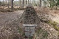
A circular in the Orléans Forest along a pretty path that winds between the trees. You will discover a series of springs converted into fountains and end this walk at the Résistance crossroads, a place steeped in Second World War history. A monument has been erected there in memory of the resistance fighters who died for France.
Sologne trails starting from Villemurlin
 6.28 mi
+66 ft
-66 ft
2h 55
Moderate
Departure from Villemurlin (Loiret)
6.28 mi
+66 ft
-66 ft
2h 55
Moderate
Departure from Villemurlin (Loiret)
Mainly on dirt, sand or gravel paths, this fairly easy circuit takes you through the peaceful and varied landscapes of the Sologne: ponds, forests, hedgerow-enclosed pastures and interspersed crops. At the start and finish, the pretty village of Villemurlin offers a typical Sologne charm with its brick houses and blue ladders, reminders of a time when the attic was accessed from outside.
Initially shared with the family path of Villemurlin (the "chouette promenade" or "owl walk"), this route then takes a shortened version of the former "PR® des domaines de chasse et cultures" (hunting grounds and farmland), of which a few signs remain.
Dampierre-en-Burly and its ponds
 8.46 mi
+102 ft
-102 ft
4h 00
Moderate
Departure from Dampierre-en-Burly (Loiret)
8.46 mi
+102 ft
-102 ft
4h 00
Moderate
Departure from Dampierre-en-Burly (Loiret)
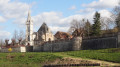
In the Orléans Forest, the route runs alongside the vast Étang de Corcambon, ending around the Étang du Bourg which borders the flower-filled village of Dampierre-en-Burly, at the foot of its fortifications.
Walk from Grignon via Vieilles-Maisons-sur-Joudry
 8.39 mi
+36 ft
-36 ft
3h 55
Moderate
Departure from Vieilles-Maisons-sur-Joudry (Loiret)
8.39 mi
+36 ft
-36 ft
3h 55
Moderate
Departure from Vieilles-Maisons-sur-Joudry (Loiret)
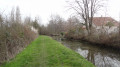
The route follows the course of the waterways of Vieilles-Maisons-sur-Joudry near the Forest of Orléans, running sometimes alongside the Orléans Canal and sometimes alongside the ‘rigoles’, tributaries of the Orléans Canal which they feed. These still waters are a source of coolness and tranquillity.
On either side of the Cosson
 8.47 mi
+36 ft
-36 ft
3h 55
Moderate
Departure from Vannes-sur-Cosson (Loiret)
8.47 mi
+36 ft
-36 ft
3h 55
Moderate
Departure from Vannes-sur-Cosson (Loiret)
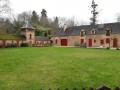
The walk follows the famous Chemin des Sables, with its heather, broom, mosses and lichens, and sections through mixed woodland. Beautiful farmhouses and homes dot the route.
 From the white sands to the Lamotte Beuvron forest
 28.06 mi
+131 ft
-131 ft
4 hrs
Moderate
Departure from Vannes-sur-Cosson (Loiret)
28.06 mi
+131 ft
-131 ft
4 hrs
Moderate
Departure from Vannes-sur-Cosson (Loiret)
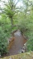
This circular route follows white sandy paths lined with broom-covered heathland and heather-filled undergrowth, crossing numerous streams. It passes through the Lamotte Beuvron State Forest and winds its way through the beautiful villages of Vannes-sur-Cosson, Souvigny-en-Sologne and Sennely.
The Trognards Route in Vannes-sur-Cosson
 2.40 mi
+620 ft
-604 ft
1h 40
Easy
Departure from Vannes-sur-Cosson (Loiret)
2.40 mi
+620 ft
-604 ft
1h 40
Easy
Departure from Vannes-sur-Cosson (Loiret)
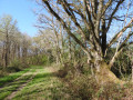
An easy family walk through the typical landscapes of Sologne, featuring several hedgerows of pollarded oaks: these pollarded oaks served as the farmers’ timber supply and formed hedgerows on an embankment enclosing the pastures.
Watercourses, ponds and woodland around Vieilles-Maisons-sur-Joudry
 15.38 mi
+85 ft
-82 ft
7h 10
15.38 mi
+85 ft
-82 ft
7h 10
 Difficult
Departure from Vieilles-Maisons-sur-Joudry (Loiret)
Difficult
Departure from Vieilles-Maisons-sur-Joudry (Loiret)
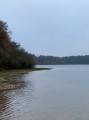
Discover how the Canal d’Orléans draws its water supply from the forest. From forest ditches to channels and from channels to ponds, the water flows imperceptibly through the hydrographic network skilfully created by human hands to ensure its proper functioning.
Courpalet ditch, Gué l’Évêque circular loop
 9.31 mi
+33 ft
-33 ft
4h 20
Moderate
Departure from Montereau (Loiret)
9.31 mi
+33 ft
-33 ft
4h 20
Moderate
Departure from Montereau (Loiret)
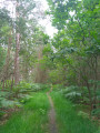
A largely shaded circular walk along the water’s edge. This walk follows the Rigole de Courpalet for nearly 5km before entering the Forest of Orléans and skirting the Étang du Gué l’Évêque.
The Rigole de Courpalet, 32.8 km long, was dug to feed the Canal d’Orléans.
Following the Aquiaulne from Saint-Gondon
 10.99 mi
+131 ft
-131 ft
5h 10
Moderate
Departure from Saint-Gondon (Loiret)
10.99 mi
+131 ft
-131 ft
5h 10
Moderate
Departure from Saint-Gondon (Loiret)
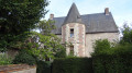
A village of Gallo-Roman origin, Saint-Gondon is situated on the borders of Berry, Sologne and the Loire Valley. The first part of the walk takes in the bucolic charm of the Aquiaulne Valley, whilst the second follows little-used paths, winding through a mix of woodland and farmland, not to mention a few heathlands.
Circular walk around the Étang du Puits, starting from Cerdon
 9.21 mi
+72 ft
-72 ft
4h 20
Moderate
Departure from Cerdon (Loiret) (Loiret)
9.21 mi
+72 ft
-72 ft
4h 20
Moderate
Departure from Cerdon (Loiret) (Loiret)
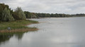
The walk offers the chance to explore unspoilt countryside, much loved by those who adore the Sologne region, mainly through woodland. The Étang du Puits, with its water sports facilities, makes for a refreshing stop.
The Borne des Quatre Paroisses circular route from Cerdon-du-Loiret
 11.09 mi
+98 ft
-102 ft
5h 10
Moderate
Departure from Cerdon (Loiret) (Loiret)
11.09 mi
+98 ft
-102 ft
5h 10
Moderate
Departure from Cerdon (Loiret) (Loiret)
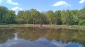
A very pretty circular route on the border between Cher and Loiret. Its long paths will take you to the Borne des Quatre Paroisses, the meeting point of the communes of Cerdon-du-Loiret, Brinon-sur-Sauldre, Villemurlin and Isdes. The walk through the forest on the border between Loiret and Cher is worth the detour alone.
From La Gravotte to Le Beuvron
 10.34 mi
+66 ft
-66 ft
4h 50
Moderate
Departure from Cerdon (Loiret) (Loiret)
10.34 mi
+66 ft
-66 ft
4h 50
Moderate
Departure from Cerdon (Loiret) (Loiret)
The wide-open spaces of Sologne offer a spectacle rich in woodland and scenic beauty. Orchids, carp leaping from the surface of a pond to snatch a flying insect, roe deer caught unawares at a bend in the path, not to mention ducks and their young – this is Sologne at its most bountiful.
The Rigole de Courpalet trail from Lorris
 10.11 mi
+52 ft
-52 ft
4h 40
Moderate
Departure from Lorris (Loiret)
10.11 mi
+52 ft
-52 ft
4h 40
Moderate
Departure from Lorris (Loiret)
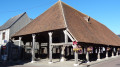
This idyllic walk follows the Rigole de Courpalet, which was dug at the end of the 17th century to feed the Canal d’Orléans. Abandoned after a few decades of use, it has for three centuries been home to numerous wild animals that come to drink there, as well as a wide variety of birds. The route ends in the old town of Lorris with its market hall, church and town hall.