Country:

 City:
City:


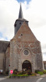
Park in the car park at the foot of Cerdon Church.
(Out and back) From the church car park, take the D948 towards Étang du Puits, Base de loisirs. Pass Rue du Paradis on your right, then keep right at the Fork in the road onto Rue des Chartreux, until you reach the junction with the D65, or Rue des Limousins, which is marked by a cross.
(1) Turn left onto the D65, cross the Surget and continue to the junction before the railway line.
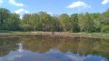
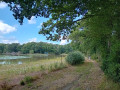
(2) Turn left onto the road running parallel to the railway line, following the edge of the village pond. Pass the recycling centre and continue along the gravel track.
(3) Leave the gravelled track before it turns left towards the Route d’Argent, continuing straight on along the grassy path (CR24), still heading south. This eventually intersects a cross-path that runs alongside the old railway line; take this to the left.
(4) Turn right at the junction with a hard-surfaced track, then immediately left as soon as you have crossed the railway line onto the CR25 signposted ‘Étang du Puits’. The straight track first follows the railway line, then veers away from it, making a right-hand bend followed by a second right-hand bend and then a third left-hand bend before meeting a cross-track.
(5) Turn left at the junction onto the CR25, which heads south towards Étang du Puits. Pass La Boulaie on your right.
(6) Turn left onto the gravelled track (CR20) towards La Prévôté, ignoring the side tracks. As soon as you have passed the power line, turn right onto the CR21 and continue southwards, ignoring the various side tracks.
(7) At La Landaserie, continue along the CR21, which runs alongside the farm buildings on your left. Turn left at the junction with a cross-road
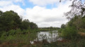
(8) Opposite the Étang du Puits, head right onto the D765 until you reach a crossroads. You can enjoy a lovely view of the pond from the embankment by taking the left-hand track for 400 metres and back.
White-red markings (GR®®3C)
(9) From the crossroads, turn right onto the CR23, which has a badly worn tarmac surface. After Bellevue, the road heads north before giving way to several paths.
(10) Take the path furthest to the left. This crosses the D79 and leads to a crossroads with four paths.
(11) Turn right onto the graded track, the CR30, and follow it for 600 metres until you reach a Fork in the road at the edge of the woodland
(12) At the fork in the road, leave the compacted track and head left onto the open track.
Walk past Château de la Boulaie and reach a three-way junction.
(13) Head left along the narrow street, then turn immediately right at Les Hodeaux. Leave the gravel track and take the first path on the right, which eventually joins Rue des Hautereaux; turn right onto this street. Continue to the junction with Route de Clémont (D65), where you turn left.
(2) Once past the railway line, carry on straight ahead, ignoring the turn-offs to the right, until you reach a Fork in the road marked with a cross
(1) Carry on straight ahead at the Fork in the road and stay on the main road until it leads to the Place du Marché. The church is situated about a hundred metres to the right, the starting point of the walk (S/E)
 Visorando Member