Historic Trail of the Vallée des Rois from Viglain

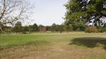
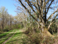
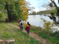
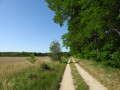
Nestled on the edge of the Sologne region, Viglain reveals the riches of its countryside, with its woods, heathland, ponds and streams, not to mention the Sully-sur-Loire golf course, a vast green space dotted with trees of various species.

Details

2626139
Creation:
Last update:
Last review:
  • Walking
    Activity: Walking
  • ↔
    Distance: 7.12 mi
  • ◔
    Average duration: 3h 20 
  • ▲
    Difficulty: Moderate

  • ⚐
    Back to start: Yes
  • ↗
    Ascent: + 66 ft
  • ↘
    Descent: - 66 ft

  • ▲
    Highest point: 479 ft
  • ▼
    Lowest point: 390 ft
  • ⚐ Country: France
  • ⚐
    Area: Sologne
  • ⚐ City: Viglain (45600)
  • ⚑
    Start/End: N 47.728136° / E 2.302375°
  • ❏
    IGN map(s): Ref. 2320ET, 2320O
  • Hour-by-hour weather

Photos

Description of the walk

Park in the car parks around the church or near the various local shops.

(S/E) From the church, head east (away from the Caquetoire) via the Place de l’Église or Rue Romaine, both of which lead to the Route de Saint-Aignan or D320.

(1) Take the first street on the left, Rue du Cormier, towards the cemetery. Turn right opposite the cemetery. The tarmac soon gives way to a gravel track skirting the sewage treatment plant.

(2) At the fork in the road, keep left onto a new gravel track.

Yellow and red markings (GR® de Pays)

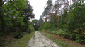
(3) At the fork in the road, turn left again onto a forest track. Keep to the busiest track as you head north. The forest track is followed by a gravel track as it crosses a side track leading to the Villiers estate.

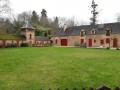
(4) At the junction with the Route de Sully, continue straight ahead along the narrow road towards La Retruère and Le Rozouer. Pass Baffou Castle and then La Retruère farm.

(5) At the crossroads, 200 metres after La Retruère, turn onto the gravelled track furthest to the right. This eventually joins another gravelled track just before intersecting with the Route de Sully.

(6) Head left onto the small Route de Sully, then right, at a place called Le Prateau, onto a narrow road towards Le Cormier and the golf course. Pass Chamon.

(7) Leave the tarmac at the Fork in the road, keeping to the left onto the gravel track.

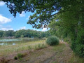
(8) At the junction after crossing the golf course, carry on straight ahead, ignoring the turn-off to the right towards Lousseau (golf course facilities). The gravel track heads south until it runs alongside a body of water on both sides, just before a Fork in the road.

(9) Keep left at the Fork in the road to stay on the gravel track, which ends at a crossroads.

End of signposting

(10) Take the sharp right-hand bend onto the signposted forest track: Viglain and rural track No. 16. Stay on the busiest track, covered in white sand, until you come to a cross track.

(11) Turn right and cross the Béon. The track eventually joins another track which you took on the way there.

(2) Carry on straight ahead, then turn left as soon as you’ve passed the cemetery.

(1) Turn right at the junction with the Route de Saint-Aignan to return to the church, the starting point of the walk (S/E).


Waypoints

  1. S/E : mi 0 - alt. 427 ft - Car park around the church
  2. 1 : mi 0.17 - alt. 423 ft - Turn left towards the cemetery
  3. 2 : mi 0.62 - alt. 423 ft - Turn left at the fork in the road
  4. 3 : mi 0.8 - alt. 420 ft - Turn left at the fork in the road
  5. 4 : mi 1.73 - alt. 479 ft - Opposite, take the narrow road towards La Retruère
  6. 5 : mi 2.46 - alt. 479 ft - The most right-hand gravel track
  7. 6 : mi 3.33 - alt. 423 ft - On the left, the small road to Sully
  8. 7 : mi 4.01 - alt. 423 ft - On the left is a compacted track.
  9. 8 : mi 4.23 - alt. 407 ft - Straight on
  10. 9 : mi 4.83 - alt. 410 ft - Turn left at the fork in the road
  11. 10 : mi 5.3 - alt. 417 ft - Take the hairpin bend to the right towards Viglain
  12. 11 : mi 6.14 - alt. 423 ft - Turn right onto the cross-country path
  13. S/E : mi 7.12 - alt. 423 ft - Car park around the church

Notes

The walk can be enjoyed in all seasons.

An alternative route that shortens the walk (8.6 km) by linking (3) to (7).

(3) Keep to the right at the fork in the road, then turn left opposite the Cormier gate, and finally keep to the right at the next fork. Follow the path until you reach the small road that continues along the lane past the golf course (Lousseau).

(7) Take the hairpin bend to the right onto the first track.

Worth a visit

Always be cautious and plan ahead when you're outdoors. Visorando and the author of this route cannot be held responsible for any accidents occurring on this route.

The GR® and PR® markings are the intellectual property of the Fédération Française de Randonnée Pédestre.

Reviews and comments

3.8 / 5
Based on 4 reviews

Reliability of the description
3 / 5
Ease of following the route
4.3 / 5
Route interest
4 / 5
pierre1er
pierre1er

Overall rating : 3.7 / 5

Date of your route : Apr 23, 2026
Reliability of the description : ★☆☆☆☆ Very disappointing
Ease of following the route : ★★★★★ Very good
Route interest : ★★★★★ Very good
Very busy route : No

Lovely. Perfectly maintained paths. They seem to stay dry whatever the weather. They must be trees from the Garden of Eden.
Picnic tables halfway along the route, by the lakeside.
The route is signposted from start to finish.

Machine-translated

JJR Rouen
JJR Rouen

Overall rating : 4.3 / 5

Date of your route : May 13, 2024
Reliability of the description : ★★★★☆ Good
Ease of following the route : ★★★★★ Very good
Route interest : ★★★★☆ Good
Very busy route : No

A pleasant and varied route

Machine-translated

Jean-Louis Pinault
Jean-Louis Pinault

Thank you, Bernard,
Have a nice day,
Jean-Louis

Machine-translated

bernardino
bernardino ★

Hello
To give our friend berly6 a very positive answer: it’s true that not all footpaths and hiking trails are signposted. Some are signposted by local council staff or Comcom officials – at the taxpayers’ expense, of course – whilst others, such as the GR and GRP trails, are signposted by volunteers. To support them, the FFRP, which is responsible for this, welcomes any contributions; to do so, please contact the departmental committees.
Have a lovely day

Machine-translated

Jean-Louis Pinault
Jean-Louis Pinault

Apart from a few GR trails and popular short walking routes, you have to learn to manage without signposting, which is why the Visorando website has been set up.
Kind regards,
Jean-Louis

Machine-translated

berly6
berly6

Overall rating : 2.7 / 5

Date of your route : Jan 17, 2022
Reliability of the description : ★★★☆☆ Average
Ease of following the route : ★★★☆☆ Average
Route interest : ★★☆☆☆ Disappointing
Very busy route : No

Hello
The complete lack of signposting is a problem,

Machine-translated

Jean-Louis Pinault
Jean-Louis Pinault

Thank you, see you soon,
Jean-Louis

Machine-translated

michelag
michelag
• Edited:

Overall rating : 4.3 / 5

Date of your route : Mar 16, 2020
Reliability of the description : ★★★★☆ Good
Ease of following the route : ★★★★☆ Good
Route interest : ★★★★★ Very good

Machine-translated

Other walks in the area

For more walks, use our search engine .

The GPS track and description are the property of this route's author. Please do not copy them without permission.