Country:
 City:
City:





Start at the car park on Place du Mail near the Lorris post office
(S/E) From the car park, head onto the Place du Mail in the opposite direction to the roundabout and the town centre. Keep right at the Fork in the road, heading towards Châteauneuf-sur-Loire.
Yellow-red signposting (GR® de pays du Gatinais)
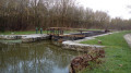
(1) Cross Boulevard de la Résistance at the traffic lights and continue left onto Faubourg d’Orléans as far as Pont Pinon, which spans the Rigole de Courpalet.
No signposting
(2) Leave Faubourg d’Orléans before crossing the Pont Pinon, heading left onto the wide grassy path between the watercourse and a private track. Follow the watercourse as it meanders widely
(3) The path crosses a track and then takes a wide bend to the left. Follow the stream until you reach a long, straight forest track.
(4) Take a sharp right-hand bend onto the Allée Forestière la Rigolette, crossing the footbridge over the ditch. This lane is protected by barriers that prevent access by motor vehicles. The lane crosses a first track (with barriers on either side) and then meets a wide, hard-surfaced lane.
(5) Turn left onto the hard-surfaced track, then left again onto the departmental road, the Route de Sully. Turn right after about a hundred metres to run alongside an industrial estate on your left. The lane known as Terre des Fourneaux leads to the hamlet of Les Fourneaux and crosses a small stream, the Limetin, bordered by a pond.
(6) This is followed by a gravel track at a junction. Ignore the various turnings: the track eventually joins a small road after running alongside the Le Breteau farm.
(7) Turn left onto the small road known as Étang de Baratte, which you’ll leave after a few dozen metres to take a path on the right. Immediately leave this path and take a forest track on the left. This leads to La Belle Étoile.
Yellow-red markings
(8) Turn left onto the small road, then immediately left again to walk alongside the ditch on your left. Cross the Pont de Baratte.
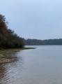
The track runs alongside the Étang de la Motte, crosses a compacted track, then bends to the right.
(9) It crosses a small road and runs alongside the ditch again, this time on your right.
(10) Cross the ditch via the footbridge just before La Gibonnière to follow it on your left. Cross the main road with care to rejoin the long, straight forest track.
(4) Turn right, with your back to the section you took on the way there. The path eventually runs alongside the main road, Boulevard de la Résistance,
No signposting
(1) Turn right onto the Faubourg d’Orléans – which you took on the way out – then left onto the Place du Mail at the starting point of the walk.
(S/E) Before finishing the route, continue by crossing the roundabout towards the old town. Pass Rue Pasteur on your right.
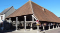
(11) Shortly after passing the town hall on your left, turn right onto the next street leading to the Place du Martroi and its old market hall, then turn left to walk past the Ecomuseum, left again to walk alongside the church, and finally complete a circular route.
(11) Carry on straight ahead towards the roundabout to return to the starting point of the walk (S/E).


 Visorando Member

 Difficult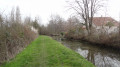
 Easy
Easy