From La Gravotte to Le Beuvron

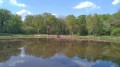
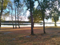
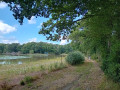
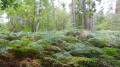
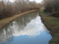
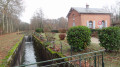
The wide-open spaces of Sologne offer a spectacle rich in woodland and scenic beauty. Orchids, carp leaping from the surface of a pond to snatch a flying insect, roe deer caught unawares at a bend in the path, not to mention ducks and their young – this is Sologne at its most bountiful.

Details

n°1131734
Creation:
Last update:
Last review:
  • Walking
    Activity: Walking
  • ↔
    Distance: 10.34 mi
  • ◔
    Average duration: 4h 50 
  • ▲
    Difficulty: Moderate

  • ⚐
    Back to start: Yes
  • ↗
    Ascent: + 66 ft
  • ↘
    Descent: - 66 ft

  • ▲
    Highest point: 515 ft
  • ▼
    Lowest point: 449 ft

Photos

Description of the walk

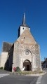
Start from the car park at Cerdon Church.

(S/E) With your back to the church porch, take the street on the right which goes round the building; leave the Route de Saint-Florent on your left and head towards Coullons.

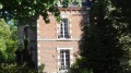
(1) Shortly after the cemetery, leave the road and take a lovely lane on the left signposted ‘Vieux Gué’ (CR 6). Cross the Vieux Gué, go round a house with a turret on the left, then turn right towards the north at the crossroads.

(2) Cross the D157, continue straight ahead and cross the Gravotte.

(3) Turn left onto the CR5, opposite the gate blocking access to the “La Creuse” property.

(4) Keep left when you reach a cross-path, then cross the D948 (take care) in the direction of “Les Pichons” and “La Lande”. Pass the pond and then the old railway line,

(5) Leave the gravelled track and take the grassy path on the left (CR4). Cross the Gravotte ford and turn right at the Fork in the road.

(6) At the crossroads of four tracks, take the track furthest to the right (CR2). This continues as theGR®3Cbeyond the first junction. Turn left as you approach “Les Guérets”. Turn right onto the D51 and follow it for about 240 metres.

(7) Turn onto the first path on the left after passing La Gravotte and continue, keeping this stream on your left.

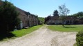
(8) Take the first path on the left (CR32). This crosses the Gravotte again. Ignore the adjacent turnings and keep heading south. Cross the D129 and continue straight ahead after a chicane formed by earthworks. At a place called “Les Harauts”, carry on straight ahead, passing the car workshop on your left and the farmhouse on your right, then turn immediately right onto a wide grassy lane, going round the building. Turn left at the end of the lane, walk alongside a small pond on your right and carry on, ignoring the turnings on both the right and left.

(9) When you come to a cross-path, keep to the right on the grassy track, ignoring the adjacent turnings.

(10) Turning right, take the lovely, well-maintained track. Cross the road at the Étang des Hautereaux. Continue straight on along the forest track.

(11) At the crossroads at the far end of a large field, turn left (CR23). Carry on, ignoring the various side paths.

GR®3C,GR® de Pays de Sologne (virtually no signposting)

(12) At the crossroads where four paths meet, take the hard-surfaced track to the left (CR30,GR®3C), ignoring the track towards Les Acensis on the left.

(13) Leave the hard-surfaced track by turning left onto an open grassy path. This path itself meets a hard-surfaced track on the right-hand side at Château de la Boulaie. Turn left onto the tarmac road, which you will quickly leave as you approach ‘Les Hodeaux’, turning right onto a new hard-surfaced track.

(14) Leave the track and take a grassy path between two hedges on the right, which you’ll follow until you reach Rue des “Hautereaux”.

(15) Head right, then turn left onto the D65 (take care). With the church tower in sight, take Rue des Chartreux at the wayside cross, then turn left onto the D948 (take care) to return to the church square (S/E).


Waypoints

  1. S/E : mi 0 - alt. 479 ft - Church Square
  2. 1 : mi 0.37 - alt. 479 ft - A lovely path to the left signposted ‘Vieux Gué’ - Beuvron (rivière)
  3. 2 : mi 1.04 - alt. 505 ft - Crossing the D157
  4. 3 : mi 1.48 - alt. 479 ft - Turn left onto the CR5
  5. 4 : mi 1.91 - alt. 495 ft - Turn left when you reach a cross-path
  6. 5 : mi 2.31 - alt. 502 ft - Grassy path to the left (CR4)
  7. 6 : mi 2.79 - alt. 479 ft - The right-hand track (CR 2)
  8. 7 : mi 3.58 - alt. 463 ft - Turn left after the stream
  9. 8 : mi 4.17 - alt. 459 ft - To the left (CR 32)
  10. 9 : mi 5 - alt. 499 ft - Turn right onto the grassy path
  11. 10 : mi 5.58 - alt. 476 ft - Turn right onto the lovely, well-maintained path
  12. 11 : mi 6.39 - alt. 499 ft - Turn left (CR23) at the edge of the field
  13. 12 : mi 7.7 - alt. 515 ft - Gravel track on the left (CR30, GR3C)
  14. 13 : mi 8.1 - alt. 512 ft - Turn left onto an open, grassy path
  15. 14 : mi 8.95 - alt. 512 ft - A grassy path between two hedges on the right
  16. 15 : mi 9.92 - alt. 486 ft - On the right, Rue des “Hautereau”
  17. S/E : mi 10.34 - alt. 479 ft - Church Square

Notes

Do not stray from this described and approved route; respect the wild flora and fauna.
(Between 10 and 11) After heavy rain, the path may be muddy or even flooded.

The lack of signposting, including on theGR®, means you should take care. However, there are relatively few changes of direction, which allows you to focus on the few difficult sections.

Worth a visit

Places to see during the walk:
- the village of Cerdon with its 12th-century church and traditional old houses
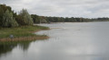
- the ponds, streams and woodland scenery

Places to visit nearby:
- the church at Caquetoir, Notre-Dame d’Isdes, a remarkable example of Sologne architecture from the Romanesque period of the 11th–12th centuries.

Always be cautious and plan ahead when you're outdoors. Visorando and the author of this route cannot be held responsible for any accidents occurring on this route.

The GR® and PR® markings are the intellectual property of the Fédération Française de Randonnée Pédestre.

Reviews and comments

4 / 5
Based on 2 reviews

Reliability of the description
4 / 5
Ease of following the route
4 / 5
Route interest
4 / 5
Jean-Louis Pinault
Jean-Louis Pinault

Thank you for your comments. It’s true that in Sologne you need a good sense of direction or a GPS, as the paths are rarely signposted. They used to be; the brown signposts were very reliable, so you could venture along the local paths without any worries. But the signs have disappeared or are no longer legible. Even the GR trails aren’t always signposted continuously. Sometimes the PR trails overlap, so you’re not quite sure where you are.
Added to this is the difficulty caused by the poor placement or orientation of certain ‘Private Property’ signs intended to deter walkers (especially during the hunting season).
Fortunately, a new wave of enthusiasm is helping us rediscover the Sologne!
Have a good evening,
Jean-Louis

Machine-translated

Sylale
Sylale

Overall rating : 4.3 / 5

Date of your route : May 16, 2019
Reliability of the description : ★★★★☆ Good
Ease of following the route : ★★★★☆ Good
Route interest : ★★★★★ Very good

A sat-nav is essential given the sheer number of road signs; however, we enjoyed driving through Sologne without wire fencing on either side of the road

Machine-translated

Jean-Louis Pinault
Jean-Louis Pinault

Thank you for these comments. As for those anxiety-inducing signs, we really do have to get used to them and learn to ignore them as long as we’re in the right – otherwise we’d no longer be able to go hiking in Sologne, and it would be a shame to miss out on such a pleasure.

Machine-translated

Igorovich
Igorovich

Overall rating : 3.7 / 5

Date of your route : Aug 27, 2018
Reliability of the description : ★★★★☆ Good
Ease of following the route : ★★★★☆ Good
Route interest : ★★★☆☆ Average

The first part of the walk isn’t particularly interesting. After that, from point 7 onwards, it’s much more enjoyable. The signposting is clear. Only once, at point 1 (the ‘Vieux Gué’ crossroads), did I take the wrong path. But I realised my mistake straight away using my compass, and a landowner kindly confirmed that it was private property. At point 3, there’s a gate rather than a chain closing off the ‘La Creuse’ property. That’s actually the problem with this walk: you’re almost always on paths between two private woodland areas and their anxiety-inducing signs (caution: trap, etc.). But that’s probably the case everywhere in Sologne...

Machine-translated

Other walks in the area

For more walks, use our search engine .

The GPS track and description are the property of this route's author. Please do not copy them without permission.