Country:

 City:
City:



The walk starts at the car park situated about a hundred metres from the church, at the end of Rue Jules Guillot.
(S/E) From the car park, head towards the church along Rue Jules Guillot, signposted ‘Centre Historique’, then turn left into Rue Charles Gondouin, with your back to the church. Cross Rue des Juifs, then keep left at the Fork in the road. Continue southwards until you reach a hard-surfaced track on your right signposted ‘les Gravières’. The fork in the path is just before ‘le Bout de la Ville’ at the southern edge of the town.
Red-and-white markings (GR®3C)
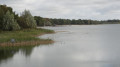
(1) The stabilised track on the right runs alongside the Aquiaulne, passes ‘les Gravières’ and then the ‘Pont de Bribard’.
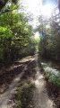
(2) Do not cross the stream; let the stabilised track branch off to the right. Turn left with your back to the ‘Pont de Bribard’, then left again facing a wooded area. Go round the woods, following the edge to form a right angle, then stay on the track until you reach ‘Grange Dieu’.
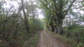
(3) Turn right onto the tarmac track at the four-way junction, just before ‘La Grange Dieu’. The tarmac ends fairly quickly, giving way to a long, stabilised track which leads to ‘La Coquillière’, then ‘La Marcillionnière’ and finally ‘La Louisette’.
(4) The track then becomes grassy, running alongside the Étang de la Louisette, before moving away from the Aquiaulne. Stay on the busiest track (GR®3C).
No signposting
(5) Shortly after ‘les Haies’, leave theGR®3C, turn right and continue along the hard-surfaced track signposted ‘Pouilly-lez-Gien’. The track becomes tarmac-surfaced as it passes through ‘la Muletière’ and then ‘les Salons’.
(6) Leave the lane heading towards Les Salons by turning left. The small road becomes grassy as it runs alongside ‘Le Bout du Buisson’ and eventually joins a narrow street, which you follow for 150 metres.
(7) Turn right onto a little-used lane. It becomes tarmac at ‘Terres Noires’ just before a junction situated beneath a power line.
(8) Turn left at an acute angle onto the compacted track leading towards heathland, woodland and farmland; the track then becomes grassy after crossing a tarmac lane.
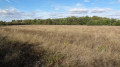
(9) 300 metres after the crossroads, turn off onto the track on the right (the original path disappears into the vegetation). This long track, used mainly by farm machinery, leads to ‘la Chassenaudière’, where it becomes tarmac.
(10) Turn left onto a little-used grassy lane just before the hamlet. It soon leads to the first houses in Saint-Gondon, where it becomes Rue des Plantes.
(11) To avoid taking the D951, turn left just before you reach it, onto Rue des Quartiers. Turn right, then left, through the housing estate to come out onto Rue du Bout de la Ville. Follow it to the right.
(1) Leave the gravel track on your left – which you took on the way there – as you head towards the church. Return to the starting point by turning right opposite the church onto Rue Jules Guillot (S/E).


 Visorando Member
 Easy
Easy