


Refine your search for walks in Saint-Pardoux (Haute-Vienne)
Saint-Pardoux (Haute-Vienne) walks


 Circular route along the northern shore of Lake Saint-Pardoux
 Visorando Member
 7.04 mi
 +433 ft
 -417 ft
 3h 35
 Moderate
 Departure from Saint-Pardoux (Haute-Vienne) (Haute-Vienne)
Covering approximately 330 hectares, Lake Saint-Pardoux is the second largest body of water in the Haute-Vienne department. Due to its irregular shape, the tour of the lake is no less than 24 km long. This hike is more accessible in length and takes you along the northern shore of the lake after climbing through the countryside to the outskirts of Chatenet Colon.
The Bayeux des Taffres scrubland
3.91 mi
+466 ft
-443 ft
2h 10
 Easy
Departure from Saint-Pardoux (Haute-Vienne) (Haute-Vienne)
The Puy de Massert (and its remarkable beech trees) served as a lookout point for the Bayeux Maquis (named after the first town liberated by the Allies).
Route bleue autour du Lac de Saint-Pardoux
 Tourist office4.36 mi
+85 ft
-85 ft
2h 05
Easy
Departure from Razès (Haute-Vienne)
Starting from the Santrop bridge, this 7 km route allows you to explore the shores of Lake Saint-Pardoux and its landscapes in the Haute-Vienne. The route follows the lake’s banks for much of the way and passes through several wooded areas, in a peaceful setting ideal for a stroll. The route passes through the heart of the village of Friaudour, whilst offering lovely views of the lake. During the walk, you’ll also catch a glimpse of the Île aux Enfants, a small island accessible via a wooden footbridge situated near the path. With a relatively easy route, this walk is ideal for enjoying nature and discovering the landscapes of Lake Saint-Pardoux as you follow the water’s edge.
Chapelle Saint-Martin Circular Route
6.00 mi
+354 ft
-354 ft
3h 05
Easy
Departure from Saint-Symphorien-sur-Couze (Haute-Vienne)
A short walk of less than 10 km passing by the Chapelle Saint-Martin, situated near the Étang des Sagnes, which is on peatland. 90% of the route is on paths and through woodland.
The Bessines-sur-Gartempe Uranium Mine Trail
3.42 mi
+384 ft
-404 ft
1h 55
Moderate
Departure from Bessines-sur-Gartempe (Haute-Vienne)
A walk along a narrow, steep path overlooking the Gartempe bypass.
Around Maillofargueix in Bersac-sur-Rivalier
3.56 mi
+279 ft
-295 ft
1h 55
Easy
Departure from Bersac-sur-Rivalier (Haute-Vienne)
A very easy walk with no significant elevation gain. Less than 600 m on the road.
Puy de l’Age
3.66 mi
+568 ft
-541 ft
2h 10
Easy
Departure from Bersac-sur-Rivalier (Haute-Vienne)
An easy walk with a slight elevation gain, access to a shepherd’s hut, two viewpoints and less than 100 m of road. It’s a shame the pond is private and inaccessible.
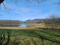
Valleys and forests of the Ambazac mountains from Jonas Pond.
 8.60 mi
+1,129 ft
-1,145 ft
4h 55
Moderate
Departure from Ambazac (Haute-Vienne)
Circular route with varied scenery, often through woodland, partly along the Monks’ Trail. Magnificent in the autumn colours of the LimousinNote from the moderator: the route was amended on 11 May 2023 due to issues with private land; instead of heading to point 4 across the fields after going round the pond, the route now passes through Bourdaleine.
 The Muret Heights
7.60 mi
+702 ft
-709 ft
3 hrs
Moderate
Departure from Ambazac (Haute-Vienne)
To ease into the climb up the small Monts d’Ambazac mountain range, I suggest you take the lovely forest paths overlooking the Domaine du Muret in Ambazac.
From Muret to the edge of Les Vergnes
7.74 mi
+558 ft
-551 ft
2 hrs
Easy
Departure from Ambazac (Haute-Vienne)
This walk is situated at the foot of the foothills of the Monts d’Ambazac range. Rich in varied landscapes, it alternates between forest trails, visits to small villages and sections across the plains.
Châtelard Oppidum
1.38 mi
+226 ft
-226 ft
0h 50
Easy
Departure from Jabreilles-les-Bordes (Haute-Vienne)
This short walk through woodland allows you to explore the listed site of the Châtelard oppidum. It is a Gallo-Roman fortified settlement on a barred spur, consisting of a platform covering around ten hectares and side terraces, now entirely wooded. The route features a steep climb over the first 600 metres, followed by a flat path around the perimeter of the site.
Circular des Bordes and Catheraud
 Association / Club / Walk leader5.26 mi
+682 ft
-663 ft
1.5 hrs
Moderate
Departure from Jabreilles-les-Bordes (Haute-Vienne)
This is a fairly steep and challenging ride for horses. It is fairly easy for riders, especially if they are comfortable with long climbs... Pretty scenery around Les Retouillères. It can be done in either direction, with the biggest climb being on the way to Catheraud on the Puy de Jabreilles side. The paths are quite rocky, so it's best to walk at a steady pace on this ride. The small roads you ride along are quiet, lined with trees and have beautiful verges.
The Bois de Bessac
 7.44 mi
+276 ft
-289 ft
3h 40
Moderate
Departure from Saint-Maurice-la-Souterraine (Creuse)
Starting from the little chapel at Le Dognon, this walk alternates between footpaths and small roads, and takes you to two places of notable interest: the Peu de l’Age, which offers a beautiful view overlooking the Vitrat pond, and the Bois de Bessac, much loved for its atmosphere and cool, refreshing surroundings.
From Fursac to Paulhac
 5.45 mi
+489 ft
-492 ft
2h 55
Easy
Departure from Saint-Pierre-de-Fursac (Creuse)
Discover the charming village of Paulhac, with its Templar Commandery (Gothic church and chapel).
La Chapuisette route
 1.61 mi
+92 ft
-92 ft
0h 50
Easy
Departure from La Souterraine (Creuse)
Near La Souterraine, the short Chapuisette route takes a detour through the surrounding countryside, runs alongside a woodland and passes through a peaceful residential area. It also offers the chance to discover a secluded yet fascinating environment: the wetland and its array of invertebrates, amphibians and moisture-loving plants.
A glimpse of the Benaize
 3.41 mi
+269 ft
-272 ft
1h 50
Easy
Departure from La Souterraine (Creuse)
A short stretch of quiet road marks the start of this route, which winds through the area around Bussière-Madeleine and continues along beautiful paths, crossing the Ruisseau de la Benaize. Charming discoveries also take us in the footsteps of a famous local figure.
The Sos’trail route in La Souterraine
 6.44 mi
+253 ft
-246 ft
3h 10
Moderate
Departure from La Souterraine (Creuse)
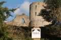
The Sos’trail is a permanent trail for trail running and Nordic walking, signposted over 10 km. It winds through the Sos’trail hinterland, taking in the Tour de Bridiers and the boxwood-lined sunken paths. Naturally, it is also suitable for traditional hiking and mountain biking.
Randoguide: Bridiers through the ages
 5.24 mi
+269 ft
-259 ft
2h 40
Easy
Departure from La Souterraine (Creuse)
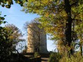
On the outskirts of La Souterraine, set off on this guided walk which, from antiquity to the end of the Middle Ages, brings to life the daily lives of our ancestors. Human settlement here has a long history, the evolution of which can be traced through the landscape.
From the shores of the Étang du Cheix to the sunken paths lined with boxwood, from the archaeological remains scattered throughout the countryside to the imposing silhouette of the castle, this excursion will transport you through time and across the ages.
More walks in Saint-Pardoux (Haute-Vienne)
Select a point of interest below: