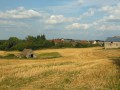
Near La Souterraine, the short Chapuisette route takes a detour through the surrounding countryside, runs alongside a woodland and passes through a peaceful residential area. It also offers the chance to discover a secluded yet fascinating environment: the wetland and its array of invertebrates, amphibians and moisture-loving plants.
Start at the “Las Damas” shopping centre in La Souterraine.
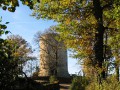
(S/E) Enter the park opposite the “Las Damas” shopping centre. Follow the stream upstream, keeping the watercourse on your right, pass a dovecote and walk through a very small wooded area. On emerging from this area, you’ll reach the ponds and a three-way junction. Turn left here, following the path which later runs along the edge of the woods. Go through the barrier blocking vehicle access, leave the marsh and reach another junction.
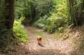
(1) Continue along the track on the left which leads to the area known as “l’Étang Rompu”. The track, sheltered by hedges, winds its way between pastures and ponds. You’ll come to a bend.
(2) Turn left towards a small copse. After another bend, walk along the edge of the copse until you emerge into a housing estate.
(3) Follow the residential road to the left (this section is shared withthe GR® 654). After about 200 m, turn right and head steeply downhill to reach Avenue de la Libération in La Souterraine, near the Pisserotte washhouse. Then follow this avenue to the left until you reach the roundabout, and go round it on the left to reach the park entrance and the starting point (S/E).
Waypoints
S/E : mi 0 - alt. 1,214 ft - Entrance to Chapuisette Park
1 : mi 0.32 - alt. 1,240 ft - Junction with the Chemin de l’Étang Rompu
2 : mi 0.63 - alt. 1,283 ft - Turn
3 : mi 1.04 - alt. 1,280 ft - Bois du Breuil housing estate
S/E : mi 1.61 - alt. 1,214 ft - Entrance to La Chapuisette Park
Notes
A short, easy route. The route is suitable for an all-terrain pushchair and is particularly well-suited for a walk with children.
Easy parking in the car park of the “Las Damas” shopping centre, 50 metres from the start.
The start is marked by an information sign.
Worth a visit
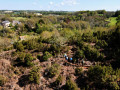
The Chapuisette Marsh: on the outskirts of La Souterraine, the Chapuisette Marsh is a small sanctuary for biodiversity. It comprises various small pools linked to the Rhin stream. It is also an educational space where you can discover the hidden qualities and unexpected ecological benefits of this very distinctive type of wetland.
The Pisserotte washhouse: this marks the endof the walk, so to speak. Despite its natural tendency towards eutrophication, it remains an interesting body of water due to the variety of plants that colonise its surface… and the ducks that sometimes come to frolic there. Note the sculpture of the Troubadour watching over the site. Several sculptures of this kind can be found in the centre of La Souterraine and in the villages of the surrounding municipalities.
The historic centre of La Souterraine: La Souterraine, a thousand-year-old town whose origins actually date back much further, boasts a wealth of architectural features ranging from simple carved corbels to the monumental structures of the church and the town gates. Several discovery routes allow you to explore the area.
Reviews and comments
5 / 5
Based on 1 review
Reliability of the description 5 / 5
Ease of following the route 5 / 5
Route interest 5 / 5
annie gandois
Overall rating :
5 / 5
Date of your route : Aug 21, 2023 Reliability of the description : ★★★★★ Very good Ease of following the route : ★★★★★ Very good Route interest : ★★★★★ Very good Very busy route : No
To open this route on your smartphone, you must have the Visorando app installed. If not, got to the Apple Store (iPhone) or Google Play Store (Android) to download the app.



 Country:
 City:





 Tourist office
 Moderate