Puy de l’Age

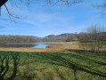
An easy walk with a slight elevation gain, access to a shepherd’s hut, two viewpoints and less than 100 m of road. It’s a shame the pond is private and inaccessible.

Details

n°28899024
Creation:
Last update:
Last review:
  • Walking
    Activity: Walking
  • ↔
    Distance: 3.66 mi
  • ◔
    Average duration: 2h 10 
  • ▲
    Difficulty: Easy

  • ⚐
    Back to start: Yes
  • ↗
    Ascent: + 568 ft
  • ↘
    Descent: - 541 ft

  • ▲
    Highest point: 1,847 ft
  • ▼
    Lowest point: 1,329 ft

Description of the walk

Park on the verge before the pond: leave space for farm machinery.

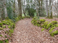
(S/E) Take the forest track to the right of the pond, which is private: do not go beyond the fence.

(1) You’ll come to the Puy de l’Age shepherd’s hut: turn right onto the path signposted in red for a 500-metre round trip. The shepherd’s hut is a very old stone shelter providing protection from the elements. Retrace your steps.

(1) Resume the route by turning right.

(2) At the fork, leave the forest track and take the stony sunken path leading uphill to the right. Marked with red and yellow arrows. As soon as you enter the woods, take the wrong sunken path on the left. At the next junction, take the track on the right and join a wide, stony forest track: follow it to the left. Further on, cross the Route de Beaubiat and then the Route de Bersac, and continue for a few dozen metres.

(3) Take the path on the left, signposted “Pierre du Loup”.

(4) Viewpoint overlooking Bersac-sur-Rivalier, Saint-Sulpice-Laurière and the telecoms tower at Saint-Goussaud. Continue along the path to the right, which winds through the woods before reaching an aerial.

(5) Turn left as you leave the woods. At the Route de Bersac (D28), head up to the left until the first bend, then take the sunken track on the right, which leads downhill and is signposted in red and yellow. You’ll reach a three-way junction.

(6) Turn right, leaving the red-and-yellow markings behind. Walk alongside the pond on your left and return to the starting point (S/E).

Waypoints

  1. S/E : mi 0 - alt. 1,332 ft - Étang du Puy de l'Age
  2. 1 : mi 0.16 - alt. 1,378 ft - Crossroads at the Puy de l’Age lodge
  3. 2 : mi 0.6 - alt. 1,437 ft - T-junction
  4. 3 : mi 1.63 - alt. 1,824 ft - Junction – ‘Pierre du Loup’ sign
  5. 4 : mi 2.12 - alt. 1,844 ft - La Pierre du Loup
  6. 5 : mi 2.72 - alt. 1,555 ft - Fork in the road – Antenne
  7. 6 : mi 3.24 - alt. 1,450 ft - Three-way junction
  8. S/E : mi 3.66 - alt. 1,332 ft - Étang du Puy de l'Age

Reviews and comments

5 / 5
Based on 1 review

Reliability of the description
5 / 5
Ease of following the route
5 / 5
Route interest
5 / 5
User 26919848
• Edited:

It was difficult to find the start of the hike.
Then, after 500 metres, we couldn't follow the marked path because it was covered by ferns.

Machine-translated

tauzin laurence
tauzin laurence

Overall rating : 5 / 5

Date of your route : Apr 25, 2025
Reliability of the description : ★★★★★ Very good
Ease of following the route : ★★★★★ Very good
Route interest : ★★★★★ Very good
Very busy route : No

I really enjoyed this walk; I even extended it by setting off from Bezanne and following the GR trail, which is to the north of the map, to begin with.
The smithy is particularly beautiful, so I’d advise everyone to make the detour (an extra 500 metres); it’s very well signposted on the ground.

Machine-translated

Other walks in the area

For more walks, use our search engine .

The GPS track and description are the property of this route's author. Please do not copy them without permission.