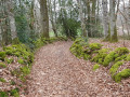
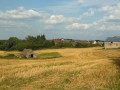
The Bois de Bessac

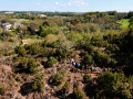
Starting from the little chapel at Le Dognon, this walk alternates between footpaths and small roads, and takes you to two places of notable interest: the Peu de l’Age, which offers a beautiful view overlooking the Vitrat pond, and the Bois de Bessac, much loved for its atmosphere and cool, refreshing surroundings.

Details

31429490
Creation:
Last update:
Last review:
  • Walking
    Activity: Walking
  • ↔
    Distance: 7.44 mi
  • ◔
    Average duration: 3h 40 
  • ▲
    Difficulty: Moderate

  • ⚐
    Back to start: Yes
  • ↗
    Ascent: + 276 ft
  • ↘
    Descent: - 289 ft

  • ▲
    Highest point: 1,273 ft
  • ▼
    Lowest point: 1,070 ft

Photos

Description of the walk

From La Souterraine, take the N145 towards Bellac. Leave the N145 at the next roundabout, taking thefirst exit towards Le Dognon. Take the second road on the right (Rue de la Chapelle, Le Dognon). Drive on until you reach the chapel.

(S/E) With your back to the chapel, follow the main road westwards until you reach a track bordering the wooded area opposite the chapel.

(1) Head up this track to the right, cross the road (Rue de la Croix) and continue along the track opposite, which also heads due north. At the first three-way junction, follow the track to the right. Further on, at the second three-way junction, take the track on the right again, skirting a small wood until you reach a bend.

(2) Turn left and you’ll come out onto a road.

(3) Follow this road to the right for about 500 m. At the junction with the D73A1, turn left and carry on until you reach the pond’s embankment.

(4) Take the track that descends to the left towards the old mill. Pass the house, then take the path that climbs to the right up the Peu de l’Age. Follow this path, which initially winds its way through coniferous woodland before emerging onto an old heathland area currently being reforested. Cross this heathland to the summit, then descend via a wide, motorable track that curves sharply to the right and leads back to a junction. Take the track on the right to reach the hamlet of Vitrat.

(5) Enter the hamlet by first turning right then left, then take the first path on the left to rejoin the D73A1. At the three-way junction, just after the exit, follow the small road on the right and continue along it until you reach the junction with the D73. Turn right and follow the D73 with care, passing the entrance to a farm and skirting a wood until you reach another junction.

(6) Take the track on the right that runs between two fields. Then enter the Bois de Bessac by following the track. You will reach the edge of the woodland.

(7) Turn left to follow the path leading into the woods. Keep left at the first three-way junction. Turn right at the second junction to reach a third.

(8) Turn right and, a little further on, follow the main path as it curves to the left. The path descends slightly as it leaves the woods and joins a wide track.

(9) Follow it to the right, along the edge of the woods. Once you reach the houses, turn left to reach Petit Bessac.

(10) Turn left at the hamlet. Shortly afterwards, take the straight farm track branching off to the right. You’ll reach the village of Rissac and come to the main road running through the village.

(11) Follow it to the left for a few dozen metres. After the bend, take the track on the right which runs past the foot of the Puy de Chatenet. Follow this track to the Route du Dognon and turn right onto it to reach the chapel (S/E).


Waypoints

  1. S/E : mi 0 - alt. 1,247 ft - Dognon Chapel
  2. 1 : mi 0.1 - alt. 1,250 ft - Junction
  3. 2 : mi 0.82 - alt. 1,171 ft - Bend in the track
  4. 3 : mi 1.23 - alt. 1,152 ft - Road
  5. 4 : mi 1.72 - alt. 1,125 ft - Vitrat Pond - Étang Bardon
  6. 5 : mi 2.63 - alt. 1,171 ft - Vitrat
  7. 6 : mi 3.81 - alt. 1,201 ft - Junction towards the Bois de Bessac
  8. 7 : mi 4.37 - alt. 1,181 ft - Edge of the woodland
  9. 8 : mi 4.83 - alt. 1,191 ft - Junction in the Bois de Bessac
  10. 9 : mi 5.14 - alt. 1,158 ft - Track – exit from the Bois de Bessac
  11. 10 : mi 5.61 - alt. 1,158 ft - Le Petit Bessac
  12. 11 : mi 6.26 - alt. 1,168 ft - Rissac
  13. S/E : mi 7.44 - alt. 1,250 ft - Dognon Chapel

Notes

Parking: it is easy to park, either in front of the chapel or at the edge of the wooded area opposite it (public access).

Take care along the D73, especially in the section through the undergrowth where poor visibility can be a problem. Do not hesitate to walk on the verge. We plan, in the medium term, to reroute the route away from this road, at least in part.

Follow the signposting carefully in the Bois de Bessac: there are many paths that criss-cross each other, and the directions on the route map alone may be misleading due to the unexpected creation of new tracks or forestry access roads.

Worth a visit

Chapelle du Dognon: a recent construction owned by the Diocese of Limoges. Not far from it, there are two stone crosses.

Vitrat Pond: it dates back to the Middle Ages, like many significant bodies of water in Limousin. It is surrounded by a vast wetland area and is managed by the Nouvelle-Aquitaine Conservatory of Natural Areas.

Le Peu de l’Age: it features remnants of heathland on its south-eastern flank, visible from the road leading to the village of Vitrat.

Not far from the route, in the village of St Maurice la Souterraine: the Bétoule stele is an ancient necropolis containing several burial chests. The commemorative stele is monumental.

Reviews and comments

4.1 / 5
Based on 4 reviews

Reliability of the description
4.5 / 5
Ease of following the route
4.3 / 5
Route interest
3.5 / 5
User 27287144

Overall rating : 4 / 5

Date of your route : Mar 02, 2026
Reliability of the description : ★★★★☆ Good
Ease of following the route : ★★★★☆ Good
Route interest : ★★★★☆ Good
Very busy route : Yes

Varied landscapes, pleasant route. It's a shame that on some sections you can hear the noise from the motorway.

Machine-translated

PEDAROUX
PEDAROUX

Overall rating : 4.3 / 5

Date of your route : Nov 02, 2024
Reliability of the description : ★★★★★ Very good
Ease of following the route : ★★★★☆ Good
Route interest : ★★★★☆ Good
Very busy route : No

A route with a few steep climbs and deep, water-filled ruts.
The route was very well marked. We set off in fog, but the sun soon broke through and the landscape revealed itself in all its simple beauty.
The estimated time for the route was spot on.
Three hours that flew by in a pleasant way.

Machine-translated

Nombo
Nombo

Overall rating : 3.3 / 5

Date of your route : May 24, 2024
Reliability of the description : ★★★★☆ Good
Ease of following the route : ★★★★☆ Good
Route interest : ★★☆☆☆ Disappointing
Very busy route : No

There was nothing particularly remarkable about this walk I went on with my two-and-a-half-year-old dog. She certainly had a good time chasing rabbits and deer. Personally, I was a bit disappointed, but still, despite the rain, it was a good, healthy walk.

Machine-translated

waiwaite
waiwaite

Overall rating : 4.7 / 5

Date of your route : Sep 24, 2023
Reliability of the description : ★★★★★ Very good
Ease of following the route : ★★★★★ Very good
Route interest : ★★★★☆ Good
Very busy route : No

A lovely countryside walk
No difficulty, well signposted, even in the Bessac woods.
A small suggestion: a bench would be welcome at the start/finish.
It took us 3 hours and 10 minutes; the sign at the start indicated 3 hours

Machine-translated

Other walks in the area

For more walks, use our search engine .

The GPS track and description are the property of this route's author. Please do not copy them without permission.