Châtelard Oppidum

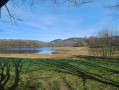
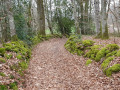
This short walk through woodland allows you to explore the listed site of the Châtelard oppidum. It is a Gallo-Roman fortified settlement on a barred spur, consisting of a platform covering around ten hectares and side terraces, now entirely wooded. The route features a steep climb over the first 600 metres, followed by a flat path around the perimeter of the site.

Details

1528494
Creation:
Last update:
Last review:
  • Walking
    Activity: Walking
  • ↔
    Distance: 1.38 mi
  • ◔
    Average duration: 0h 50 
  • ▲
    Difficulty: Easy

  • ⚐
    Back to start: Yes
  • ↗
    Ascent: + 226 ft
  • ↘
    Descent: - 226 ft

  • ▲
    Highest point: 1,811 ft
  • ▼
    Lowest point: 1,585 ft

Description of the walk

Start from the car park at the northern entrance to the village of Le Maillorat (sign describing the site).

(S/E) Follow the stony path northwards and then north-westwards, climbing for about 500 metres.

(1) At the first junction (signpost), continue straight on.

(2) About 200m further on, at the second junction (signpost), turn right onto the path leading to the entrance of the oppidum. Continue along this forest path, which follows the outer edge of the site. The circular path takes you back to the main path.

(1) Turn left onto the stony path you took on the way there and walk down to the car park (S/E).

Waypoints

  1. S/E : mi 0 - alt. 1,585 ft - Le Mailorrat – Car park
  2. 1 : mi 0.31 - alt. 1,749 ft - Junction
  3. 2 : mi 0.42 - alt. 1,775 ft - Second junction
  4. S/E : mi 1.38 - alt. 1,585 ft - Le Mailorrat – Car park

Reviews and comments

4 / 5
Based on 4 reviews

Reliability of the description
3.8 / 5
Ease of following the route
4 / 5
Route interest
4.3 / 5
JPC19
JPC19

Overall rating : 4 / 5

Date of your route : Feb 03, 2025
Reliability of the description : ★★★★☆ Good
Ease of following the route : ★★★☆☆ Average
Route interest : ★★★★★ Very good
Very busy route : No

Thank you for everything

Machine-translated

Armelle L
Armelle L
• Edited:

Overall rating : 3.3 / 5

Date of your route : Dec 23, 2024
Reliability of the description : ★★★☆☆ Average
Ease of following the route : ★★★★☆ Good
Route interest : ★★★☆☆ Average
Very busy route : No

The start of the path is very good. Then you walk along the perimeter of the remains of the oppidum. You have to use your imagination to picture them.
I’d expected better.
It’s still a walk in the woods, so it’s refreshing!

Machine-translated

tourlim
tourlim

Overall rating : 4.7 / 5

Date of your route : Aug 06, 2020
Reliability of the description : ★★★★☆ Good
Ease of following the route : ★★★★★ Very good
Route interest : ★★★★★ Very good
Very busy route : No

A very pleasant walk through the woods. The only downside is that it takes about an hour, rather than the time stated

Machine-translated

GUILLAUMEAUX Gaëtan
GUILLAUMEAUX Gaëtan

Overall rating : 4 / 5

Date of your route : Feb 16, 2019
Reliability of the description : ★★★★☆ Good
Ease of following the route : ★★★★☆ Good
Route interest : ★★★★☆ Good

Perfect.

Machine-translated

Other walks in the area

For more walks, use our search engine .

The GPS track and description are the property of this route's author. Please do not copy them without permission.