Country:
 City:
City:


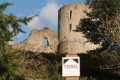
Start at La Souterraine, at the Étang du Cheix car park.
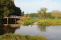
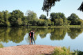
(S/E) Start by walking along the southern shore of the lake, on the beach side. Once you have crossed the bridge leading to the small island, leave the lake area, cross a footbridge and you will arrive at the edge of a small wood near a junction.
(1) Do not head into the woodland but follow the main path to the left, marked by electricity pylons. At the top of this track at a three-way junction, follow the path leading uphill to the left. At the next junction, continue along the wide path opposite, then, at the next two junctions, take the left-hand path again. You’ll reach a cluster of old houses in Vieux Bridiers.
(2) Once on the road, in the centre of this hamlet, turn left and weave your way between two houses. You’ll come to a flat track; cross a road a little further on by continuing straight ahead along the track as it continues, and you’ll reach a junction near the D91. Approach the road and cross it carefully to join a side road.
(3) Continue along this small road and then take the first track on the left which joins the departmental road; avoid this by staying on the wide verge for about ten metres.
(4) Then take a path that leads into the woodland on the right. Shortly afterwards, head downhill to cross a narrow stream and then climb back up to the edge of the woodland, before a descent that brings you back to a farm track. Follow this track down to the right until it bends to the right and reaches its junction.
(5) Follow the shaded path that branches off to the left. You’ll emerge between two fields, then continue along a sunken track that descends. This track is often damp, and you may need to step carefully along the edges to keep your feet dry.
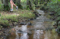
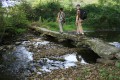
(6) You’ll reach the stream, which literally flows through the path; well-stabilised verges allow you to walk alongside it without any trouble. The path continues to a cluster of houses and a road junction at Fongeneuil.
(7) Walk back up to the junction and follow the road on the right, which climbs gradually. You’ll reach the hamlet of Lavaud. Then head down the small road on the right, which further on becomes a track again. Follow this track to where it meets another wide track, below the village of Bridiers.
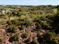
(8) Continue along the track on the left, leaving the village behind you. The track narrows considerably between boxwood hedges. At the junction, follow the path on the right, which emerges shortly afterwards between two fields and joins a road. Continue along the road to the right. At the crossroads, turn left and you’ll come out onto a main road.
(9) Follow this road to the right, then take the disused road that branches off slightly to the right. Finish with a short grassy stretch that leads to the edge of the D951 at a crossroads. Cross carefully.
(10) Head to the right-hand side of the road opposite and follow it until you reach the junction with a minor road. Continue along the main road, keeping to the right-hand side, passing a bus shelter and a commemorative stele, then take a wide track on the right which leads to the castle site.
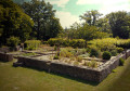
(11) At a crossroads of paths, turn left to go round the medieval garden enclosure, then head down a track leading to the circular tower of the ramparts. When you see a wooden structure, leave the track and head down a grassy path on the left to reach a wooden footbridge. At the end of the footbridge, turn right, cross a clearing and head up the path to enter the woodland and reach a crossroads in the Bois des Roudets.
(12) Follow this path to the left, which overlooks a small valley, then joins a slightly more defined track. Continue along this track to the left, go down a step by a large beech tree and, at the bottom, continue along the track straight ahead (without attempting to cross the stream). You’ll emerge onto the track from the start of the route, not far from the footbridge.
(1) Return along the track to the left, heading in the opposite direction to the start of the route, cross the footbridge, walk past the bridge connecting the island and follow the edge of the pond to return to the starting point (S/E).


 PLEASE NOTE: due to preparations for and the staging of the ‘Fresque de Bridiers’ show, the Sostrail route has been temporarily rerouted to avoid the entire castle area, which is off-limits to the public until 12 August. The final section of the route consists of a short return leg along the same path. Please follow the signposting carefully. The usual route will resume shortly after 15 August.
 Tourist office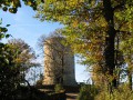
 Easy
Easy 


 Visorando Member