Route bleue autour du Lac de Saint-Pardoux

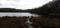
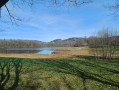
Starting from the Santrop bridge, this 7 km route allows you to explore the shores of Lake Saint-Pardoux and its landscapes in the Haute-Vienne. The route follows the lake’s banks for much of the way and passes through several wooded areas, in a peaceful setting ideal for a stroll. The route passes through the heart of the village of Friaudour, whilst offering lovely views of the lake. During the walk, you’ll also catch a glimpse of the Île aux Enfants, a small island accessible via a wooden footbridge situated near the path. With a relatively easy route, this walk is ideal for enjoying nature and discovering the landscapes of Lake Saint-Pardoux as you follow the water’s edge.

Details

n°110357303
Creation:
Last update:
Last review:
–
  • Walking
    Activity: Walking
  • ↔
    Distance: 4.36 mi
  • ◔
    Average duration: 2h 05 
  • ▲
    Difficulty: Easy

  • ⚐
    Back to start: Yes
  • ↗
    Ascent: + 85 ft
  • ↘
    Descent: - 85 ft

  • ▲
    Highest point: 1,283 ft
  • ▼
    Lowest point: 1,181 ft
  • ⚐ Country: France
  • ⚐ City: Razès (87640)
  • ⚑
    Start/End: N 46.03811° / E 1.29577°
  • ❏
    IGN map(s): Ref. 2030E
  • Hour-by-hour weather

Description of the walk

The start of the walk is at the Santrop bridge.

(S/E) With the bridge behind you, follow the route along the road towards La Brandouille.

(1) The route passes through the Brandouille area. Keep to the left before turning right, then left, and then heading towards the village of Friaudour, which you’ll need to walk through.

(2) Just before leaving the village, turn left. The route continues through natural surroundings, alternating between wooded areas and views of the lake.

(3) The path passes close to Île aux Enfants, a small island accessible via a wooden footbridge. The route does not cross the footbridge. Continue along the path that runs alongside the lake’s shores.

(4) At the southern shore of the lake, continue along the path that skirts the lake’s banks. Enjoy the scenery as you head towards the Santrop bridge (S/E).

Waypoints

  1. S/E : mi 0 - alt. 1,198 ft - Santrop Bridge - Couze (rivière) - Affluent de la Guartempe
  2. 1 : mi 0.48 - alt. 1,283 ft - La Brandouille
  3. 2 : mi 1.01 - alt. 1,234 ft - Friaudour
  4. 3 : mi 1.82 - alt. 1,188 ft - L’Île aux Enfants - Lac de Saint-Pardoux
  5. 4 : mi 3.06 - alt. 1,181 ft - Lake shores – southern section - Lac de Saint-Pardoux
  6. S/E : mi 4.36 - alt. 1,198 ft - Santrop Bridge

Worth a visit

Île aux Enfants

Situated near the footpath, Île aux Enfants is a small island accessible via a wooden footbridge. This interesting feature of Lake Saint-Pardoux offers a brief escape above the water and is a lovely spot to discover during your walk. Please note that access to the island is off the main route.

Other walks in the area

For more walks, use our search engine .

The GPS track and description are the property of this route's author. Please do not copy them without permission.