


Refine your search for walks in Saint-Pardoux (Deux-Sèvres)
Saint-Pardoux (Deux-Sèvres) walks
 Around the Massicart in Verruyes
 Visorando Member
 7.05 mi
 +407 ft
 -400 ft
 3h 35
3h 35
 Moderate
 Departure from Verruyes (Deux-Sèvres)
The vast majority of this walk takes place within the municipality of Verruyes. You’ll start by following paths through the Gâtinais countryside alongside the Ruisseau du Massicart, which flows into the Chambon – on which the Barrage de la Touche Poupard is built. Finally, a series of small roads will take you back to the starting point. You’ll pass through small hamlets typical of the region.
Around Azay-Sur-Thouet
6.07 mi
+302 ft
-279 ft
3h 05
 Easy
Departure from Azay-sur-Thouet (Deux-Sèvres)
Easy
Departure from Azay-sur-Thouet (Deux-Sèvres)
Shaded route using dirt tracks and a few sections of tarmaced local roads.
Idyllic route in Gâtine at Azay-sur-Thouet
6.40 mi
+285 ft
-282 ft
3h 10
Moderate
Departure from Azay-sur-Thouet (Deux-Sèvres)
A countryside walk in the Gâtine, with shaded sections through copses and a few high points offering views of the bocage landscape.
Maison Neuve walking route
8.22 mi
+364 ft
-341 ft
4h 05
Moderate
Departure from Azay-sur-Thouet (Deux-Sèvres)
A walk through the Gâtinaise countryside along unpaved paths and local roads.
Chemin des Pommes in Secondigny
 5.44 mi
+180 ft
-187 ft
2h 40
Easy
Departure from Secondigny (Deux-Sèvres)
5.44 mi
+180 ft
-187 ft
2h 40
Easy
Departure from Secondigny (Deux-Sèvres)
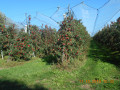
A pleasant little route through the orchards of Secondigny.
The Effres Route starting from Secondigny
 4.48 mi
+135 ft
-138 ft
2h 10
Easy
Departure from Secondigny (Deux-Sèvres)
4.48 mi
+135 ft
-138 ft
2h 10
Easy
Departure from Secondigny (Deux-Sèvres)
This short walk through the Secondigny countryside, along small roads and country lanes, takes you past Lac des Effres and through the Gâtine countryside, ending with a walk through the Bois de l’Aumônerie.
It is based on walk no. 7 published in a leaflet by the Parthenay Gâtine heritage department. It is partly signposted: look for the ‘Blue Circle’ signs.
Chemin des digitales in the Secondigny forest
 Association / Club / Walk leader
 5.98 mi
+371 ft
-374 ft
3h 05
Easy
Departure from Le Retail (Deux-Sèvres)
5.98 mi
+371 ft
-374 ft
3h 05
Easy
Departure from Le Retail (Deux-Sèvres)
A hike in the Secondigny National Forest, dotted with foxgloves and ending with magnificent views of the Pays de Gâtine.
Saint-Georges-de-Noisné circular via Soleil Levant
 5.69 mi
+338 ft
-341 ft
2h 55
Moderate
Departure from Saint-Georges-de-Noisné (Deux-Sèvres)
5.69 mi
+338 ft
-341 ft
2h 55
Moderate
Departure from Saint-Georges-de-Noisné (Deux-Sèvres)
This circular route takes you along the Soleil Levant lake, along theGR® 364 andGRP® des Marches de Gâtine footpaths, and to the village of Les Nénéens.
Circular Touche Poupard in Saint-Georges-de-Noisné
 4.80 mi
+174 ft
-207 ft
2h 20
Easy
Departure from Saint-Georges-de-Noisné (Deux-Sèvres)
4.80 mi
+174 ft
-207 ft
2h 20
Easy
Departure from Saint-Georges-de-Noisné (Deux-Sèvres)
This is an easy route that runs along the right bank of the Touche Poupard reservoir, crosses a few small streams that partially feed the dam, and passes through a few hamlets in Saint-Georges-de-Noisné. Part of the GRP® des Marches de Gâtine and GR®364 trails are used. Waterproof walking shoes with good gripping soles are recommended in case of recent rainfall.
Les villages de Clavé
 6.66 mi
+243 ft
-253 ft
3h 15
Moderate
Departure from Clavé (Deux-Sèvres)
6.66 mi
+243 ft
-253 ft
3h 15
Moderate
Departure from Clavé (Deux-Sèvres)
A walk through a small village in the Gâtine region. The route follows small roads and paths, passing through several villages in the area, takes a section ofthe GR®® 364 and ends by skirting the Soleil Levant lake.
Walk in Pamplie
 7.24 mi
+135 ft
-157 ft
3h 25
Moderate
Departure from Pamplie (Deux-Sèvres)
7.24 mi
+135 ft
-157 ft
3h 25
Moderate
Departure from Pamplie (Deux-Sèvres)
A peaceful walk through the Pamplie countryside, between fields and forests.
Around the Touche-Poupard reservoir
 13.68 mi
+522 ft
-515 ft
6h 45
13.68 mi
+522 ft
-515 ft
6h 45
 Difficult
Departure from Clavé (Deux-Sèvres)
Difficult
Departure from Clavé (Deux-Sèvres)
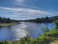
A pleasant walk around the Touche-Poupard reservoir, presenting no difficulty other than its length. There are plenty of spots along the route where you can stop for a nice break.
The Soleil Levant lake from Clavé
 4.08 mi
+141 ft
-148 ft
2h 00
Easy
Departure from Clavé (Deux-Sèvres)
4.08 mi
+141 ft
-148 ft
2h 00
Easy
Departure from Clavé (Deux-Sèvres)
A pleasant walk around the Soleil Levant lake behind the Clavé dam bridge. The route follows both banks in turn along paths that are steep in places, offering lovely scenery and fine views of Lac de la Touche Poupard. The walk takes in a landscape information board, the Church of Notre-Dame de Clavé, the Gros Chêne fountain, old hamlets and the Clavé garden.
The Bois de Cathelogne
 6.61 mi
+436 ft
-446 ft
3h 25
Moderate
Departure from Saint-Georges-de-Noisné (Deux-Sèvres)
6.61 mi
+436 ft
-446 ft
3h 25
Moderate
Departure from Saint-Georges-de-Noisné (Deux-Sèvres)
A walk that takes place largely within the commune of the ‘Nénéens’ (the inhabitants of Saint-Georges-de-Noisné). You’ll pass through villages with working farms. The first part follows shaded paths in summer, though these can be damp in winter. The rest of the route takes you along two stretches of minor roads, ending with a walk through the Bois de Cathelogne, with its ponds and a cabin that has a touch of Canada about it.
Circular loops around Saint-Projet
 6.90 mi
+338 ft
-338 ft
3h 30
Moderate
Departure from La Chapelle-Bâton (Deux-Sèvres)
6.90 mi
+338 ft
-338 ft
3h 30
Moderate
Departure from La Chapelle-Bâton (Deux-Sèvres)
This route consists of three circular loops that are linked, allowing you to adjust the length of the walk as you wish. In a delightfully undulating landscape, dotted with fountains and wash houses, you’ll walk along paths that are more or less overgrown with grass and small country lanes passing through villages with beautifully restored old houses.
 Parcours autour de Clavé
7.31 mi
+427 ft
-436 ft
3 hrs
Moderate
Departure from Clavé (Deux-Sèvres)
Ce parcours comporte des chemins variés, assez peu de route.
Il est à faire plutôt en été, automne (chemins assez humides).
Il faut soit des poneys aguerris, soit être prêt à quitter sa monture pour lui montrer le passage en 2 ou 3 endroits.
Il n'y a qu'1 ou 2 chemins où le galop est possible.
Beaucoup de pas, du trot de temps à autre.
À éviter les après-midis en week-end du fait de la présence de piétons autour du lac à Clavé.
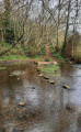
Cherveux, Lussais and Villeneuve lakes from Saint-Christophe-sur-Roc
 7.42 mi
+354 ft
-358 ft
3h 45
Moderate
Departure from Saint-Christophe-sur-Roc (Deux-Sèvres)
7.42 mi
+354 ft
-358 ft
3h 45
Moderate
Departure from Saint-Christophe-sur-Roc (Deux-Sèvres)
A pleasant, mostly shaded walk, mainly along very narrow roads.
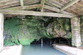
Route des lavoirs de Saint-Christophe-sur-Roc
 6.69 mi
+276 ft
-285 ft
3h 20
Moderate
Departure from Saint-Christophe-sur-Roc (Deux-Sèvres)
6.69 mi
+276 ft
-285 ft
3h 20
Moderate
Departure from Saint-Christophe-sur-Roc (Deux-Sèvres)
A pleasant walk exploring the restored wash houses, between the Roche and Musson valleys. This route takes you past the Romanesque church, the Tree of Liberty and the Hosanna cross in the village, then on to the wash house at Boisne, the wash house at La Perdillière, the wash house at Chazais and the wash house at La Roche, as well as the underground river. The route offers varied scenery and a chance to experience the natural beauty of this lovely corner of the Gâtine region.
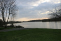
A glimpse of Lac de la Touche-Poupard from Lachereau
 5.52 mi
+144 ft
-144 ft
2h 40
Easy
Departure from Exireuil (Deux-Sèvres)
5.52 mi
+144 ft
-144 ft
2h 40
Easy
Departure from Exireuil (Deux-Sèvres)
A very beautiful walk to discover a section ofthe GR® de Pays des Marches de Gâtine along Lac de la Touche Poupard. This route offers lovely views and magnificent scenery, made all the more enjoyable by the frequent sunshine.
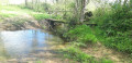
Around Chantecorps
 4.92 mi
+98 ft
-105 ft
2h 20
Easy
Departure from Chantecorps (Deux-Sèvres)
4.92 mi
+98 ft
-105 ft
2h 20
Easy
Departure from Chantecorps (Deux-Sèvres)
A short walk through the former commune of Chantecorps, along sunken paths and small country lanes. It is based on a walk featured in a leaflet published by the Parthenay Gâtine heritage service.
Circular Pommier starting from Lachereau
 5.28 mi
+207 ft
-210 ft
2h 35
Easy
Departure from Exireuil (Deux-Sèvres)
5.28 mi
+207 ft
-210 ft
2h 35
Easy
Departure from Exireuil (Deux-Sèvres)
In the commune of Exireuil, this short route follows the eastern bank of the La Touche Poupard reservoir.Starting from the Lachereau sailing club car park, it partly follows the GR®364 trail, passes through the Bois de la Vergne and Bois de Chantoiseau woods, and joins the Clavé au Pommier road.
Fourbeau to Les Ritraisses route in the Egray valley
 5.07 mi
+502 ft
-515 ft
2h 45
Moderate
Departure from Surin (Deux-Sèvres)
5.07 mi
+502 ft
-515 ft
2h 45
Moderate
Departure from Surin (Deux-Sèvres)
A pretty, hilly route, mainly shaded, which leads through the countryside between three rivers, from the village of Fourbeau to Les Ritraisses via two different paths.
A tour of the hamlets in Augé
 5.82 mi
+433 ft
-427 ft
3h 05
Easy
Departure from Augé (Deux-Sèvres) (Deux-Sèvres)
5.82 mi
+433 ft
-427 ft
3h 05
Easy
Departure from Augé (Deux-Sèvres) (Deux-Sèvres)
This walk, starting from the village of Augé, will take you through some of the hamlets that make up the parish, along shaded paths and small country lanes. You’ll have the chance to pass three of Augé’s many wash houses and catch a glimpse of the Houmelière farmhouse.
The Montbrune stream and the village of Augé
 7.92 mi
+633 ft
-617 ft
4h 10
Moderate
Departure from Augé (Deux-Sèvres) (Deux-Sèvres)
7.92 mi
+633 ft
-617 ft
4h 10
Moderate
Departure from Augé (Deux-Sèvres) (Deux-Sèvres)
This unmarked hike will first take you through the village of Augé and its narrow streets, then along paths that will lead you to the Montbrune stream via several footbridges and through a few pretty villages with their wash houses. The end of the route is on the old Deux-Sèvres tramway line (TDS).
Le Chambon and La Ligueure
 8.02 mi
+702 ft
-702 ft
4h 20
Moderate
Departure from Augé (Deux-Sèvres) (Deux-Sèvres)
8.02 mi
+702 ft
-702 ft
4h 20
Moderate
Departure from Augé (Deux-Sèvres) (Deux-Sèvres)
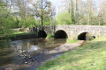
A unique walk offering the chance to explore the Chambon and Ligueure valleys, featuring fountains and wash houses, family cemeteries, the Roman bridge at Azay-le-Brûlé, the Valette dairy farm, the village of Augé with its narrow lanes and medieval houses, and the church at Augé.
Fichères Route
 1.66 mi
+184 ft
-194 ft
0h 55
Easy
Departure from Cours (Deux-Sèvres) (Deux-Sèvres)
1.66 mi
+184 ft
-194 ft
0h 55
Easy
Departure from Cours (Deux-Sèvres) (Deux-Sèvres)
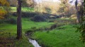
A short walk near Les Fichères along lovely shaded paths, offering beautiful views of the surrounding countryside.
The Brangeard Valley, starting from the Cherveux-Saint-Christophe pond
 6.03 mi
+325 ft
-341 ft
3h 05
Easy
Departure from Saint-Christophe-sur-Roc (Deux-Sèvres)
6.03 mi
+325 ft
-341 ft
3h 05
Easy
Departure from Saint-Christophe-sur-Roc (Deux-Sèvres)
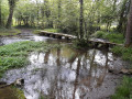
Setting off from the Cherveux-Saint-Christophe lake, you’ll reach the water tower, the highest point on the route, surrounded by countryside stretching as far as the eye can see, then a shaded path will lead you to the hamlet of Lussais. You’ll then enjoy the lush greenery of the Brangeard, Musson and Marcusson valleys as you follow a circular route along small roads, footpaths and grassy tracks that will take you back to the lake where you started.
Around the Egray and the Rochers de la Chaise
 7.01 mi
+627 ft
-636 ft
3h 45
Moderate
Departure from Germond-Rouvre (Deux-Sèvres)
7.01 mi
+627 ft
-636 ft
3h 45
Moderate
Departure from Germond-Rouvre (Deux-Sèvres)
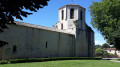
A pleasant hike in hilly terrain around the Egray River and its tributaries. It offers beautiful landscapes and allows you to discover a rich heritage of ancient buildings (Château de la Pimpelière, houses, farm buildings, etc.). The natural heritage is not to be outdone, with the Planche de Rochard and the Rochers de la Chaise, for example.
Circular walk around Saivres
 6.04 mi
+387 ft
-358 ft
3h 05
Moderate
Departure from Saivres (Deux-Sèvres)
6.04 mi
+387 ft
-358 ft
3h 05
Moderate
Departure from Saivres (Deux-Sèvres)
This walk circles the village of Saivres via minor roads, dirt tracks and footpaths. It passes through several of the area’s many villages. You will cross the River Chambon twice, via the Cailletière and Coutancière footbridges, and walk past the Château de l’Herbaudière.
.
From the church at Xaintray to the Logis de Pichenin
 6.53 mi
+410 ft
-410 ft
3h 20
Moderate
Departure from Xaintray (Deux-Sèvres)
6.53 mi
+410 ft
-410 ft
3h 20
Moderate
Departure from Xaintray (Deux-Sèvres)
A circular route that takes you from sunny country lanes to shaded paths and tracks on either side of the Autize valley.
The footbridge known as the ‘planche de la route’, which spans the Autize at the bottom of the Rousillon woods, has been swept away by the floods of recent weeks.
Xaintray Town Hall (20 March 2024)
From La Chancelée to L’Autise
 5.90 mi
+492 ft
-489 ft
3h 10
Moderate
Departure from Xaintray (Deux-Sèvres)
5.90 mi
+492 ft
-489 ft
3h 10
Moderate
Departure from Xaintray (Deux-Sèvres)
A pleasant walk around the Autize valley offering beautiful views and varied landscapes. The village of Xaintray and its hamlets feature many renovated old houses, lending the village a certain charm. Gorre Castle and the wash houses complete the built heritage. The Autize and Chancelée valleys are areas of unspoilt natural beauty.
The Racounette Wash House
 5.80 mi
+302 ft
-276 ft
2h 55
Easy
Departure from Xaintray (Deux-Sèvres)
5.80 mi
+302 ft
-276 ft
2h 55
Easy
Departure from Xaintray (Deux-Sèvres)
Beautiful views and a few wash houses enhance this route, the first part of which is shared with the Logis de Pichenin trail.
The Donia Quarry
6.55 mi
+571 ft
-591 ft
3h 30
Moderate
Departure from Saivres (Deux-Sèvres)
A 3-hour walk in the commune of Saivres along the sunken paths that are still accessible. You’ll explore the banks of the Chambon downstream of the Touche Poupart dam, a stretch offering a view of the Donia quarry, its working face and its spoil heap. The walk ends with a stroll through an arboretum.
Circular walk between Le Tail and the Pouzay dovecote
12.48 mi
+591 ft
-577 ft
4 hrs
Moderate
Departure from Surin (Deux-Sèvres)
Circular route comprising half small roads and half tracks. Four fords that are dry in summer and shallow in winter (no deeper than the top of a horse’s legs). There are opportunities for three or four gallops on decent tracks. Half of the ride is in the shade.
Circular route of the Rabané and Renardière valleys
 5.60 mi
+472 ft
-443 ft
3h 00
Easy
Departure from Exireuil (Deux-Sèvres)
5.60 mi
+472 ft
-443 ft
3h 00
Easy
Departure from Exireuil (Deux-Sèvres)
A peaceful hike in the countryside around Exiroise and Nanteuillaise. This circular hike, marked by the presence of several streams, takes you through villages, across a ford and past a 19th-century private cemetery.
The Puits d’Enfer in Exireuil
1.47 mi
+236 ft
-243 ft
0h 55
Moderate
Departure from Exireuil (Deux-Sèvres)
A short, hilly walk that’s very pleasant, especially in summer as the route is shaded.
Explore the bocage countryside around the old Clessé railway station
 7.27 mi
+233 ft
-210 ft
3h 35
Moderate
Departure from Clessé (Deux-Sèvres) (Deux-Sèvres)
7.27 mi
+233 ft
-210 ft
3h 35
Moderate
Departure from Clessé (Deux-Sèvres) (Deux-Sèvres)
This walk allows you to discover the varied landscapes of the Gâtine bocage: paths winding through hedgerows and meadows, woods and small ponds. The start and finish are on the Voie Verte, the former Parthenay–Bressuire railway line, which has been converted into a walking route. You can see the old Clessé station there, with its buildings in the typical railway style.