Country:
 City:
City:


Park at the village hall or, better still, at the sports ground. The start and finish are on the Magnou side, in front of the tennis court.
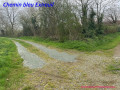
(S/E) As you leave the stadium, turn right towards Le Magnou and take the first path on the left, which is tarmacked at the start. This path takes a sharp right-hand bend and leads to a crossroads at a place called La Coutancière.
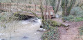
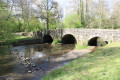
(1) First turn right then left; continue to the next crossroads and turn right towards the bridge. Do not cross the bridge; instead, take a small road on the left just before it, heading towards Maunay. Walk alongside the River Chambon and follow the road until you find yourself amongst the houses. Look carefully to your right: you will see a footbridge spanning the River Chambon.
(2) Cross this footbridge (it is open to the public, though the surrounding area is private). Take the opportunity to enjoy the view and walk quietly along the path (not shown on the IGN map), which can be muddy after rain, until you reach a road that is very busy during the week (keep an eye on where the path joins the road if you are with children).
(3) Turn right, ignore the road branching off to the right, then take the first path on the left towards Le Pinier. At the junction with another path, keep to the left. Walk through the hamlet and head straight on towards La Chaillochère.
(4) Once at the junction at the end of the path, carry on straight ahead, veering slightly to the left after the house. You are not entering a farm; you are indeed on a public path. Follow the main path; the others are merely field entrances that would only waste your time. As you head downhill, you’ll see the excavations of the Donia quarry ahead of you.
Leaving the track, walk past an isolated house – the grounds of which are private – and you’ll reach the roadside (take care outside weekends). Turn right onto the bridge and continue along the left-hand side of the road until you reach a tarpaulin storage area.
(5) Turn left towards Les Vallées and, at the end of the track, turn right onto a path that joins it at a sharp angle and climb up to the road leading to La Fragnelière. Turn left, cross the farmyard and follow the path slightly to your right to reach a small road.
(6) Turn left towards the hamlets of L’Houmeau and La Mardière.
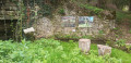
(7) Between the two, a small communal washhouse makes a good halfway stop. At the junction just outside La Mardière (elevation 152), carry on straight ahead and continue to the next crossroads (elevation 149), where you should turn left towards Puymorillon. Continue downhill for about 400 metres.
(8) Leave the road and take the path on your right. Follow it until you reach the tarmac again. Once back on the road, turn left, then left again about fifty metres further on towards the arboretum.
(9). Continue downhill for about 400 metres.
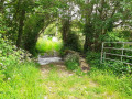
(10) Take the path on your right which leads back up towards Le Magnou (not shown on the IGN map). When you reach the wide path you took at the start, turn right and then right again in the centre of the hamlet to reach the sports ground and the tennis courts. You have arrived (S/E).





 Visorando Member

 Easy
Easy