Les villages de Clavé

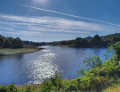
A walk through a small village in the Gâtine region. The route follows small roads and paths, passing through several villages in the area, takes a section ofthe GR®® 364 and ends by skirting the Soleil Levant lake.

Details

16465021
Creation:
Last update:
Last review:
  • Walking
    Activity: Walking
  • ↔
    Distance: 6.66 mi
  • ◔
    Average duration: 3h 15 
  • ▲
    Difficulty: Moderate

  • ⚐
    Back to start: Yes
  • ↗
    Ascent: + 243 ft
  • ↘
    Descent: - 253 ft

  • ▲
    Highest point: 663 ft
  • ▼
    Lowest point: 430 ft
  • ⚐ Country: France
  • ⚐ City: Clavé (79420)
  • ⚑
    Start/End: N 46.49274° / W 0.222642°
  • ❏
    IGN map(s): Ref. 1627SB
  • Hour-by-hour weather

Photos

Description of the walk

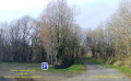
The walk starts at the small car park near the bridge on the Clavé side.

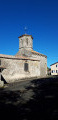
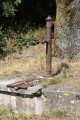
(Start/End) Carefully take the road that climbs up to the village of Clavé. Turn right onto Rue du Bas Bourg and follow it to Place Fiée Janon, near the water pump. Turn right and head towards the church.

(1) Cross the road to join the path, passing behind the factory until you reach the D 329. Turn right onto this road and follow it for 400 m until you reach L’Épinaie.

(2) Turn left to continue on theGR®® 364 until you reach the road. Leave theGR®® on the right and head along the road to Le Cormenier.

(3) As you come out of the bend, turn left onto the track until you reach another road. Turn left onto this small road until you reach the next junction. Leave the road and take the track branching off to the right, skirting a wood on your right until you reach another small road.

(4) Turn left, walk through the hamlet of Culpelé and continue to a crossroads. Turn left and walk 700 m to the crossroads at La Lande.

(5) Take the hairpin bend towards this hamlet, pass through it and continue to a crossroads.

(6) Take the path on the left, which leads down to another small road. Turn left. Pass La Pierrière, ignore the Allée de la Molière and carry on to the next crossroads.

(7) Carry on straight ahead until you reach a junction with a path on the right. Follow this path and join a road on the right. Cross La Rousselière.

(8) Join theGR®®364and follow it to the right until you reach the cross on the right.

(9) Continue along theGR®® to the left. Cross the road with care and head towards the Touche Poupard lake.

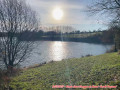
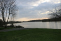
(10) Leave theGR®® to the left, taking the path that runs along the shore of the lake until you reach the old road at a place called Soleil Levant.

(11) Continue along the path, following the road and passing behind the safety barrier, to return to the starting point (S/E).

Waypoints

  1. S/E : mi 0 - alt. 443 ft - Car park by the lake
  2. 1 : mi 0.52 - alt. 558 ft - Église Notre-Dame (Clavé)
  3. 2 : mi 1.05 - alt. 623 ft - L’Épinaie
  4. 3 : mi 1.69 - alt. 627 ft - Le Cormenier
  5. 4 : mi 2.72 - alt. 633 ft - Crossroads near Culpelé
  6. 5 : mi 3.62 - alt. 636 ft - Hairpin bend
  7. 6 : mi 4.05 - alt. 633 ft - Crossroads
  8. 7 : mi 4.7 - alt. 554 ft - Crossroads near La Molière
  9. 8 : mi 5.38 - alt. 528 ft - Crossroads (GR)
  10. 9 : mi 5.5 - alt. 545 ft - Stone cross
  11. 10 : mi 5.83 - alt. 433 ft - Lake at the - Chambon (rivière)
  12. 11 : mi 6.13 - alt. 430 ft - Rising Sun
  13. S/E : mi 6.66 - alt. 443 ft - car park

Notes

This walk requires sturdy footwear in winter, as some paths may be damp.
This walk is not signposted, except on theGR®®364and the return route, which is signposted in yellow from the lake.
Hike completed in October 2021.

Worth a visit

The Touche Poupard reservoir has existed since the dam of the same name was commissioned in 1995 on the Chambon stream.
The purpose of the reservoir is to maintain a water level for the supply of drinking water.
The small village of Clavé has a population of just 360.
The apse and bell tower of Notre Dame Church were listed as Historic Monuments on 9 January 1932.

Always be cautious and plan ahead when you're outdoors. Visorando and the author of this route cannot be held responsible for any accidents occurring on this route.

The GR® and PR® markings are the intellectual property of the Fédération Française de Randonnée Pédestre.

Reviews and comments

3.7 / 5
Based on 3 reviews

Reliability of the description
3.5 / 5
Ease of following the route
4 / 5
Route interest
3.5 / 5
lemarcheur65
lemarcheur65 ★

Hello User 1828875
Thank you for bringing this to our attention

In the description, I read:

(6) Take the path on the left which leads down to another small road. Turn left. Walk past La Pierrière, ignore the Allée de la Molière and continue to the next junction.

(7) Carry on straight ahead until you reach a junction with a path on the right. Follow this path and join a road on the right. Cross La Rousselière.

The author of the walk does not go via the hamlet of La Giltière because at (7) you should carry on straight ahead (implying => leaving the hamlet of La Giltière on your right, obviously!).

Machine-translated

User 1828875

Overall rating : 3 / 5

Date of your route : Aug 22, 2026
Reliability of the description : ★★★☆☆ Average
Ease of following the route : ★★★☆☆ Average
Route interest : ★★★☆☆ Average
Very busy route : No

Hello,
I would like to point out that the area known as La Giltière is private property. The owners have kindly allowed us to pass through, but the route will need to be altered.
Kind regards.

Machine-translated

POULIN Gérard
POULIN Gérard ★

Hello,
Indeed, according to the land registry, the path runs across private land through the farm. However, the public section is blocked by one of the farm buildings. It is urgent that we consult the local land registry at the town hall to check that it is up to date. Thank you to the author for providing us with further details.

Machine-translated

claude7911
claude7911

Overall rating : 4 / 5

Date of your route : Dec 21, 2023
Reliability of the description : ★★★★☆ Good
Ease of following the route : ★★★★☆ Good
Route interest : ★★★★☆ Good
Very busy route : No

A very pleasant route, despite the very muddy paths; however, I would like to point out a problem between points 7 and 8: the walk passes through a farm; we were ‘chased off’ by a short-tempered person who claimed we were on private property. Not wanting any trouble, we turned back, adding an extra kilometre to the route to get back onto the original path. What exactly is the situation here? It would be better to alter the route to avoid any ‘unpleasant encounters’.

Machine-translated

philouis
philouis

There’s tarmac on the very narrow country lanes. The walk is called ‘The Villages of Clavé’, so to get to these villages, you need roads.
Apart from the starting stretch, which is a bit rough, the rest are quiet.
It’s up to you.

Machine-translated

rvforcas
rvforcas

Overall rating : 5 / 5

Date of your route : Dec 10, 2021
Reliability of the description : Not used / Not applicable
Ease of following the route : ★★★★★ Very good
Route interest : Not used / Not applicable
Very busy route : Yes

Hello everyone… I’d like to know if this walk involves a lot of tarmac… For me, a proper walk is one where there’s very little tarmac, or none at all… I might have one or two routes to suggest I often walk around Safrelle… In Chambrille, there’s about thirty metres of tarmac at most.

Machine-translated

JC79
JC79

Thank you for taking my comments on board – that’s perfect!

Machine-translated

philouis
philouis

Thank you. That’s more in line with reality.

Machine-translated

philouis
philouis

Hi. The walk is indeed listed as starting from Clavé. The change was made by people more knowledgeable than me.

Machine-translated

TINO1779
TINO1779

Hello

Oh, but I understand perfectly well.

I’ll pop back from time to time to see if it’s working. Thank you all for this website – it’s a brilliant tool....

Machine-translated

POULIN Gérard
POULIN Gérard ★

Hello,
To philouis: The route has been adjusted to ensure that the town of Clavé is correctly indicated. This error was caused by the proximity of the boundary between the two towns.
To TINO1779: We are currently investigating this download issue; it occurs from time to time, and Louis is looking into it. Thank you for your understanding.

Machine-translated

TINO1779
TINO1779

Hello
It seems the link to download the GPX file isn’t working; I’ve been trying for several days now… to no avail.
Thank you

Machine-translated

philouis
philouis

Hi.
Thanks for the info.
I hadn’t spotted the spelling mistake; I’ll correct it. I think I saw it written on signs with a ‘t’.
As for the location, I didn’t place it in St Georges de Noisné myself; I’m not sure what to do about it. I’ll ask the moderator.

Machine-translated

JC79
JC79

Clavé is a commune, and the entire proposed route is within that commune (and not in St Georges de Noismé).
The ‘Poupard’ key (with a ‘D’ at the end, not a ‘T’).
Thank you in advance for taking these two points into account.

Machine-translated

Other walks in the area

For more walks, use our search engine .

The GPS track and description are the property of this route's author. Please do not copy them without permission.