A tour of the hamlets in Augé

This walk, starting from the village of Augé, will take you through some of the hamlets that make up the parish, along shaded paths and small country lanes. You’ll have the chance to pass three of Augé’s many wash houses and catch a glimpse of the Houmelière farmhouse.

Details

40975281
Creation:
Last update:
Last review:
  • Walking
    Activity: Walking
  • ↔
    Distance: 5.82 mi
  • ◔
    Average duration: 3h 05 
  • ▲
    Difficulty: Easy

  • ⚐
    Back to start: Yes
  • ↗
    Ascent: + 433 ft
  • ↘
    Descent: - 427 ft

  • ▲
    Highest point: 397 ft
  • ▼
    Lowest point: 190 ft

Photos

Description of the walk

Park in the car park opposite the town hall.

(S/E) Head towards the crossroads, turn left onto Rue de la Poste, then turn left onto Rue des Passeroses until you reach Rue du Lavoir Saint-Grégoire. Turn right, then left, and walk up Rue Mélusine without leaving it until you reach Chemin du Carillon, which you should follow to its end.

(1) Turn left onto Chemin de la Foye until you reach the Stop sign on the D6. Turn right onto the road, then take the first path on the right. Continue along this path, which can be damp in places, until you reach the road at a place called Esset.

(2) Cross the road and continue along the small road opposite, ignoring the turn-off to the left. Pass the water reservoir, ignore the track on the right leading to the farm, and head for the house on the left.

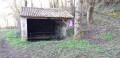
(3) As soon as you’ve passed this house, turn onto the path on the left, carry on, ignoring the path on the left, and walk past the Beauvais washhouse. Continue along this path, which offers a view of La Houmelière, until you reach the D6. Cross it carefully, then head right, walking along the wide grassy verge until you reach the path on the left.

(4) Walk along this path until you reach Chemin du Pavillon, which you take to the right. At the next junction, turn left onto Rue du Haut Village. Turn right onto the first path, then left at the next junction, and you’ll come out onto Chemin de Grand Champ, leading back to Chemin du Pavillon.

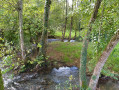
(5) Turn right and, at the next junction, turn left towards the Ruisseau du Marcusson.

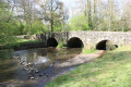
(6) Cross the stream and head up towards Le Breuil de Bessé to reach the wash house on the right.

(7) At the next junction, turn left, continue along the road that passes through the hamlet, ignoring all side roads, until you reach the D142. Cross carefully, carry on straight ahead along the small road, pass a private cemetery and continue to the next junction.

(8) Turn right and immediately take the path on the left. At the next junction, turn left and continue to the D174. Follow it carefully to the right and immediately turn left onto the Route des Soucis Coutant. At the next crossroads, make a quick left-then-right turn to head towards La Rochette.

(9) Head down the small stony path on the left to the Rochette washhouse. Set off opposite the washhouse to join the path, which you’ll take to the right, following the small signs pointing towards the village. Pass through Les Échassières and head towards Peumont.

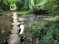
(10) Take the stony path on the right that leads downhill. Walk past the Fontaine des Trois Cressons. Continue along this path, which can be very wet, and carry on along the narrow track through the woods until you finally reach the old railway line. Walk past the station and come out onto the D174.

(11) Head back down towards the village to return to the town hall car park (S/E).

Waypoints

  1. S/E : mi 0 - alt. 226 ft - Town hall car park
  2. 1 : mi 0.41 - alt. 308 ft - Junction of Rue du Carillon and Chemin de la Foye
  3. 2 : mi 1.22 - alt. 397 ft - Esset
  4. 3 : mi 1.54 - alt. 358 ft - Crossroads
  5. 4 : mi 2.14 - alt. 292 ft - D6 junction/path
  6. 5 : mi 2.7 - alt. 367 ft - Junction of Chemin du Grand Champ and Chemin du Pavillon
  7. 6 : mi 3.13 - alt. 240 ft - Marcusson (cours d'eau) - Affluent de la Sèvre Niortaise
  8. 7 : mi 3.34 - alt. 331 ft - Crossroads
  9. 8 : mi 4.06 - alt. 354 ft - Crossroads (road/path)
  10. 9 : mi 4.66 - alt. 276 ft - La Rochette, junction of road and footpath
  11. 10 : mi 4.95 - alt. 266 ft - Peumont, junction of road and track. Towards the - Ligueure (cours d'eau) - Affluent du Chambon
  12. 11 : mi 5.6 - alt. 276 ft - D174
  13. S/E : mi 5.82 - alt. 226 ft - Town hall car park

Notes

This walk, which is relatively easy at the start but more challenging towards the end, requires sturdy footwear in all seasons due to wet patches, particularly from point (9) onwards and occasionally between (1) and (2).

Worth a visit

(S/E) In Augé, there are toilets and a picnic table. There is also a restaurant: l’Ardoise.
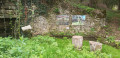
Along the route, starting from the Rochette wash house, there is a photo exhibition (taken by the schoolchildren).
As well as the three wash houses on the route (Beauvais, Breuil de Bessé and La Rochette), you can visit the one at Saint-Grégoire at the end of the street of the same name, and the one at L’Égonière below the road at the end of the cul-de-sac of the same name, which is situated just before you return to the car park.
You can also explore the upper part of the village of Augé via its many narrow lanes.

Reviews and comments

4.8 / 5
Based on 2 reviews

Reliability of the description
5 / 5
Ease of following the route
5 / 5
Route interest
4.5 / 5
jlfaure
jlfaure

Overall rating : 4.7 / 5

Date of your route : Jul 05, 2024
Reliability of the description : ★★★★★ Very good
Ease of following the route : ★★★★★ Very good
Route interest : ★★★★☆ Good
Very busy route : No

This lovely walk begins with a climb up Rue des Passeroses, which is well worth a detour.
(magnificent flower boxes at this time of year and humorous posters) On the other hand, the path leading from the D6 to the hamlet of Esset (2) is, shall we say, rather damp in the lower section. At least three springs flow through the uncut grass, which really puts waterproof shoes to the test. Even at the start of July, we found this stretch a bit of a slog. But anyway, thankfully the rest of the walk was more pleasant, offering varied scenery, a lovely view of the rear of the Logis de l’Houmelière and a few wash houses from a bygone era.
A small trickle of water on the stony path at the Fontaine des Trois Cressons – just the thing to cool you down.
I’d recommend it, but preferably in dry weather...

Machine-translated

philouis
philouis

It is indeed a way of making it last longer

Machine-translated

GILMIC79
GILMIC79

Overall rating : 5 / 5

Date of your route : Apr 24, 2024
Reliability of the description : ★★★★★ Very good
Ease of following the route : ★★★★★ Very good
Route interest : ★★★★★ Very good
Very busy route : No

A lovely walk with varied scenery. The only downside is that it’s a bit short. As I’m from the area, I extended it by about 2.5 km from point 6 by taking the path that heads south-west to Villeneuve, then heading back up from the small road where this path joins, and skirting Villeneuve to the west to reach point 7 directly via a path heading north-north-east followed by a small road.

Machine-translated

Other walks in the area

For more walks, use our search engine .

The GPS track and description are the property of this route's author. Please do not copy them without permission.