


Refine your search for walks in Roullours
Roullours walks


 Short Roullotin walk via the mill
 Visorando Member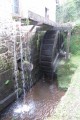
 2.51 mi
 +85 ft
 -102 ft
 1h 15
1h 15
 Easy
Easy
 Departure from Roullours (Calvados)
A short walk of about 4km through the village of Roullours and its mill.
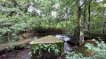
Tour of Lake Dathée
 3.60 mi
+49 ft
-46 ft
1h 40
Easy
Departure from Saint-Manvieu-Bocage (Calvados)
3.60 mi
+49 ft
-46 ft
1h 40
Easy
Departure from Saint-Manvieu-Bocage (Calvados)
A walk around Lake Dathée, ideal for families.
Around Clairefougère
3.16 mi
+194 ft
-187 ft
1h 35
Easy
Departure from Clairefougère (Orne)
The route passes along both sides of the Diane valley and offers a view of the canton of Tinchebray from Sainte-Radegonde Chapel.
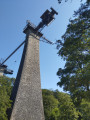
The Beny-Bocage circular route via the Souleuvre Viaduct
 5.24 mi
+479 ft
-456 ft
2h 50
Easy
Departure from Le Bény-Bocage (Calvados)
5.24 mi
+479 ft
-456 ft
2h 50
Easy
Departure from Le Bény-Bocage (Calvados)
A pleasant, shaded path with little foot traffic. Ideal for families, with a lovely break at the Souleuvre Viaduct site. Large picnic area with toilets, children’s play equipment, a sensory garden and bar-restaurants.
The Tortillon Valley
5.43 mi
+322 ft
-328 ft
2h 45
Easy
Departure from Vassy (Calvados)
This short, family-friendly route takes you along the Tortillon valley from the town of Vassy in Calvados.
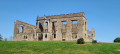
Around Mont Secret
 4.37 mi
+640 ft
-650 ft
2h 35
Easy
Departure from Montsecret (Orne)
4.37 mi
+640 ft
-650 ft
2h 35
Easy
Departure from Montsecret (Orne)
Circling Mont Secret with an off-centre start at the car park near L’Aufrairie, this more challenging route climbs towards Mont de Cerisy along the section belonging to the commune of Montsecret. Between two hills, will Mont Secret perhaps reveal itself?
In the footsteps of the potters of yore, starting from the Musée Le Placitre
4.02 mi
+1,404 ft
-1,263 ft
3h 05
 Moderate
Departure from Manche
Moderate
Departure from Manche
A 6 km route starting from the Ceramics Museum – Ger Creative Centre. You can park in the museum car park when the museum is closed. Otherwise, please park in the field opposite to leave the car park for museum visitors (coaches). Woodland, sunken lanes and old pottery hamlets.
Between Vaux and Val de Druance around Lénault
 6.57 mi
+663 ft
-663 ft
3h 35
Moderate
Departure from Lénault (Calvados)
6.57 mi
+663 ft
-663 ft
3h 35
Moderate
Departure from Lénault (Calvados)
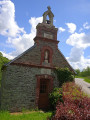
A walk passing through Lénault, St-Jean-le-Blanc, Marsangle and the Notre-Dame-de-Pitié chapel.
Via La Belle Eau from Mortain-Bocage
 6.97 mi
+810 ft
-807 ft
3h 55
Moderate
Departure from Mortain (Manche)
6.97 mi
+810 ft
-807 ft
3h 55
Moderate
Departure from Mortain (Manche)
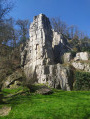
Although "Belle Eau" is the name of a hamlet located at the northernmost point of this route, hikers will be amazed from the outset by the water gushing through the rocks in magnificent waterfalls. The route continues along wide paths, often bathed by runoff water from the various branches of the Cance, and ends on a high note with the panorama offered at altitude 314, famous not only for its small chapel but also for the battles that took place there in August 1944.
Mont Pinçon in Le Plessis-Grimoult
 4.39 mi
+302 ft
-308 ft
2h 15
Easy
Departure from Le Plessis-Grimoult (Calvados)
4.39 mi
+302 ft
-308 ft
2h 15
Easy
Departure from Le Plessis-Grimoult (Calvados)
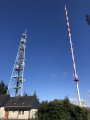
Hike around Mont-Pinçon, the highest point in the Calvados department, best known for its radio and television transmitter. Along the way, you will see traces of the Roman presence and discover that, in August 1944, it was also the site of a fierce tank battle during the liberation of France.
The Moulin du Fay
 6.83 mi
+820 ft
-830 ft
3h 50
Moderate
Departure from Cauville (Calvados)
6.83 mi
+820 ft
-830 ft
3h 50
Moderate
Departure from Cauville (Calvados)
Swiss Normandy: valleys, springs, streams, fir trees, small villages – everything you need to have a great day out and come home tired.
On the heights of Roucamps
 5.60 mi
+367 ft
-358 ft
2h 55
Easy
Departure from Roucamps (Calvados)
5.60 mi
+367 ft
-358 ft
2h 55
Easy
Departure from Roucamps (Calvados)
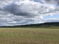
A pleasant hike that allows you to rediscover cornflowers and poppies. A pleasant walk through the forest.
The Fosse Arthour tour
 5.26 mi
+433 ft
-410 ft
2h 50
Easy
Departure from Saint-Georges-de-Rouelley (Manche)
5.26 mi
+433 ft
-410 ft
2h 50
Easy
Departure from Saint-Georges-de-Rouelley (Manche)
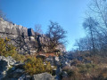
This easy hike allows you to discover the Fosse Arthour. It is a geological fault called a cluse, which gives the landscape an exceptional appeal.
This cluse forms a narrow, 70-metre-deep gorge carved into a rocky ridge and strewn with large boulders on its sides. The area is ideal for walking and climbing.
Brectouville route
 5.47 mi
+328 ft
-325 ft
2h 50
Easy
Departure from Condé-sur-Vire (Manche)
5.47 mi
+328 ft
-325 ft
2h 50
Easy
Departure from Condé-sur-Vire (Manche)
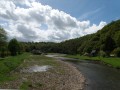
The hike is accessible to a wide range of people as there are no difficult sections.
La Fosse Arthour in all its splendour
9.61 mi
+587 ft
-600 ft
4h 55
Moderate
Departure from Rouellé (Orne)
Passing through a marshland to discover this natural wonder – a gorge over 70 metres high, carved out by a river which, at this point, is more like a torrent – come and explore the Sonce and walk a short section ofthe GR® trail that links France’s two most spectacular sites: Notre-Dame Cathedral in Paris and Mont-Saint-Michel Abbey.
Panoramic views of the pre-bocage landscape at Bonnemaison
 5.54 mi
+413 ft
-407 ft
2h 55
Easy
Departure from Bonnemaison (Calvados)
5.54 mi
+413 ft
-407 ft
2h 55
Easy
Departure from Bonnemaison (Calvados)
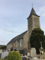
Starting from Bonnemaison, walk through the meadows, make your way through the hedgerow countryside, descend into the Vingt-Bec valley, lined with woods, and discover the Valcongrain State Forest.
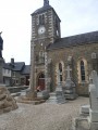
 Condé-sur-Vire - Pont-Farcy via the greenway
 23.78 mi
+417 ft
-394 ft
4 hrs
Easy
Departure from Condé-sur-Vire (Manche)
23.78 mi
+417 ft
-394 ft
4 hrs
Easy
Departure from Condé-sur-Vire (Manche)
A beautiful route in the heart of nature, along the Vire river, very quiet and very pleasant.
Beneath the Monts d'Ancre
 8.22 mi
+883 ft
-869 ft
4h 35
Moderate
Departure from Hamars (Calvados)
8.22 mi
+883 ft
-869 ft
4h 35
Moderate
Departure from Hamars (Calvados)
A very pleasant walk through the undergrowth, with the sound of small streams flowing through this magnificent forest. Lots of mushrooms in season.
Forges de Varennes and La Nocherie via the Voie Verte and footpaths
 5.05 mi
+184 ft
-197 ft
2h 30
Easy
Departure from Saint-Bômer-les-Forges (Orne)
5.05 mi
+184 ft
-197 ft
2h 30
Easy
Departure from Saint-Bômer-les-Forges (Orne)
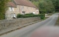
A picturesque circular route with no navigation difficulties, ideal for families. The route mainly follows the Flers-Domfront Greenway, passes by the Château de Varenne and its old forges, then climbs up a path towards the Manoir de la Nocherie. It rejoins the Greenway after crossing the Varenne at the Moulin de la Nocherie ford to return to the start.