Country:
 City:
City:



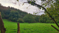
Park on the Place des Halles du Bény-Voyage, near the church.
(S/E) Set off past the church and its cemetery and continue along Rue Gaston de Renty, which climbs straight away.
(1) At the top of the hill, take the first path on the left and you’ll reach the D109.
(2) Cross it carefully and take the path leading down opposite. It curves to the right and leads to a tarmac road.
(3) Follow this for 30 metres to the left, then take the path on the right. Continue straight on, ignoring the first path on the left. You’ll arrive at the hamlet of Le Drouard, just before the D109.
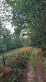
(4) Turn left, then take the path on the right. Continue straight on along a sunken track which crosses a stream and then a tarmac road. Continue straight ahead for 500 m until you reach a T-junction.
(5) Take the track on the left and carry on straight ahead, leaving a road on your left.
(6) At the junction of the paths, turn right and continue along this path which runs alongside the Souleuvre.
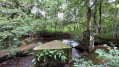
(7) Take the bridge on the left, which crosses the river, and turn right onto the path through the woodland, which then runs alongside the river. Continue straight on along this path until you reach the D56 at the entrance to Bény-Bocage.
(8) Follow it carefully to the left until you reach Rue du Haras on the left.
(9) Carry on straight ahead until you reach the Place des Halles du Bény-Voyage (S/E).
 Visorando Member

 Local authority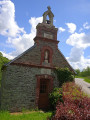
 Moderate