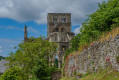
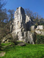
Walk from the Ermitage to the Lac du Gast observation points

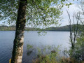
This walk takes you along a forest track and past the shores of Lac du Gast.

Details

n°21304905
Creation:
Last update:
Last review:
  • Walking
    Activity: Walking
  • ↔
    Distance: 2.37 mi
  • ◔
    Average duration: 1h 10 
  • ▲
    Difficulty: Easy

  • ⚐
    Back to start: Yes
  • ↗
    Ascent: + 102 ft
  • ↘
    Descent: - 105 ft

  • ▲
    Highest point: 974 ft
  • ▼
    Lowest point: 830 ft

Photos

Description of the walk

The starting point is in the Ermitage car park. There is plenty of space to park. You also have the choice of walking the route in the direction indicated or in the opposite direction.

(S/E) Join the road and leave the Ermitage buildings on your right.

(1) You’ll need to leave the road just after the Ermitage’s service entrance and take a small dirt track on the right. After crossing a small stream, you’ll come to a fork in the path: take the path on the right. You’ll need to cross the road to reach the path directly opposite. At the next junction, take the path on the right again. You’ll need to follow the road for about 200 metres to reach the next path on the right.

(2) The path is at the far end of the car park, which is rather poorly signposted, but you can spot it by the large tree trunks lying on the ground. It curves first to the right, then to the left, heading south. You should keep going in this direction.

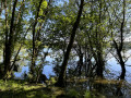
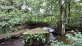
(3) You can head down to the first observation point to see the birds on the lake. To get back onto the path, simply walk back the way you came or take a small path hidden by the vegetation. Continue to the left.

(4) At this junction, head down to the left to see the lake a little further down. Turn back and take the second path on the left, following it all the way to the car park (S/E).

Waypoints

  1. S/E : mi 0 - alt. 932 ft - L’Ermitage car park
  2. 1 : mi 0.1 - alt. 971 ft - Path on the right
  3. 2 : mi 0.72 - alt. 860 ft - Car park and path
  4. 3 : mi 1.37 - alt. 850 ft - Turn-off for the observatory at the - Lac du Gast
  5. 4 : mi 1.61 - alt. 883 ft - Descent to the second observation point
  6. S/E : mi 2.37 - alt. 932 ft - L’Ermitage car park

Notes

It is important to wear sturdy footwear, especially in wet weather when the path can get a bit muddy. Furthermore, there is a good birdwatching facility at the first observation point.

Worth a visit

You can drive back via the Route du Gast rather than the Route de Saint-Sever to reach La Forge, where an observation point has been set up to offer a different view from that of the walk. Furthermore, during the walk you may come across horses, dogs, as well as roe deer and a very wide variety of birds (see photo).

Reviews and comments

3.4 / 5
Based on 3 reviews

Reliability of the description
3 / 5
Ease of following the route
3.7 / 5
Route interest
3.7 / 5
Azimut71
Azimut71

Overall rating : 4 / 5

Date of your route : Jun 07, 2025
Reliability of the description : ★★★★☆ Good
Ease of following the route : ★★★★☆ Good
Route interest : ★★★★☆ Good
Very busy route : No

Very pleasant walk in the forest. The birds were on holiday.

Machine-translated

gerard14500
gerard14500

Overall rating : 1.7 / 5

Date of your route : Jul 13, 2024
Reliability of the description : ★☆☆☆☆ Very disappointing
Ease of following the route : ★★☆☆☆ Disappointing
Route interest : ★★☆☆☆ Disappointing
Very busy route : No

To be honest, a bit of a clear-up would be welcome! The weeds and ferns are hiding the signs, and brambles are taking over the path. It’s impossible to do this with children. The first viewing point is unusable because of the thorny broom. In short, give it a miss.

Machine-translated

Emmanuel Malan
Emmanuel Malan

Overall rating : 4.7 / 5

Date of your route : Jun 11, 2023
Reliability of the description : ★★★★☆ Good
Ease of following the route : ★★★★★ Very good
Route interest : ★★★★★ Very good
Very busy route : No

A lovely walk through the heart of the forest. A short and easy route.

Machine-translated

Other walks in the area

For more walks, use our search engine .

The GPS track and description are the property of this route's author. Please do not copy them without permission.