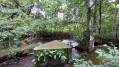
Route mémorielle autour de la Chapelle Saint-Michel et des Rochers de la Montjoie

A very short route through the sites of the Mortain counter-attack, which took place from 7 to 13 August 1944 during the Battle of Normandy. Several information boards line the route. There are some lovely, sweeping views to enjoy.

Details

n°31047311
Creation:
Last update:
Last review:
  • Walking
    Activity: Walking
  • ↔
    Distance: 1.03 mi
  • ◔
    Average duration: 0h 35 
  • ▲
    Difficulty: Easy

  • ⚐
    Back to start: Yes
  • ↗
    Ascent: + 108 ft
  • ↘
    Descent: - 98 ft

  • ▲
    Highest point: 1,060 ft
  • ▼
    Lowest point: 955 ft
  • ⚐ Country: France
  • ⚐ City: Mortain (50140)
  • ⚑
    Start/End: N 48.646729° / W 0.9327°
  • ❏
    IGN map(s): Ref. 1415O
  • Hour-by-hour weather

Photos

Description of the walk

Starts from the Croix Crespin car park, along the D487E1, on the eastern slopes of Mortain.

No signposting

(S/E) At the far end of the car park, on the right, look out for a flight of steps. Climb these, ignore a path on the left and pass an information ‘board’ on the right. Turn immediately left into a wide path. After about fifty metres, follow a fitness trail to the right and head downhill.

Red and white + yellow markings

At a three-way junction, turn left onto level ground. Ignore a path on the right (not shown on the map) and head uphill. You’ll come to a crossroads (chapel on the right, memorial site opposite).

No markings

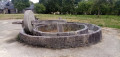
(1) Turn right, go round the chapel on the left and you’ll immediately reach a viewpoint (orientation table). Retrace your steps.

Red and white + yellow markings

(1) Turn sharply right and head downhill for a few dozen metres.

No markings

At a junction, carry on straight ahead (let theGR® head off to the right) and pass sign no. 20 on the fitness trail. At the three-way junction that follows (not shown on the map; sign no. 22), veer to the right. Carry on straight ahead until you reach the staircase you took at the start of the route. Go down the staircase and head back to the car park.

(S/E) Cross the car park. Cross the D487E1, then turn right onto a small road towards the Rochers de la Montjoie.

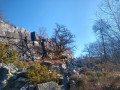
(2) After about 150 m (information sign on the left, house on the right), turn left onto a path (not shown on the map); there are actually two paths, so choose the one furthest to the left and best marked. Climb a flight of wooden steps to reach a sort of ridge. Follow the ridge to the right (viewpoints, information boards). When you reach a sign relating to German and American positions, turn right and ignore a track on the left. Continue along the path marked by a rope and rejoin the road.

(2) Follow the road to the right. At the end, cross the D487E1 again and return to the car park (S/E).

Waypoints

  1. S/E : mi 0 - alt. 1,014 ft - Croix Crespin car park
  2. 1 : mi 0.29 - alt. 1,017 ft - Chapelle Saint-Michel (Mortain)
  3. 2 : mi 0.8 - alt. 1,040 ft - Junction with the circular loop of the - Rochers de la Montjoie
  4. S/E : mi 1.03 - alt. 1,014 ft - Croix Crespin car park

Notes

A good pair of trainers is all you need for this very short walk.

No water points were spotted along the route. There are bars, restaurants and shops in Mortain town centre.

A detailed map is useful (at the very least, the one accompanying this description).

Walk completed by the author on 23 February 2023.

Worth a visit

- A brief history of the Mortain counter-attack (August 1944).
- Numerous information boards along the route.
- Saint-Michel Chapel (19th–20th centuries) (1).
- Viewpoint and orientation board just behind the chapel. In good weather, there is a view of Mont Saint-Michel, situated 100 km away.
- Memorial esplanade (1).
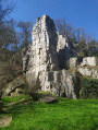
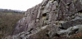
- Montjoie Rocks (2) with beautiful views.

Always be cautious and plan ahead when you're outdoors. Visorando and the author of this route cannot be held responsible for any accidents occurring on this route.

The GR® and PR® markings are the intellectual property of the Fédération Française de Randonnée Pédestre.

Reviews and comments

5 / 5
Based on 1 review

Reliability of the description
5 / 5
Ease of following the route
5 / 5
Route interest
5 / 5
Azimut71
Azimut71

Overall rating : 5 / 5

Date of your route : Sep 17, 2024
Reliability of the description : ★★★★★ Very good
Ease of following the route : ★★★★★ Very good
Route interest : ★★★★★ Very good
Very busy route : Yes

The view from the chapel is exceptional!
Sign no. 22 is no longer there. But you just need to keep walking parallel to the main path without joining it.

Machine-translated

Other walks in the area

For more walks, use our search engine .

The GPS track and description are the property of this route's author. Please do not copy them without permission.