Clarafilisecrémontins Route

‘The Clarafilisecrémontins walk’, starting from the village of Clairefougère, takes you through both communes, following routes such as the Chemin du Moulin, Grippe-Chat and the old railway line, and climbs almost as far as the wind turbines.

Details

67106765
Creation:
Last update:
Last review:
  • Walking
    Activity: Walking
  • ↔
    Distance: 5.40 mi
  • ◔
    Average duration: 2h 50 
  • ▲
    Difficulty: Easy

  • ⚐
    Back to start: Yes
  • ↗
    Ascent: + 449 ft
  • ↘
    Descent: - 440 ft

  • ▲
    Highest point: 682 ft
  • ▼
    Lowest point: 436 ft

Photos

Description of the walk

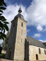
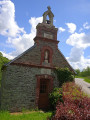
Park in the car park in the village of Clairefougère, which means ‘where the ferns have been cleared’. The church is dedicated to Saint Martin.

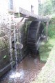
(S/E) Start the route by following the sign for ‘La porte Blaise’ opposite the church forecourt. Follow the path straight ahead to the stone bridge, then turn left to pass under the railway bridge. Continue to the hamlet of Trompe-Souris: its name refers to the small, inefficient mill that could not even feed the rodents, a building that already existed in 1832.

(1) Cross the junction and continue straight ahead to the Chapelle des Épinets, built in memory of the soldiers from Montsecret who died during the 1914–1918 war. Turn right onto the D265 and continue for about 150 metres.

(2) Take the path on the left leading to the Tinchebray–Montsecret road (D911), which was once flanked by the old railway line from Montsecret to Tinchebray, built in 1883 and permanently closed in 1964.

(3) Head left towards Montsecret, whose name is thought to mean ‘hidden hill’ – isolated and therefore secret. Another theory suggests it derives from ‘ségré’ or ‘segreur’, the ancient name for a druid, hence ‘the druid’s hill’. Walk past the town hall, a building constructed in 1859, which became Montsecret’s town hall and school in 1931. Turn right and head for Parc Constant Aubry: a good spot for a picnic, with toilets available.

(4) Turn back to the crossroads and head up Rue des Chardonnets opposite. Ignore a small road branching off to the right.

(5) Take the dirt track on the right known as the ‘Grippe-Chat’: is it because it climbs so steeply that, like cats, you have to cling on to get up it? Follow this winding track for about 1 km.

(6) Turn right onto the Chemin du Moulin, created in 2021. Take the first bend to the right, then the second to the left, and you’ll reach the level crossing.

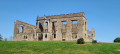
(7) Cross the railway line and turn right towards the Lambone manor house, seat of the seigneury of Clairefougère. It was rebuilt in the 15th century by the noble de La Bigne family.

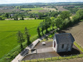
(8) At the wayside cross, take the path up to the left. This bends to the left and leads to the Chapel of Sainte-Radegonde. Every year, on the second Sunday in August, a pilgrimage is held in its honour.

(9) Continue downhill to the church and the car park (S/E).

Waypoints

  1. S/E : mi 0 - alt. 522 ft - Clairefougère church car park.
  2. 1 : mi 0.72 - alt. 482 ft - Trompe-Souris crossroads
  3. 2 : mi 1.48 - alt. 518 ft - Chemin de la Cornière
  4. 3 : mi 1.84 - alt. 456 ft - D911
  5. 4 : mi 2.56 - alt. 436 ft - Constant Aubry Park. Near the - Noireau (rivière) - Affluent de l'Orne
  6. 5 : mi 2.75 - alt. 489 ft - Chemin du Grippe-Chat
  7. 6 : mi 3.43 - alt. 495 ft - Chemin du Moulin
  8. 7 : mi 3.95 - alt. 486 ft - Level crossing, after the - Diane (rivière) - Affluent du Noireau
  9. 8 : mi 4.32 - alt. 515 ft - Lambone Path
  10. 9 : mi 5.1 - alt. 640 ft - Sainte-Radegonde Chapel
  11. S/E : mi 5.4 - alt. 522 ft - Church car park

Reviews and comments

4.5 / 5
Based on 2 reviews

Reliability of the description
4.5 / 5
Ease of following the route
4.5 / 5
Route interest
4.5 / 5
User 21681520

Overall rating : 4 / 5

Date of your route : Jun 29, 2026
Reliability of the description : ★★★★☆ Good
Ease of following the route : ★★★★☆ Good
Route interest : ★★★★☆ Good
Very busy route : No

Lots of places with quite a lot of brambles and ferns.

Machine-translated

JJ et Marie
JJ et Marie
• Edited:

Overall rating : 5 / 5

Date of your route : Jan 04, 2026
Reliability of the description : ★★★★★ Very good
Ease of following the route : ★★★★★ Very good
Route interest : ★★★★★ Very good
Very busy route : No

Hello,
A very pleasant and easy route with a few small hills. However, I would recommend taking a slight detour to avoid the D911 and its fairly heavy and fast traffic between points 3 and 4. At point 3, turn right for about 100 metres, then take the small road on the left towards "La Monnerie". Cross the village of Fresnes. After the hamlet of La Galetière, take the path on the left. (1.3 km from point 3). After 400 metres, turn left onto the small road that leads to Montsecret. You will rejoin the route at point 4. The additional distance is approximately 1.5 km.
Enjoy your walk.

Machine-translated

Other walks in the area

For more walks, use our search engine .

The GPS track and description are the property of this route's author. Please do not copy them without permission.