Along the River Noireau from Montsecret

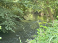
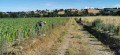
The walk begins in the village of Montsecret. After passing the highest point, the streams flowing into the Noireau will lead you towards Les Vaux in the Noireau valley, bringing you closer to Mont Secret… via Vieux-Saint-Pierre.

Details

n°53530654
Creation:
Last update:
Last review:
  • Walking
    Activity: Walking
  • ↔
    Distance: 5.06 mi
  • ◔
    Average duration: 2h 30 
  • ▲
    Difficulty: Moderate

  • ⚐
    Back to start: Yes
  • ↗
    Ascent: + 164 ft
  • ↘
    Descent: - 164 ft

  • ▲
    Highest point: 535 ft
  • ▼
    Lowest point: 394 ft
  • ⚐ Country: France
  • ⚐ City: Montsecret (61800)
  • ⚑
    Start/End: N 48.796574° / W 0.676159°
  • ❏
    IGN map(s): Ref. 1514SB, 1515SB
  • Hour-by-hour weather

Photos

Description of the walk

Start from the Constant Aubry leisure park car park, situated near the Town Hall and the church in Montsecret.

(S/E) Head towards the Grande Rue, going round the Town Hall and School. Pass Place Lieutenant Maurice Guilbert (in memory of the children of Montsecret who died for France in 1914–1918) then continue to the junction with the D54. Turn left towards Frênes, passing the gatekeeper’s cottage (on the former branch line of the Montsecret–Tinchebray Railway, 1883–1964).

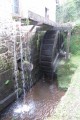
(1) Cross the bridge over the River Noireau, where you’ll find the old Mottette flour mill, which was in use until 1930, and at the three-way junction that follows, continue left towards the village of La Grûlière and reach thefirst path on the left (known as Chemin aux Loups, a former Roman road running from Jublains (53) towards Vieux-la-Romaine (14)).

(2) Take this path and follow it until you reach a road. Turn right and you’ll come to a junction with a car park on your right.

(3) Continue to the left, towards La Moisandière, cross the bridge under the railway line and turn right immediately afterwards. Cross the bridge over the little stream known as the Nussons and join the path on the left after house number 11, with the stone-built Noireau well on your left.

(4) Take this path and head towards the village of Vieux Saint-Pierre.

(5) Walk through the hamlet, passing the flour mill belonging to the monks of Belle-Étoile Abbey in Cerisy (in use until 1910). Cross the Romanesque-style bridge and continue straight ahead on the red and white-marked path. Take a sharp right-hand bend and follow the Noireau on your right (there isan old mill on the opposite bank). Ignore a bridge on the left and pass in front of the Rochette mill (dating from 1804, in operation until 1975).

(6) At the end, cross the D911, follow it to the left and take the bridge over the River Diane. Turn immediately right towards Pont Dienne. At the next junction, turn left.

(7) When the path bends to the right, continue to the left (south-west). Join the railway line, turn left and follow it on your right-hand side.

(8) Join the D911, turn right and cross the level crossing. Carry on for about 300 m and take the arboretum path which runs alongside the road and joins it further on. Continue to No. 48. Take the Chemin du Noireau on the left and head towards the 90° right-hand bend and the Tilleul de Hollande (a remarkable tree).

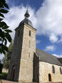
(9). Continue along the tarmac road towards the church and, at the next junction, note the boat wash on the left. Cross the road, walk past the church and head for the leisure park (S/E).

Waypoints

  1. S/E : mi 0 - alt. 436 ft - Leisure park car park - Église Saint-Michel (Montsecret)
  2. 1 : mi 0.26 - alt. 430 ft - Cross the bridge at the - Noireau (rivière) - Affluent de l'Orne
  3. 2 : mi 0.74 - alt. 525 ft - Path on the left
  4. 3 : mi 1.46 - alt. 472 ft - Junction with a car park on the right-hand side
  5. 4 : mi 1.85 - alt. 413 ft - Start of the trail
  6. 5 : mi 2.15 - alt. 397 ft - Vieux Saint-Pierre - Noireau (rivière) - Affluent de l'Orne
  7. 6 : mi 3.28 - alt. 423 ft - D911 road – Bridge over the - Diane (rivière) - Affluent du Noireau
  8. 7 : mi 3.66 - alt. 479 ft - Junction
  9. 8 : mi 4.25 - alt. 456 ft - Route
  10. 9 : mi 4.87 - alt. 427 ft - Notable tree
  11. S/E : mi 5.06 - alt. 436 ft - Leisure park car park - Église Saint-Michel (Montsecret)

Worth a visit

Montsecret has two possible etymologies: the hidden, isolated, secret mountain; or Montsegré, as the former inhabitants called it until around 1975, which is thought to derive from ‘segreur’ (= druid), meaning the druid’s mountain.

Reviews and comments

4 / 5
Based on 2 reviews

Reliability of the description
4 / 5
Ease of following the route
5 / 5
Route interest
3 / 5
waiwaite
waiwaite

Overall rating : 4.7 / 5

Date of your route : Aug 25, 2025
Reliability of the description : ★★★★★ Very good
Ease of following the route : ★★★★★ Very good
Route interest : ★★★★☆ Good
Very busy route : No

A very pleasant and enjoyable hike. No difficulty, varied landscapes. The only slight downside is that there is a bit too much tarmac. We couldn't find the path to the arboretum after point 8. The 911 is busy but you can walk on the hard shoulder.
Regarding the previous review, I would like to point out that Visorando's philosophy is not to rely on signposting (which is sufficient). So you read the map... and use the description.

Machine-translated

Blanchet Jacqueline
Blanchet Jacqueline

Overall rating : 2.5 / 5

Date of your route : Sep 12, 2024
Reliability of the description : ★★★☆☆ Average
Ease of following the route : Not used / Not applicable
Route interest : ★★☆☆☆ Disappointing
Very busy route : No

The route isn’t signposted, so we used the map to walk part of it after realising we were in the wrong place!!!....

Machine-translated

Other walks in the area

For more walks, use our search engine .

The GPS track and description are the property of this route's author. Please do not copy them without permission.