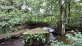
La Jacre Route

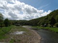
A easy route along very pleasant sunken paths.

Details

n°55534042
Creation:
Last update:
Last review:
  • Walking
    Activity: Walking
  • ↔
    Distance: 3.60 mi
  • ◔
    Average duration: 1h 55 
  • ▲
    Difficulty: Easy

  • ⚐
    Back to start: Yes
  • ↗
    Ascent: + 282 ft
  • ↘
    Descent: - 272 ft

  • ▲
    Highest point: 387 ft
  • ▼
    Lowest point: 197 ft

Description of the walk

Car park: you can park in the town hall car park, which is the starting point of the walk.

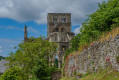
(S/E) At the town hall, head towards the school and the sports centre. You can visit Domjean Church. Take the path on the left and continue straight on. Walk past the Résidence des Pommiers and follow the dirt track to a crossroads. Carry on straight ahead until you reach a second crossroads.

(1) Follow the path on the left, then continue downhill to the right towards Pithaunay.

(2) Carry on and cross the D13 road to take the dirt track opposite. Follow this track to the end until you reach a junction on the D551.

(3) Carry on to the left along the road towards Domjean. After going up the hill, you’ll come to a Fork in the road.

(4) Take the shaded path on the right, until you reach the next junction at Mont Hébert.

(5) Cross the road and take the dirt track opposite. Continue to the crossroads and you’ll arrive at La Houllière.

(6) Turn left onto the path (which is damp for a few metres). Cross the tarmac road, coming from the right of L’Épinière and to the left of the village of Domjean.

(7) Take the path opposite and enjoy the view of Troisgots on your right. Continue straight on, following the path uphill to a four-way junction by the apple trees.

(8) Turn left, skirting the orchard, and continue along the street until you reach the departmental road. Turn left, then right to reach the town hall (S/E).

Waypoints

  1. S/E : mi 0 - alt. 295 ft - Town Hall
  2. 1 : mi 0.52 - alt. 384 ft - Crossroads
  3. 2 : mi 0.99 - alt. 220 ft - Pithaunay
  4. 3 : mi 1.32 - alt. 213 ft - D551
  5. 4 : mi 1.51 - alt. 318 ft - Fork
  6. 5 : mi 1.63 - alt. 331 ft - Mont Hébert
  7. 6 : mi 2.14 - alt. 230 ft - La Houillière
  8. 7 : mi 2.39 - alt. 243 ft - Path, view of Troisgots church
  9. 8 : mi 2.75 - alt. 236 ft - Apple orchard
  10. S/E : mi 3.6 - alt. 295 ft - Town Hall

Notes

You can top up your water supply at the start of the walk. The water point is in the courtyard of the old school buildings next to the town hall. Open the wooden door leading into the courtyard.
You’ll also find toilets there.

Worth a visit

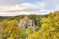
In the village of Domjean, you can take a stroll through the landscaped park and enjoy the flowers.

Reviews and comments

4.3 / 5
Based on 2 reviews

Reliability of the description
5 / 5
Ease of following the route
4 / 5
Route interest
4 / 5
marieluce
marieluce

Overall rating : 5 / 5

Date of your route : Nov 24, 2025
Reliability of the description : ★★★★★ Very good
Ease of following the route : ★★★★★ Very good
Route interest : ★★★★★ Very good
Very busy route : No

Very nice route because it's on paths

Machine-translated

St Loup
St Loup

Overall rating : 3.7 / 5

Date of your route : Feb 14, 2025
Reliability of the description : ★★★★★ Very good
Ease of following the route : ★★★☆☆ Average
Route interest : ★★★☆☆ Average
Very busy route : No

A very muddy route. Best done in spring, as it could be lovely when the vegetation starts to grow and the various flowers are in bloom.

Machine-translated

Other walks in the area

For more walks, use our search engine .

The GPS track and description are the property of this route's author. Please do not copy them without permission.