Country:
 City:
City:


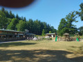
To return to the starting point, cross the village of Bény-Bocage via the D56. Follow signs for “Viaduc de la Souleuvre”. There are several car parks to choose from. We opted for the car park opposite the Bar de la Poste and the petrol station.
(S/E) Turn right onto Rue de la 11e Division Blindée Britannique, pass Chemin de Caen on your right and continue along Route de la Sablonnière to join the GR® a few metres further on.
(1) Take the path on the right and follow the GR® for about 1.5 km until you cross the bridge over the Souleuvre.
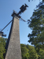
(2) At the junction, follow the sign for the Viaduc de la Souleuvre to the left. The path runs alongside the Souleuvre for about 1.5 km. Continue until you pass under the old Eiffel bridge, recognisable by its large granite piers and the bungee jumping platform at the top of one of the piers. Cross the Souleuvre again on your left to reach the site.
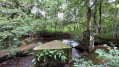
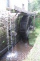
(3) Make the most of the spot for a drink, a picnic and/or a rest, then return via the same path, following the Souleuvre on your right-hand side until you reach the junction at the Cervelle mill.
(2) At the junction, leave the bridge on your right and continue straight on (the Souleuvre is still on your right). Follow this path for about 1 km.
(4) Leave the Chemin des Moulins de Cervelles and cross the Souleuvre again via a wooden bridge on the right. Follow this path as it climbs up to the Route du Bois Pépin.
(5) Turn right towards the cul-de-sac known as ‘le Désert’. Just before the ‘Impasse’ sign (less than 10 m away), cross the road and turn onto the Chemin de la Croix Angélique on the left. Continue along this path for about 1.5 km until you reach a junction.
(6) Continue along the Chemin de la Croix Angélique on the right until you come out onto a small, winding road.
(7) Turn left and almost immediately right onto the small dirt track between the trees. Follow this winding track to the first junction.
(8) Turn right to reach the village. The path leads onto a small road; follow this until the first junction at a car park with garages (likely council buildings).
(9 ) Turn left before the buildings and continue along Rue du Haras. Walk past the sports ground on your right, then continue straight on along the path that runs behind the town hall. Walk past the back of the school until you reach the car park opposite the Bar de la Poste (S/E).

 Visorando Member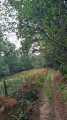

 Local authority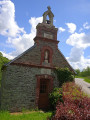
 Moderate