Les Champs Boullot from Domjean

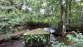
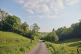
A easy route with lovely views, sunken paths and plenty of shade.

Details

57535105
Creation:
Last update:
Last review:
  • Walking
    Activity: Walking
  • ↔
    Distance: 4.64 mi
  • ◔
    Average duration: 2h 20 
  • ▲
    Difficulty: Easy

  • ⚐
    Back to start: Yes
  • ↗
    Ascent: + 217 ft
  • ↘
    Descent: - 233 ft

  • ▲
    Highest point: 446 ft
  • ▼
    Lowest point: 203 ft

Description of the walk

The car park is on the town hall square, the starting point for the walk.

(S/E) At the town hall, head towards the school and the sports centre until you reach a crossroads.

(1) Take the path on the left and continue straight on towards the Résidence des Pommiers. Carry on straight ahead and take the path on the left to reach a junction with a shaded path.

(2) At the end of the path, turn right and carry on until you reach a Fork in the road, then take the right-hand fork. Once you reach the village of Le Pallis, cross the road and carry on straight ahead. Turn right until you reach the D159.

(3) Turn left, then immediately continue along the dirt track on the right, taking in the
view of Tessy and Troisgots.” Carry on down the shaded path. At the bottom of the path, turn left. Caution: wet section. You’ll reach a crossroads with four paths.

(4) Carry on straight ahead until you reach a road (D96), follow it to the left, then turn onto the track on the right, until you reach a viewpoint over Saint-Vigor.

(5) Carry on straight ahead, and a little further on, enjoy a view of Troisgots and Fervaches. At the four-way junction, carry on straight ahead until you reach the D13 road. Cross over carefully towards La Priorté de Bas. You’ll come to a viewpoint overlooking Tessy-bocage.

(6) Keep going straight on and, at the end of the path, turn right onto the tarmac road. Viewpoint over Tessy.
Leave the track and follow the dirt track to the right, which runs alongside the house on your right. Caution: the ground is a bit wet here. Carry on straight ahead until you reach an apple orchard.

(7) Take the path on the right. Carry on straight ahead until you reach the village of Domjean. Then first turn left then right to return to the car park (S/E).

Waypoints

  1. S/E : mi 0 - alt. 295 ft - Start
  2. 1 : mi 0.1 - alt. 305 ft - Crossroads towards Résidence des Pommiers
  3. 2 : mi 0.52 - alt. 384 ft - Shaded path
  4. 3 : mi 1.19 - alt. 446 ft - Route
  5. 4 : mi 1.73 - alt. 341 ft - Crossroads
  6. 5 : mi 2.29 - alt. 335 ft - Viewpoint over Saint-Vigor
  7. 6 : mi 3.14 - alt. 253 ft - Viewpoint overlooking Tessy-bocage
  8. 7 : mi 3.8 - alt. 236 ft - Junction
  9. S/E : mi 4.64 - alt. 295 ft - Arrival and the church to visit

Notes

You’ll find water in the courtyard of the old school buildings, as well as toilets

Worth a visit

You can visit the park; there are facilities for picnicking and staying overnight (municipal campsite)

Reviews and comments

5 / 5
Based on 2 reviews

Reliability of the description
5 / 5
Ease of following the route
5 / 5
Route interest
5 / 5
User 3736645

Overall rating : 5 / 5

Date of your route : Oct 06, 2025
Reliability of the description : ★★★★★ Very good
Ease of following the route : ★★★★★ Very good
Route interest : ★★★★★ Very good
Very busy route : No

A very pleasant hike, with hardly any roads and lots of quiet paths
Be careful towards the end of the route, as you will cross an apple orchard. Quickly leave it behind and take the path under the trees on your right, otherwise you will have to turn back to take this path
As indicated, there are two slightly muddy areas that require closed-toe shoes
I recommend it 🤗

Machine-translated

Sarah zz
Sarah zz

Overall rating : 5 / 5

Date of your route : Aug 03, 2024
Reliability of the description : ★★★★★ Very good
Ease of following the route : ★★★★★ Very good
Route interest : ★★★★★ Very good
Very busy route : No

We cut it a bit short at the end because it was raining too much!

Machine-translated

Other walks in the area

For more walks, use our search engine .

The GPS track and description are the property of this route's author. Please do not copy them without permission.