


Refine your search for walks in Rœux
Rœux walks


 Lacs et marais depuis Roeux
 Association / Club / Walk leader
 8.18 mi
 +66 ft
 -66 ft
 3h 50
3h 50
 Moderate
 Departure from Rœux (Pas-de-Calais)
Boucle par Roeux et Biache-Saint-Vaast, entre lacs et marais.
From Lac Bleu to the Plouvain Marsh
 Visorando Member3.42 mi
+59 ft
-59 ft
1h 35
Visorando Member3.42 mi
+59 ft
-59 ft
1h 35
 Easy
Departure from Rœux (Pas-de-Calais)
Easy
Departure from Rœux (Pas-de-Calais)
A peaceful, shaded walk around Lac Bleu, along the River Scarpe and through the Plouvain Marshes. Easily accessible and suitable for all seasons.
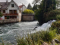
Fampoux from top to bottom
 5.39 mi
+135 ft
-135 ft
2h 35
Easy
Departure from Fampoux (Pas-de-Calais)
5.39 mi
+135 ft
-135 ft
2h 35
Easy
Departure from Fampoux (Pas-de-Calais)
A short walk around Fampoux, best done when the sun isn’t too strong!
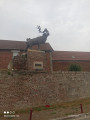
Caribou from Monchy-le-Preux
 6.37 mi
+108 ft
-105 ft
3h 00
Moderate
Departure from Monchy-le-Preux (Pas-de-Calais)
6.37 mi
+108 ft
-105 ft
3h 00
Moderate
Departure from Monchy-le-Preux (Pas-de-Calais)
This walk will take you through the plains and woods of the Arrageois region, which marked the limit of the German advance during the First World War. The marker can be seen on the RD 939. From Monchy, the Germans bombarded Arras, destroying the belfry.
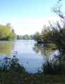
Marsh trail around Biache - Saint-Vaast
 6.28 mi
+26 ft
-26 ft
2h 55
Easy
Departure from Biache-Saint-Vaast (Pas-de-Calais)
6.28 mi
+26 ft
-26 ft
2h 55
Easy
Departure from Biache-Saint-Vaast (Pas-de-Calais)
Hiking through the marshes of Biache - Saint-Vaast, Plouvain Roeux and Pelves.
Chemin du Marasquay à Athies
8.19 mi
+98 ft
-98 ft
3h 50
Moderate
Departure from Athies (Pas-de-Calais)
Venez découvrir les village de Fampoux, Feuchy et Athies en passant par les bois, étangs et marais.
The twenty-foot ditch from Bailleul-Sir-Berthoult
8.04 mi
+148 ft
-151 ft
3h 50
Moderate
Departure from Bailleul-Sir-Berthoult (Pas-de-Calais)
This flat hike will take you from Bailleul-sir-Berthout to the villages of Gavrelle and Oppy, along good paths.
Bailleul was completely destroyed during the First World War.
In 1833, Minister Guizot passed a law requiring all municipalities to have a school.
Les bords de la Scarpe depuis Saint-Laurent-Blangy
 7.62 mi
+43 ft
-39 ft
3h 30
Moderate
Departure from Saint-Laurent-Blangy (Pas-de-Calais)
7.62 mi
+43 ft
-39 ft
3h 30
Moderate
Departure from Saint-Laurent-Blangy (Pas-de-Calais)
Superbe randonnée entre rivière et marais et leur biodiversité
Between Vitry and Brebières
 4.01 mi
+26 ft
-26 ft
1h 50
Easy
Departure from Vitry-en-Artois (Pas-de-Calais)
4.01 mi
+26 ft
-26 ft
1h 50
Easy
Departure from Vitry-en-Artois (Pas-de-Calais)
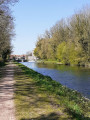
A short, picturesque round trip along the towpath.
 The city centre
 16.26 mi
+197 ft
-207 ft
2.5 hrs
Easy
Departure from Beaurains (Pas-de-Calais)
16.26 mi
+197 ft
-207 ft
2.5 hrs
Easy
Departure from Beaurains (Pas-de-Calais)
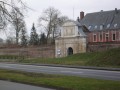
A route combining town and countryside, taking you round Arras. A mix of rural landscapes and historic monuments such as the Citadel, the English Memorial and the ramparts.
Arras and its monuments
 6.57 mi
+102 ft
-108 ft
3h 05
Moderate
Departure from Arras (Pas-de-Calais)
6.57 mi
+102 ft
-108 ft
3h 05
Moderate
Departure from Arras (Pas-de-Calais)
This walk will introduce you to Arras, starting along the Scarpe river. You will then continue through the town and admire its monuments, from the citadel to the execution wall, the belfry and the main square.
Short route around Farbus
3.29 mi
+141 ft
-144 ft
1h 40
Easy
Departure from Farbus (Pas-de-Calais)
A circular route around Farbus, allowing you to explore the village and the surrounding countryside.
Woods and trenches between Thélus and Vimy
7.66 mi
+318 ft
-331 ft
3h 45
Moderate
Departure from Thélus (Pas-de-Calais)
Very few roads on this rural route, which becomes quite difficult in wet weather. Although the elevation gain does not seem significant, the Sentier de la Vignette, on the northern edge of Vimy Wood, is very hilly, with steep slopes that will give your calves a good workout. It is, of course, possible to go down into the trenches and wander a little through this labyrinth.
Bois de Berthonval depuis Thélus
 7.26 mi
+312 ft
-295 ft
3h 35
Moderate
Departure from Thélus (Pas-de-Calais)
7.26 mi
+312 ft
-295 ft
3h 35
Moderate
Departure from Thélus (Pas-de-Calais)
À la decouverte des villages de Thélus et Farbus, en passant par le Bois de Berthonval.
La plaine au Nord d'Arras et le Bois de Vimy
14.48 mi
+663 ft
-673 ft
7h 15
 Difficult
Departure from Thélus (Pas-de-Calais)
Difficult
Departure from Thélus (Pas-de-Calais)
A countryside walk near the town of Arras.Plenty of paths and small roads that are not really suitable for vehicles.
To spice up the route a little, I’ve added a section of the Vignette trail (going in the opposite direction, so there are no signposts) which takes you round the Bois de Vimy. This route is quite challenging but very enjoyable and is now well maintained.
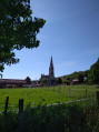
Discover the villages of Thélus, Willerval and Farbus
 8.25 mi
+197 ft
-180 ft
4h 00
Easy
Departure from Thélus (Pas-de-Calais)
8.25 mi
+197 ft
-180 ft
4h 00
Easy
Departure from Thélus (Pas-de-Calais)
You will discover the villages of Thélus, Willerval, and Farbus. These three villages are less than 10 km from Vimy and its Canadian First World War memorial, which is well worth a visit to complement this hike.
Les antennes depuis Vimy
 8.43 mi
+315 ft
-315 ft
4h 10
Moderate
Departure from Vimy (Pas-de-Calais)
8.43 mi
+315 ft
-315 ft
4h 10
Moderate
Departure from Vimy (Pas-de-Calais)
Jolie randonnée qui vous conduira tout d'abord dans la campagne entre Vimy et Farbus, puis vous fera monter à Thelus avant de rejoindre le Mémorial Canadien et la Forêt de Vimy.
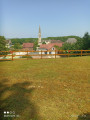
Le Champ des Saints depuis Vimy
 7.95 mi
+289 ft
-308 ft
3h 55
Moderate
Departure from Vimy (Pas-de-Calais)
7.95 mi
+289 ft
-308 ft
3h 55
Moderate
Departure from Vimy (Pas-de-Calais)
Venez découvrir les villages de l'Artois par Farbus, Willerval et Vimy. Randonnée entre bois et plaine avec vue sur les terrils de Loos-en-Gohelle
Les Voyettes
 4.53 mi
+164 ft
-167 ft
2h 15
Easy
Departure from Vimy (Pas-de-Calais)
4.53 mi
+164 ft
-167 ft
2h 15
Easy
Departure from Vimy (Pas-de-Calais)
This local hike will introduce you to this charming village in the community of Lens-Lievin. It took in the wounded during the Battle of Lens in August 1648 and many other battles, including the Battle of Vimy Ridge from 9 to 12 April 1917. The ponds around Vimy are former shell holes. Even today, unexploded ordnance can still be found.
The two bridges from Vimy
4.76 mi
+108 ft
-118 ft
2h 15
Easy
Departure from Vimy (Pas-de-Calais)
This short hike around Vimy, between the town, voyettes (small streets in local dialect) and plains, will give you a different perspective on our beautiful region, its heritage and its memory of the Great War
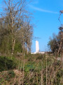
The Goulot from Vimy
 7.34 mi
+295 ft
-299 ft
3h 40
Moderate
Departure from Vimy (Pas-de-Calais)
7.34 mi
+295 ft
-299 ft
3h 40
Moderate
Departure from Vimy (Pas-de-Calais)
This walk, starting from Place de la République, will take you to the Canadian Memorial. It then follows a descent through Thélus and Farbus via the Bois du Goulot. You will pass by the Saint-Ranulphe Fountain. The whole route is on good paths.