


Refuge Mautino
Gite des Fonds de Cervières
Bivouac Andrea Tornior, dans le vallon italien des Thures. Au confluent du torrent des Thures et du torrent qui descend du Bric Froid
Refuge Nino Sardi
Refuge du Granero
Refuge Baillif Viso
Refuge de la Blanche
Gite des Gabelous à Saint Véran
Queyras Transfrontière

On joue à saute mouton entre France et Italie du Montgenèvre à Saint Véran.
Details
Creation:
Last update:
-
 Activity: Walking
 -
 Distance: 77.10 mi
 -
 Average duration: 8 days
 -
 Difficulty: Difficult
 -
-
 Back to start: No
 -
 Ascent: + 36,227 ft
 -
 Descent: - 34,006 ft
 -
-
 Highest point: 10,879 ft
 -
 Lowest point: 5,617 ft
-
 Country:
France
Country:
France
-

-
 City:
Montgenèvre (05100)
City:
Montgenèvre (05100) -
 Start: N 44.931272° / E 6.725573°
 -
 End: N 44.666476° / E 6.941491°
 -


 Hour-by-hour weather
Photos
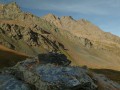
Stages of the route
This route needs several days, find the details below:
Notes
This route passes through a protected area, which may be subject to special regulations:
Worth a visit
Ca passe tout près du Mont Viso.
Other walks in the area
The Tour du Prarial
 Visorando Member3.68 mi
+784 ft
-771 ft
2h 20
Visorando Member3.68 mi
+784 ft
-771 ft
2h 20
 Easy
Departure from Montgenèvre (Hautes-Alpes)
Easy
Departure from Montgenèvre (Hautes-Alpes)
A pleasant circular route through the forest along the watershed. You first follow the Durance, which is then just a small stream and which will eventually flow into the Rhône and then the Mediterranean. The circular route ends along the Doire, another small stream that is a tributary of the Po, which in turn flows into the Adriatic Sea.
Sestrières Wood and Torrent du Vallon, starting from Montgenèvre
 9.04 mi
+2,585 ft
-2,589 ft
6h 25
Difficult
Departure from Montgenèvre (Hautes-Alpes)
9.04 mi
+2,585 ft
-2,589 ft
6h 25
Difficult
Departure from Montgenèvre (Hautes-Alpes)
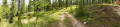
A walk through a beautiful, open forest canopy dominated by larch trees, which grow alongside a few deciduous trees such as oaks, alders and birches. Higher up, the forest features other conifers, including various species of pine and fir, where the bird cherry grows. The path is lined with beautiful flowering willowherbs and coltsfoot. From the Bois des Bans, there is a stunning view over the Clarée valley. This walk is classified as difficult as there are a few sections with steep, challenging gradients.
Le Brousset and the Durance Valley
 5.31 mi
+1,217 ft
-1,234 ft
3h 30
5.31 mi
+1,217 ft
-1,234 ft
3h 30
 Moderate
Departure from Montgenèvre (Hautes-Alpes)
Moderate
Departure from Montgenèvre (Hautes-Alpes)
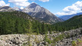
A very beautiful, easy walk through the larch forest. It runs alongside the Bois du Prarial before taking a lovely path (Le Brousset) which offers magnificent panoramic views of Mont Chaberton and the summit of La Loubatière. You then head towards the headwaters of the Durance, which converge in a beautiful glacial cirque dominated by the Sommet de Château Jouan and the Janus military fortification. The walk ends as you follow the river along its left bank.
The Grand Charvia from Montgenèvre
 6.94 mi
+2,641 ft
-2,625 ft
5h 30
Moderate
Departure from Montgenèvre (Hautes-Alpes)
6.94 mi
+2,641 ft
-2,625 ft
5h 30
Moderate
Departure from Montgenèvre (Hautes-Alpes)
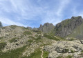
This walk, starting from Montgenèvre, passes through a beautiful forest before reaching a vast natural terrace offering superb panoramic views, particularly of the Grand Charvia, the small pass and the surrounding mountains.
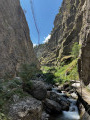
San Gervasio Gorges, starting from Montgenèvre
 5.20 mi
+965 ft
-965 ft
3h 15
Easy
Departure from Montgenèvre (Hautes-Alpes)
5.20 mi
+965 ft
-965 ft
3h 15
Easy
Departure from Montgenèvre (Hautes-Alpes)
This easy route, which crosses the French-Italian border, will allow you to discover the magnificent San Gervasio Gorges, the stream that flows through them, and the charming village of Clavière.
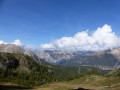
Mont de la Plane or Sommet de la Loubatière
 5.69 mi
+2,421 ft
-2,405 ft
4h 45
Moderate
Departure from Montgenèvre (Hautes-Alpes)
5.69 mi
+2,421 ft
-2,405 ft
4h 45
Moderate
Departure from Montgenèvre (Hautes-Alpes)
A hike starting from the Montgenèvre resort towards a border peak offering a fantastic panorama of the surrounding French-Italian summits.
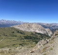
Le Chenaillet, Le Grand Charvia and the Sommet de la Loubatière
 9.42 mi
+3,501 ft
-3,481 ft
7h 25
Difficult
Departure from Montgenèvre (Hautes-Alpes)
9.42 mi
+3,501 ft
-3,481 ft
7h 25
Difficult
Departure from Montgenèvre (Hautes-Alpes)
This long circular route starting from Montgenèvre first takes you through a beautiful forest before reaching the high-altitude areas of Les Gondrans and L’Aigle. The three peaks over 2,500 m along the route offer superb panoramic views of the surrounding peaks.
The Pointe des Rochers Charniers
 11.50 mi
+4,879 ft
-4,872 ft
8 hrs
11.50 mi
+4,879 ft
-4,872 ft
8 hrs
 Very difficult
Departure from Montgenèvre (Hautes-Alpes)
Very difficult
Departure from Montgenèvre (Hautes-Alpes)
Behind the famous and very popular Mont Chaberton lies a magnificent, little-known but equally impressive ridge. This route takes you there after a pleasant climb through the forest and mountain pastures of the Col des Fonds, before descending via the Italian side of the ridge.
Please note: this route is reserved for experienced walkers accustomed to long hikes, as it includes some very steep and stony sections. I strongly recommend bringing walking poles to make the ascent and descent of the ridge easier.
For more walks, use our search engine .
The GPS track and description are the property of this route's author. Please do not copy them without permission.

