Country:

 City:
City:


Park near the Prarial car park.
(S/E) Take the wide path to the right of the Espace Prarial towards the La Ferme d’Augustin holiday complex. Go round the complex on the left and continue along a narrow path through the forest.
(1) Pass under the ski lift and begin your ascent along the lovely path leading uphill on your left. Keep going in the same direction until you come to a ski run.
(2) Cross it to find and follow another path that winds its way uphill.
(3) Turn right and continue to the Gondrans crossroads.
(4) Cross the “Lac” ski run to rejoin a wide path leading up to Lac des Anges. Turn right towards the lake, then branch off to the left to reach it.
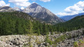
(5) Leave the lake on your left and continue your ascent along a narrow path leading up to the right. Reach the Col de Gondrans near Lac de Sagne Enfonza.
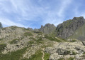
(6) Take the path on your left, which climbs gently, to reach the first summit of this route: the Chenaillet.
(7) Take the fairly steep path down to your right, signposted for the Collet Vert. Continue to a Y-junction.
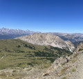
(8) Follow the path on your right towards the Grand Charvia.
(9) Carry on straight ahead to complete your ascent to the Grand Charvia via a gentle circular loop to the left.
(10) Retrace your steps.
(9) Take the path on your right, which descends slightly towards the Collet Vert.
(11) Cross the Piste des Souréous and continue along a wide path slightly below to reach the Collet Vert.
(12) Head back down via a small path on the Italian side, descending to your right and leading to the Petit Collet.
(13) Carry on opposite along the ridge of the same name to reach the summit of La Loubatière.
(14) Once at the summit, begin the descent towards Montgenèvre, returning to the Petit Collet.
(13) Take the path descending to your right towards Montgenèvre, then continue to the Piste du Vallon.
(15) Cross the track and the stream, then complete your descent towards Montgenèvre by taking the wide path ahead of you. Pass above the lake, then head back to the right towards Montgenèvre.
(16) Turn left just before the Route de France, then complete this route by returning to the Prarial car park (S/E).
 Visorando Member
 Moderate
 Easy
Easy