Le Collet – Clavière – Prarial – Bois Sestrières circular loop

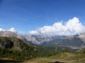
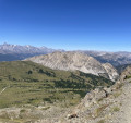
A pleasant, leafy path that descends gently towards Clavière and, after crossing the Doire, climbs back up towards Montgenèvre. The route crosses the Bois de la Blanche, covered in majestic larch trees, then the Bois de Prarial, which you climb to reach the north-western slope. This offers a stunning panoramic view of the resort and, if you look carefully, reveals a heavily overgrown Second World War bunker. The walk ends with a detour through the Bois de Sestrières.

Details

n°25259064
Creation:
Last update:
Last review:
  • Walking
    Activity: Walking
  • ↔
    Distance: 5.71 mi
  • ◔
    Average duration: 3h 30 
  • ▲
    Difficulty: Moderate

  • ⚐
    Back to start: Yes
  • ↗
    Ascent: + 1,033 ft
  • ↘
    Descent: - 1,047 ft

  • ▲
    Highest point: 6,486 ft
  • ▼
    Lowest point: 5,758 ft

Photos

Description of the walk

Park in Montgenèvre at the car park along the Route d’Italie, opposite the church on the other side of the road.

(S/E) From Saint-Maurice Church, take Rue de l’Église as far as the Obelisk. Follow the N94 towards Italy, then, after passing under a bridge, follow a path alongside Rue des Baisses.

(1) Head towards Clavière. Before passing under the Serre Thibaut Télémix, take the path on the right which leads gently uphill to Clavière.

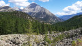
(2) View of Mont Chaberton.

(3) Woodcarver. Presence subject to weather conditions and the carver’s schedule. Shortly afterwards, cross the road at the pedestrian crossing leading to a covered walkway and head down towards the town centre.

(4) Sundial showing the correct time. On the left-hand pavement as you walk down, it is situated on a building set slightly back from the Via Francigena. Then continue down the street and take Strada Valle Gimont.

(5) Path towards Montgenèvre. On the ground, the French-Italian border is marked by a small slab. Follow the path uphill to a bridge over the Rio Secco.

(6) Cross the bridge over the Rio Secco and take the path leading up towards Montgenèvre.

(7) View of Mont Chaberton. Continue, leaving the pumping station on your right, and head up the valley along the path that runs alongside the left bank of the Doire.

(8) Tipis. When you reach the area near the start of the Brousset chairlift, on the right, you’ll see some teepees. Turn right onto the path that climbs through the Bois du Prarial, then cross over to the north-western slope, following the track above the golf course.

(9) A Second World War bunker on the right, heavily overgrown with vegetation.
Continue along the path, pass under the Chalmettes Télémix and cross the small stream, the Durance, below. Finish by taking one of the many paths leading to the adventure park, then head down to the road, passing a water sports centre on your left. After crossing the Route de France, head back up to join the Route des Sablons and the Rue de l’Église (S/E).

Waypoints

  1. S/E : mi 0 - alt. 6,076 ft - Saint-Maurice Church
  2. 1 : mi 0.74 - alt. 6,093 ft - Junction towards Clavière
  3. 2 : mi 0.95 - alt. 6,004 ft - View of Mont Chaberton
  4. 3 : mi 1.13 - alt. 5,886 ft - Woodcarver
  5. 4 : mi 1.41 - alt. 5,807 ft - Sundial
  6. 5 : mi 1.71 - alt. 5,758 ft - Path to Montgenèvre
  7. 6 : mi 1.76 - alt. 5,761 ft - Rio Secco Bridge
  8. 7 : mi 2.25 - alt. 6,079 ft - View of Mont Chaberton
  9. 8 : mi 3.05 - alt. 6,224 ft - Tipis
  10. 9 : mi 3.96 - alt. 6,339 ft - Blockhouse
  11. S/E : mi 5.71 - alt. 6,076 ft - Saint-Maurice Church

Notes

The village of Clavière offers places to eat. Standard hiking kit.

Worth a visit

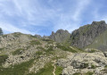
From the path branching off to the right onto Rue des Baïsses, the descent towards Clavière is pleasant. It runs along the edge of larch trees and through clearings offering fine views of Mont Chaberton. This mountain range rises to 3,131 metres, having been levelled by a few metres by Italian military engineers to build a fortification...
The village of Clavière is well worth a visit.
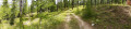
The ascent via the Bois de la Blanche takes you through a larch forest where the treetops reach around thirty metres in height, whilst the undergrowth is very sparse. The venerable conifers have left little room for other shrubby or herbaceous species (see photo and additional comments).

Reviews and comments

4.7 / 5
Based on 1 review

Reliability of the description
5 / 5
Ease of following the route
5 / 5
Route interest
4 / 5
Trainmania
Trainmania

Overall rating : 4.7 / 5

Date of your route : Jul 28, 2026
Reliability of the description : ★★★★★ Very good
Ease of following the route : ★★★★★ Very good
Route interest : ★★★★☆ Good
Very busy route : Yes

A lovely walk through the forest, sheltered, with no major difficulties apart from the climb from point 8, which is quite steep after all. (Which explains its ‘medium’ difficulty rating).
I’d definitely recommend it!

Machine-translated

Other walks in the area

For more walks, use our search engine .

The GPS track and description are the property of this route's author. Please do not copy them without permission.