The Grand Charvia from Montgenèvre

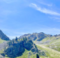
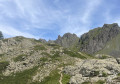
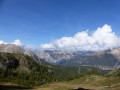
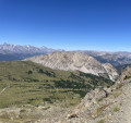
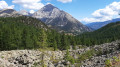
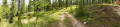
This walk, starting from Montgenèvre, passes through a beautiful forest before reaching a vast natural terrace offering superb panoramic views, particularly of the Grand Charvia, the small pass and the surrounding mountains.

Details

102620897
Creation:
Last update:
Last review:
  • Walking
    Activity: Walking
  • ↔
    Distance: 6.94 mi
  • ◔
    Average duration: 5h 30 
  • ▲
    Difficulty: Moderate

  • ⚐
    Back to start: Yes
  • ↗
    Ascent: + 2,641 ft
  • ↘
    Descent: - 2,625 ft

  • ▲
    Highest point: 8,619 ft
  • ▼
    Lowest point: 6,020 ft

Photos

Description of the walk

Park in one of the car parks near the Prarial area.

(S/E) Head along the Route d’Italie towards Clavière. Walk to the ice rink.

(1) Turn right, walk past the ice rink, then head uphill along the track to reach the area above the lakes.

(2) Turn right and follow an easy path towards Collet Vert. You’ll reach a Y-junction at the entrance to the Vallon.

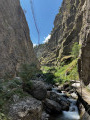
(3) Cross the small stream to rejoin a yellow-marked path heading towards Collet Vert. Continue along this fairly steep path through the forest until you reach a junction by the River Doire.

(4) Take the path on the left, then reach another junction.

(5) Stay on the path on the right to begin a steeper climb, leading to a flat section.

(6) Turn left to quickly reach the summit of the small pass of Collet Vert.

(7) Continue to the right, passing beneath the Rocher de l’Aigle cable car, then complete the ascent of the Grand Charvia at an elevation of 2,648 metres with a gentle circular loop to the left .

(8) Then retrace your steps along the same route to return to the Prarial car park (S/E).

Waypoints

  1. S/E : mi 0 - alt. 6,060 ft - Prarial car park - Col de Montgenèvre
  2. 1 : mi 0.17 - alt. 6,070 ft - Ice rink
  3. 2 : mi 0.55 - alt. 6,030 ft - Lake
  4. 3 : mi 0.88 - alt. 6,079 ft - Vallon Track
  5. 4 : mi 1.64 - alt. 6,686 ft - La Doire
  6. 5 : mi 2.13 - alt. 7,375 ft - Trail junction
  7. 6 : mi 2.59 - alt. 7,871 ft - Flat section
  8. 7 : mi 2.89 - alt. 8,245 ft - Grand Collet
  9. 8 : mi 3.47 - alt. 8,619 ft - Grand Charvia - Grand Charvia
  10. S/E : mi 6.94 - alt. 6,060 ft - Prarial car park

Notes

This hike is rated as upper-medium difficulty. There are no water sources along this route. The second part of the hike offers little shade and is very exposed to the sun.

Other walks in the area

For more walks, use our search engine .

The GPS track and description are the property of this route's author. Please do not copy them without permission.