Le Brousset and the Durance Valley

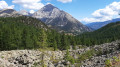
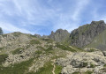
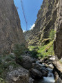
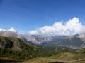
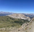
A very beautiful, easy walk through the larch forest. It runs alongside the Bois du Prarial before taking a lovely path (Le Brousset) which offers magnificent panoramic views of Mont Chaberton and the summit of La Loubatière. You then head towards the headwaters of the Durance, which converge in a beautiful glacial cirque dominated by the Sommet de Château Jouan and the Janus military fortification. The walk ends as you follow the river along its left bank.

Details

24969030
Creation:
Last update:
Last review:
  • Walking
    Activity: Walking
  • ↔
    Distance: 5.31 mi
  • ◔
    Average duration: 3h 30 
  • ▲
    Difficulty: Moderate

  • ⚐
    Back to start: Yes
  • ↗
    Ascent: + 1,217 ft
  • ↘
    Descent: - 1,234 ft

  • ▲
    Highest point: 7,195 ft
  • ▼
    Lowest point: 5,971 ft

Photos

Description of the walk

Park in the car park alongside the Route d’Italie, opposite the church on the other side of the road.

(S/E) Facing the church, turn right to walk alongside the road, then turn right again to reach the ice rink, where the path bordering the Bois du Prarial begins. At the three-way junction at the end of the second water reservoir, keep to the right.

(1) Take the path that climbs to the right: the one on the left, which slopes gently downwards, leads to the Collet Vert. Follow the valley up to a flat area at an altitude of approximately 2,070 metres, where several paths meet.

(2) With your back to the Bois du Prarial and facing south, take the path furthest to the left, which runs halfway up the slope of the Brousset. There are stunning views of the Chaberton and the summit of the Loubatière. Continue to the next junction.

(3) Take the path that climbs to the right up to the start of the Rocher chairlift. Navigate the right-hand bend and carry on to the top of the Brousset chairlift.

(4) Head down towards the headwaters of the Durance. Enjoy the stunning view of the cirque at the headwaters of the Durance and the fortifications overlooking them opposite. You can make out the Fort du Janus.

(5) Carry on to the right, ignoring the access to the water reservoir, and continue the descent to the confluence of the springs.

(6) Begin the final downhill section along the left bank of the Durance.

(7) Carry on along the forest track. There is an alternative route at this point: see Practical Information. Reach the hairpin bend to the left.

(8) Leave the track and take a path on the right which runs alongside the Chalmettes télémix. Pass the tennis courts on your right, cross Rue du Bois de Sestrière and continue straight ahead to reach the télémix departure station.

Turn right, go under the bridge on Rue des Chalmettes and continue straight on to reach the departure car park (S/E).

Waypoints

  1. S/E : mi 0 - alt. 6,073 ft - Car park
  2. 1 : mi 0.85 - alt. 6,089 ft - Path on the right
  3. 2 : mi 1.62 - alt. 6,617 ft - Flat stretch – Junction
  4. 3 : mi 2.14 - alt. 6,683 ft - Junction
  5. 4 : mi 2.62 - alt. 7,195 ft - Arrival at the Brousset chairlift
  6. 5 : mi 3.07 - alt. 7,018 ft - Junction
  7. 6 : mi 3.38 - alt. 6,850 ft - Confluence of the headwaters of the - La Durance
  8. 7 : mi 3.76 - alt. 6,693 ft - Start of alternative route
  9. 8 : mi 4.51 - alt. 6,325 ft - Bend, end of alternative route
  10. S/E : mi 5.31 - alt. 6,073 ft - Car park

Notes

No drinking water available. Shelters at the chairlift stations. Standard hiking kit.

(7) There is an unmarked alternative route to the right: rather than following the forest track shown on the route, which is a bit monotonous, walk along the Durance on the right-bank path, marked with black dashes on the IGN map. You can take a short break here. Then rejoin the route at (8).

Worth a visit

Saint-Maurice Church: this church was built in the 18th century and features a lantern on the south-east-facing façade of the bell tower. The oil lamp was used to guide travellers towards the Col de Montgenèvre in conditions of reduced visibility.

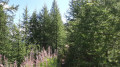
On the Brousset path: you soon reach a moraine plateau (see photo with additional comments) which opens up the horizon to the north-north-east as far as Mont Chaberton, which rises to 3,131 m (Italian engineers levelled the summit by 7 m to build an artillery battery there). It was destroyed during the Second World War by French artillery positioned behind the ridges overlooking the cirque of the Durance’s headwaters! This destruction operation required months of preparation and absolute secrecy to deploy the French batteries and carry out the ballistic calculations made by officers from the École Polytechnique to ensure the shells hit their target! The flora is abundant and varied (see photo), with plenty of burrows, particularly in the wind-felled woodlands.

Nearby

(1) A lovely walk to the Collet Vert, where pillow lavas rise to over 2,500 metres. They alone are worth the detour and… the effort involved: the final slope is a bit steep, sometimes over scree, but not dangerous. They are very easy to spot thanks to their characteristic shape, formed along mid-ocean ridges at depths of several thousand metres. Through plate tectonics and the Alpine orogeny of the Tertiary period, these solidified magma flows were thrust up to this summit; their exposure at the surface is unique in the world. Continue the hike to Le Chenaillet and possibly further. It is a challenging hike that takes just under a day.

The military fortifications mentioned are open to visitors on certain days. Enquire at the Montgenèvre Tourist Office, which also organises a tour of the blockhouses, bunkers and a French dam belonging to the Maginot Line – a very interesting tour led by a local historian.

Reviews and comments

4.3 / 5
Based on 3 reviews

Reliability of the description
4.3 / 5
Ease of following the route
4.3 / 5
Route interest
4.3 / 5
titi_rando
titi_rando
• Edited:

Overall rating : 3.3 / 5

Date of your route : Aug 28, 2025
Reliability of the description : ★★★☆☆ Average
Ease of following the route : ★★★☆☆ Average
Route interest : ★★★★☆ Good
Very busy route : No

a pleasant hike, with the first part being moderately difficult, especially if you haven't been hiking recently (in which case, allow 4 to 4½ hours)

in 4 hours, you will have the opportunity to see several nice panoramas, so I find it quite efficient.

one small regret is that the description is very brief and sometimes not precise enough:
the description never mentions the yellow signposts along the route or the exact names on them, which is a shame (are they really that new?). So I recommend taking the GPX track with you.
i am thinking in particular of points 2 and 3 (and, incidentally, for point 3: be careful, as the GPX track is not entirely accurate)

Machine-translated

CanardFly
CanardFly
• Edited:

Overall rating : 4.7 / 5

Date of your route : Oct 29, 2023
Reliability of the description : ★★★★★ Very good
Ease of following the route : ★★★★★ Very good
Route interest : ★★★★☆ Good
Very busy route : No

The perfect walk for admiring the larch trees in late October. An easy route that passes through the resort without it being too obtrusive. 3½ hours at a moderate pace. The replacement of the Rocher de l’Aigle chairlift with a gondola lift in 2023 has led to major earthworks before point 4: make sure you head back up towards the ski run before the embankment (the path is less visible). Opt for the alternative route between points 7 and 8 to enjoy views of the Durance.

Machine-translated

ROUQUEROL
ROUQUEROL

Overall rating : 5 / 5

Date of your route : Aug 12, 2023
Reliability of the description : ★★★★★ Very good
Ease of following the route : ★★★★★ Very good
Route interest : ★★★★★ Very good
Very busy route : No

As we’re quite fit, we completed this walk – which was advertised as taking 4 hours – in 2 hours, from 7.30 am to 9.30 am.

Machine-translated

Other walks in the area

For more walks, use our search engine .

The GPS track and description are the property of this route's author. Please do not copy them without permission.